
Population 750 (2013 est) President Julie Russell Website Shire of Wickepin Area 2,042 km² Council seat Wickepin | Established 1909 Founded 1909 | |
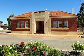 | ||
The Shire of Wickepin is a local government area in the Wheatbelt region of Western Australia, east of Narrogin and about 220 kilometres (137 mi) southeast of the state capital, Perth. The Shire covers an area of 2,042 square kilometres (788 sq mi), and its seat of government is the town of Wickepin.
Contents
History
In 1909, the Wickepin Road District was created. The Road Board consisted of a chairman, secretary and seven members. On 1 July 1961, it became a shire under the Local Government Act 1960.
Wards
The Shire is at present undivided with its nine councillors representing the entire shire.
Until 20 October 2007 the shire was divided into 5 wards:
Towns and localities
References
Shire of Wickepin Wikipedia(Text) CC BY-SA