
Time zone MST (UTC+06:30) Area 93,704 km² ISO 3166 code Myanmar (Burma) | Region Central Northwestern Area rank 2nd Website sagaingregion.gov.mm Population 5.325 million (2014) | |
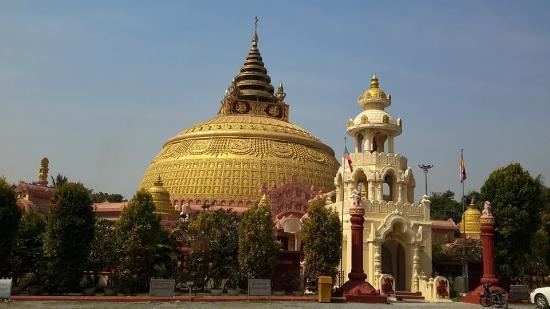 | ||
Colleges and Universities Points of interest Mingun Pahtodawgyi, Mingun Bell, Kaunghmudaw Pagoda, Laykyun Sekkya, Thanboddhay Pagoda Destinations Namdapha National Park, Mingun, Kalay, Tamu - Myanmar, Monywa District | ||
Myanmar flooding 2015 natural disaster sagaing region chin state
Sagaing Region (Burmese: စစ်ကိုင်းတိုင်းဒေသကြီး, [zəɡáiɴ táiɴ dèθa̰ dʑí], formerly Sagaing Division) is an administrative region of Myanmar, located in the north-western part of the country between latitude 21° 30' north and longitude 94° 97' east. It is bordered by India’s Nagaland, Manipur, and Arunachal Pradesh States to the north, Kachin State, Shan State, and Mandalay Region to the east, Mandalay Region and Magway Region to the south, with the Ayeyarwady River forming a greater part of its eastern and also southern boundary, and Chin State and India to the west. The region has an area of 93,527 km². In 1996, it had a population of over 5,300,000 while its population in 2012 was 6,600,000. The urban population in 2012 was 1,230,000 and the rural population was 5,360,000. The capital is Monywa.
Contents
- Myanmar flooding 2015 natural disaster sagaing region chin state
- Map of Sagaing Region Myanmar Burma
- History
- Administrative divisions
- Demographics
- Ecology
- Transport
- Economy
- Education
- Health care
- References
Map of Sagaing Region, Myanmar (Burma)
History
The Pyu were the first to in recorded history to populate the area of Sagaing Region by the 1st century CE. The Burmans first migrated into Upper Myanmar by 9th century CE. The area came under the Pagan Kingdom certainly by the middle of 11th century when King Anawrahta (r. 1044–1077) founded the Pagan Empire, which encompasses the modern day Myanmar.
After the fall of Pagan in 1287, the northwestern parts of Upper Myanmar came under the Sagaing Kingdom (1315–1364) ruled by Burmanized Shan kings. The area was ruled by the kings of Ava from 1364 to 1555 and the kings of Taungoo from 1555 to 1752. Konbaung Dynasty (1752–1885), founded by king Alaungpaya in Shwebo, became the last Burmese dynasty before the British conquest of Upper Burma in 1885. The area became Sagaing Division after the Burmese independence in January 1948.
Administrative divisions
Sagaing Region consists of eight districts divided into 34 townships with 198 wards and villages. The major cities are Sagaing, Monywa, Shwebo, Katha, Kale, Tamu, Mawlaik and Hkamti. Mingun with its famous bell is located near Sagaing but can be reached across the Ayeyarwady from Mandalay. The districts are Sagaing, Shwebo, Monywa, Katha, Kale (Kalemyo), Tamu, Mawlaik and Hkamti. The townships are:
In August 2010, three former townships of Sagaing Region were transferred, in accordance with the 2008 constitution, to a new administrative unit the Naga Self-Administered Zone which is no longer part of Sagaing Region. Those townships were Lahe, Leshi and Nanyun.
Demographics
The Bamar (Burmans) are the majority ethnic group in the dry regions and along the Mandalay-Myitkyina Railroad. Shan live in the upper Chindwin River valley. A sizable minority of Naga resides in the north of north-west mountain ranges and Zomi in the south. Smaller ethnic groups native to the Region include the Kadu and Ganang, who live in the upper Mu River valley and Meza River valley.
Ecology
There are a number of protected areas in Sagaing Region, among them are Alaungdaw Kathapa National Park, Chatthin Wildlife Sanctuary, Mahamyaing Wildlife Sanctuary, and Htamanthi Wildlife Sanctuary in Homalin Township.
Transport
Hemmed in by two great rivers of Myanmar, the Ayeyarwady and the Chindwin, river transport is a common way to move people and cargo. Much of the inland Sagaing Region relies on roads and rail in poor condition.
Economy
Agriculture is the chief occupation. The leading crop is rice, which occupies most of the arable ground. Other crops include wheat, sesame, peanut, pulses, cotton, and tobacco. Sagaing is Myanmar’s leading producer of wheat, contributing more than 80% of the country's total production. Forestry is important in the wetter upper regions along the Chindwin River, with teak and other hardwoods extracted. As in other parts of the country, reforestation is not effective enough to maintain sustainable forestry. Important minerals include gold, coal, salt and small amounts of petroleum. Industry includes textiles, copper refining, gold smelting, and a diesel engine plant. The Region has many rice mills, edible oil mills, saw mills, cotton mills, and mechanized weaving factories. Local industry includes earthen pots, silverware, bronze-wares, iron-wares and lacquerware.
Education
Educational opportunities in Myanmar are extremely limited outside the main cities of Yangon and Mandalay. According to official statistics, less than 10% of primary school students in Sagaing Region reach high school.
Sagaing Region has two national "professional" universities in the Monywa Institute of Economics and the Sagaing Institute of Education. Monywa University is the main liberal arts university in the region.
Health care
The general state of health care in Myanmar is poor. The military government spends anywhere from 0.5% to 3% of the country's GDP on health care, consistently ranking among the lowest in the world. Although health care is nominally free, in reality, patients have to pay for medicine and treatment, even in public clinics and hospitals. Public hospitals lack many of the basic facilities and equipment. Moreover, the health care infrastructure outside of Yangon and Mandalay is extremely poor. In 2003, Sagaing Region had less than a quarter of the number of hospital beds counted in Yangon Region, with a similar size of population.