
Country Burma Capital Population 478,690 | Area 36,018.8 km2 USDP | |
 | ||
Colleges and Universities Chin Christian College | ||
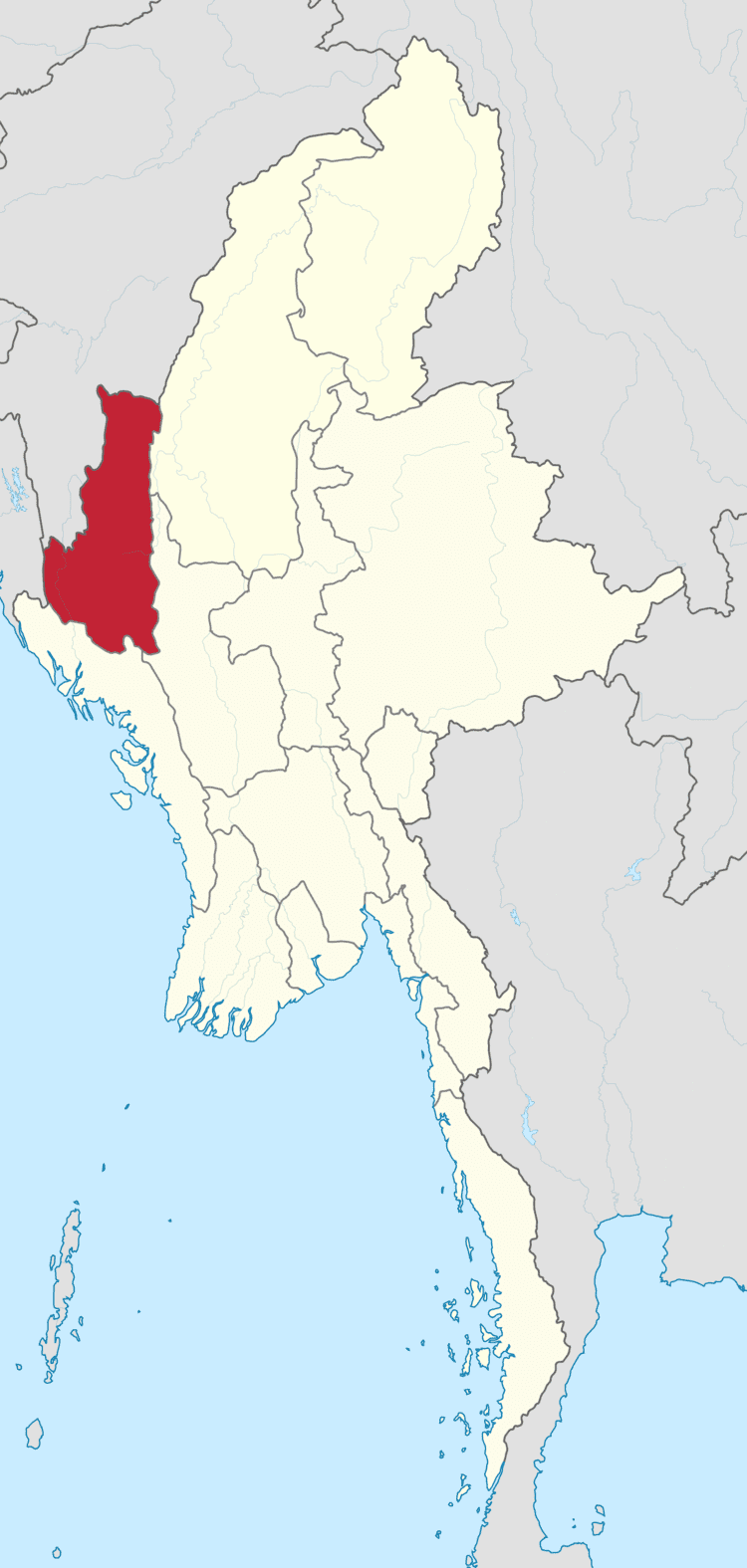
Map of Chin State
Chin State (Burmese: ချင်းပြည်နယ်; MLCTS: hkyang: pranynai, [tɕʰɪ́ɴ pjìnɛ̀]) is a state in western Myanmar. The 36,019-square-kilometre (13,907 sq mi) Chin State is bordered by Sagaing Division and Magway Division to the east, Rakhine State to the south, Bangladesh to the south-west, and the Indian states of Mizoram to the west and Manipur to the north. The population of Chin state is about 478,801 in 2014 census. The capital of the state is Hakha. The state is a mountainous region with few transportation links. Chin State is sparsely populated and remains one of the least developed areas of the country. Chin State has the highest poverty rate of 73% as per the released figures from the first official survey.
Contents
- Map of Chin State
- Two days in chin state burma 4k
- Falam chin state myanmar feb2017
- Early history
- Feudal era
- Colonial era
- Post Burmese independence
- Administrative divisions
- Districts and townships
- Cities
- Geography
- Demographics
- Religion
- Transport
- List of bridges in Chin State
- Airports
- Development in the communication sector
- Electricity
- Development in the electric power sector
- List of Hydro power plants
- Industrial sector
- Education
- Health care
- References
Two days in chin state burma 4k
Falam chin state myanmar feb2017
Early history
The Chin people entered the Chin Hills in the first millennium AD as part of the wider migration of Chin peoples into the area. For much of history, the sparsely populated Chin Hills were ruled by local chiefs, such as Tlaisun and Zahau chiefs in the mid-land (present Falam area), Guite and Sukte chiefs in the north (present Tedim, Tonzang, and Lamka areas), Hakha and Zote chiefs in the south (present Hakha and Thantlang areas), and Sailo and Hualngo chiefs in the Lushai hill.
Some historians (Arthur Phayre, Tun Nyein) put Pateikkaya in eastern Bengal, thus placing the entire Chin Hills under Pagan suzerainty but others, like Harvey, citing stone inscriptions, put it near the eastern Chin Hills. (Burmese Chronicles report the kings of Pateikkaya as Indian though the ethnicity of the subjects is not explicitly cited.)
Feudal era
The first confirmed political entity in the region was the Shan State of Kale (Kalay), founded by the Shan people who came to dominate Kale kabaw valley of the northwestern-to-eastern arc of Burma after the fall of the Pagan Kingdom in 1287. Kale was a minor Shan state. Its author. The minor state occasionally paid tribute to the larger Shan States of Mohnyin and Mogaung and ultimately became a vassal state of the Burmese Ava Kingdom in the 1370s. Starting in the 1480s, Ava began to disintegrate and Kale was swallowed up by the Shan State of Mohnyin by the 1520s.
The Burmese kingdoms between 1555 and 1559 when King Bayinnaung of the Toungoo Dynasty conquered part of Upper Burma and its surrounding regions, stretching from the eastern and northern Shan states to the western Maguay division and plain region in Manipur. Toungoo began to weaken in the late 17th century. By the 1730s a resurgent Manipuri Kingdom had conquered the Kabaw Valley, which is at the eastern front of Chin Hills, from the Burmese. Situated in a far west hilly region, however, Chin Hills was traditionally autonomous and far for successional Burman kingdoms to reach. Until British colonial rule, independent city states such as Ciimnuai (Chinwe) and Vangteh in the north, Tlaisun and Rallang in the mid-land, and Hakha and Zokhua in the south played important political role in securing peace of the region, and each city states practised its own independent sovereignty in their own rights.
Colonial era
The British acquired the Chin Hills a decade after the Third Anglo-Burmese War of 1885. The ensuing Chin resistance to the British was suppressed only by 1896 with the arrest of Khai Kam Suantak of Siyin area. The administered the Chin Hills as part of Arakan Division. American missionaries began arriving in the 1890s and, by the middle of the 20th century, most of the Chin people had converted to Christianity.
The region was the westernmost advance of the Imperial Japanese Army, which occupied the region in November 1943, in World War II. After the war, Chin state leaders headed by Vumkhohau Suantak, with Burman, Shan and Kachin leaders, participated in the Panglong Conference which discussed the future of an independent Union of Burma. Because of the region's heavy economic dependence on Burma, Chin leaders, unlike Shan and Kachin leaders, asked only for a "special administrative division", not a full-fledged state. As a result, when the 1947 Constitution of Burma granted the right of secession to states after 10 years after the independence, the Chin people did not get a state (no right to secede). (The Karen, who did not participate in the conference, received a state, with the right to secede.)
Post Burmese independence
Upon Burma's independence from the United Kingdom in 1948, Chin Hills Special Division was created out of Arakan Division, with its capital at Falam. On January 4, 1974, it was granted state status and became Chin State. Today, the state has little infrastructure and remains extremely poor and undeveloped.
"Chin National Day" is designated on 20 February to commemorate the "General Assembly of Chinland" held in 1948. The first celebration of Chin National Day was held in 1951. But it was not well recognized by Myanmar governments until the 2010s.
Chin National Front proposed to designate 3 January as "Chin State Day".
Administrative divisions
For more easily convince the Chin people within the declaration of emergency rule by the Burma government, Chin State divided of two districts in the north (Hakha District and Falam District) and one in the south (Mindat District) and was further subdivided into nine townships and three sub-townships. Falam had been the state capital since the British colonization. After the military coup in 1962, the junta in the 1974 reorganization shifted the state capital to Hakha.
The township borders have been adjusted, most recently in a reorganization of Falam District in 2008. Falam Township lost area in its northeast to Tedim Township but gained territory from Tedim in the northwest, extending northward as far as the developing town of Rihkhawdar (Reehkawdar) on the Indian border. In that reorganization Falam lost a small area in its southwest back to Thantlang Township from which it had recently been shifted.
Districts and townships
Cities
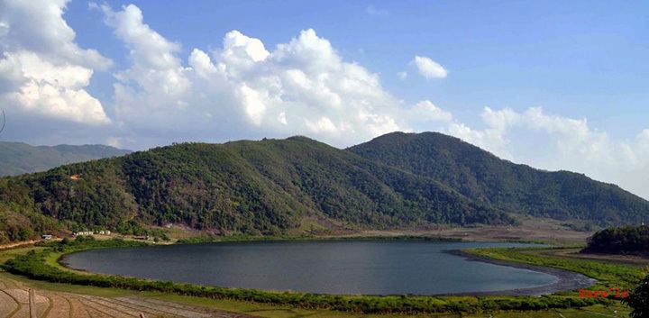
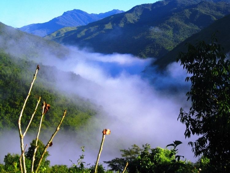
Geography
Khonumtung (Mount Victoria), 10,500 feet (3,200 m) high, is the highest peak in Chin State.
Many natural watercourses flow among mountain ranges running from north to south forming valleys and gorges. The state has many rivers and the Meitei Gun flows through its northern half. The Tio River forms much of the border with India for the northern half of the state. The Bawinu River, as the Kaladan River is known upstream from its confluence with the Tio, forms the border with India for the central portion of the state. In the southwestern part of the state, the Kaladan River enters from India and flows down past Paletwa and exits into Rakhine State. The longest waterfall in Chin state is the Bungtla Waterfall near Matupi.
Demographics
The Chin people are made up of many tribes which, though historically related, now speak divergent languages and have different cultural and historical identities. Some consider the name Chin an exonym, given by the Burmese and of unclear origin.
The first 'Chin National Day' was celebrated in 1951 at Mindat.
The term Laimi was a common name for some people in Falam, Hakha and Thantlang. There are some major western tribes like Lusei, Hmar and Thado are claiming the term Mizo to refer themselves and the whole tribes of the so-called Chins.
The government of Myanmar officially designated Falam as the official language of Chin State more than 30 years ago. Since then Falam has been the medium for Chin radio program broadcast by the government.
However, the Tedim language is the common language used among Zomi/Zo people. Tedim is spoken widely in Kalay township where they have been vastly overwhelming long before Burmese Independence. The population of Tedim language speaking people is calculated to be more than 300,000, without taking into account of the fact that Ngawn, Vaiphei, Sizaang, Thadou, Teizaang and other tribes understand and communicate with the language easily.
Lai is used as main communication languages in most parts of Falam, Hakha and Thantlang habitat areas although it is not used by all of the people. As some dialects in the areas of Hakha and Falam are from Tibeto-Burman dialect and 85% of the phonetic and accent are the same, people from Falam can easily communicate with Hakha language and vice versa. Chin people have a native-like understanding of Mizo language, except for those who live in very remote areas speaking dialects.
Zo people are called by names such as Chin people, K'Cho, Lusei (later Mizo), Kuki and others based on the names they were designated by Burmese people in the surrounding areas and the British. Recently, some people have accepted Zomi nomenclature, which means the people of Zo (mountain) or Highlanders. This very Zo people who live and dwel in the plain region are called phaimi (which means people from plain area). According to the record of Zam Siian Sang Gualnam who surveyed the seasons and population of the people called Chin Nationalities during the years 2004-2007 with the Chin Survey research team, the combination of all Chin peoples and their populations are as follows:
1. In Sagaing Division
2. In Chin State
3. In India (Census of India 2011)
Except for Thadou-Kuki, Lusei and Hmar, the remaining tribes in India mentioned above are united under Zomi Council. They are Paite, Simte, Vaiphei, Zou, Komrem, Mate and Tedim people. Furthermore, the tribes under Zomi Council and Thadou people speak different dialects that are close to those of the Tedim people. They migrated to Manipur State (India) about 800 years ago.
Although the exact population of Chin people is unknown so far and the population of Tedim language speaking Zomi vastly overwhelms the others, the population in Chin State is dispersing in rush in the past 50 years. Besides, the number of Chin people in Chin State has been decreasing at a rapid rate due to migration since the early 2000s for economic and political reasons.
Making a living is getting harder due to rapid population increase and unsustainable practice of slash and burn agriculture.
Since the early 1990s, a large number of Burmese soldiers began moving into Chin State because there have been movements of rebellion. It is estimated that from Falam region alone, approximately 100,000 have moved to other parts of Burma and a significantly large number has gone to neighboring countries of India, Malaysia and Thailand since 2000. From Hakha and Thantlang regions, no fewer than 100,000 people have migrated to Malaysia, India and other parts of Burma. This emigration is true for other townships in Chin State, with the exception of Mindat, Kanpetlet and Paletwa — three of the most isolated towns. Since early 2000, a large number of Chin people living and working legally and illegally have been settled as refugees in third countries including Australia, Norway, Finland, Denmark, Netherland, Canada, United States and New Zealand with the United States taking in the largest numbers.
The Chin people in Falam use the word Salai for Mr. and Mai as Miss since the early 1970s under the leadership of Salai Tin Maung Oo. Though the Hakha (ethnic Chin) use Leng as Miss and Val as Mr.
The Tedim ethnic group use Tang as Mr. and Lia as Miss. Pa/Nu as the marired person male/female respectively. The honour person as Sia for person and Sianu or Siapa as female/male respectively.
Matu use Mang and Tuem for (Matu woman) and Pu and Pi, and Pa and Nu, are used commonly for elderly Chin and Chin leaders such as Pu Hrang Thio (famous for his courage in the nationwide). The title of Pu is a term of respect. Failure to use it may be interpreted as a sign of disrespect. The word Pi is used to address elderly Chin women. Tribes also practice different ways in naming people.
Religion
Owing to missionary work over the last hundred years, a great deal of the population now identifies itself as Christian. A sizable minority, however, adheres to Theravada Buddhism, animism, and Laipian Pau Cin Hau.
Chin State is the only state in Myanmar (Burma) with a Christian majority.
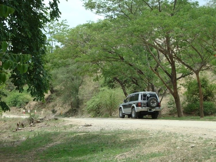
Transport
The government has been building many new miles of roads in the mountainous region. Earth roads have been upgraded into metaled ones and metaled roads to bituminous facilities. The 115-mile (185 km) Kalay-Falam-Haka road is already completed. Bituminous roads include
ASEAN Highway crosses through the center of Chinland settling areas of Madalay-Kalay-Tamu-Lamka/Behiang.
The sector-wise upgrading of the gateways to Chin State
is in progress.
Kyaukhtu Airport, built by Directorate of Military Engineers of the Ministry of Defence in Kyaukhtu, Saw Township, Gangaw District, Magway Division, was commissioned into service on July 10, 2004. The airport has helped develop the transport sector of southern Chin State linking Yaw and Pakokku regions in Magway Division.
Cars can reach Kanpetlet from Magway (capital of Magway division) via Saw and from Kyautthu and Mindat and Matupi in southern Chin State from Pakukku via Kyaukhtu.
In 1988, the state has two over 180-foot (55 m) bridges:
The military government has built the 340-foot (100 m) Var Bridge across Manipura River on Kalay-Haka Road in Falam Township in 1998 and 480-foot (150 m) 'Mansuang Hlei' Bridge across River Manipura on Tiddim-Kaptel-Rih Lake road in Tiddim District in 2002. The 460-foot (140 m) Mansaung Bridge is being built across Manipura River on Tiddim-Rih Lake section.
List of bridges in Chin State
Airports
Development in the communication sector
"Comparison between period preceding 1988 and after (up to 31-12-2006)
Electricity
The effective use of land and water resources in the state has helped develop its power generation capacity.
In 1988, the state has four small scale hydro-power stations:
The military government built another 12 diesel power stations and six new hydro power plants, helping increase the power consumption.
The four new hydroelectric power plants are the
The Manipura Multipurpose Dam Project will be implemented.
Development in the electric power sector
"Comparison between period preceding 1988 and after (up to 31-12-2006)"
List of Hydro power plants
Industrial sector
Due to the facilitation of the transport and communication sectors and increase in the power generation in the state, many new private industries have emerged in the region. The state now has 522 private industires, 179 more than 343 in 1988. The number of state-owned industries has now reached nine from five in the past. The government has been striving to develop the industrial sector of the state which will become a major tea-growing region.
"Comparison between period preceding 1988 and after (up to 31-12-2006)"
Education
According to official statistics, Chin State had 25 high schools in 2003.
Chin state does not have any secular colleges or universities. Students have leave to pursue higher education. The majority attend university in Tahan-Kalay, Sagaing Division. However, there are private theological colleges in Chin state:
Health care
The general state of health care in Myanmar is poor. The health care infrastructure outside of Yangon and Mandalay is extremely poor. Although health care is nominally free, in reality, patients have to pay for medicine and treatment, even in public clinics and hospitals. Public hospitals lack many of the basic facilities and equipment. The following is a summary of the public health system in the state.