
Country Burma Time zone MST (UTC+6.30) | Local time Sunday 2:51 PM | |
 | ||
Weather 31°C, Wind S at 6 km/h, 38% Humidity | ||
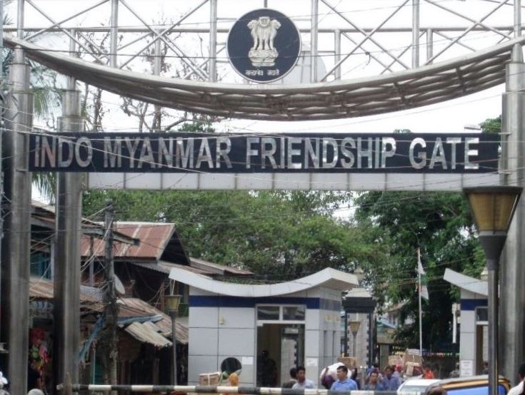
A trip to tamu myanmar via moreh manipur
Tamu or Tuimu is a town in Sagaing Region in north-west Burma near the border with the eastern Indian state of Manipur. It is the administrative seat for Tamu Township.
Contents
- A trip to tamu myanmar via moreh manipur
- Map of Tamu Myanmar Burma
- Imphal india to tamu myanmar burma
- Transport
- Highway to Thailand
- References
Map of Tamu, Myanmar (Burma)
Imphal india to tamu myanmar burma
Transport
Tamu is something of a transport hub for cross-border traffic to India, being just across the border from Moreh. It is on the alignment of a proposed railway connecting the two countries. Tamu is an important commercial town serving the Indian border town of Moreh. It is also a hub for smuggled goods from Thailand and China which are transported to India. The town is mainly populated by the Burmese, Chin ethnic people and lots of other people from different corners of the country.
Highway to Thailand
India’s foreign minister met with Myanmar’s construction minister in Delhi on 22 February 2012, and spoke about opening a highway between Moreh, in India, and the Myanmar-Thai border near Mae Sot.