
Existed: 1997 – present Constructed 1997 | Length 33.1 km | |
 | ||
Districts | ||
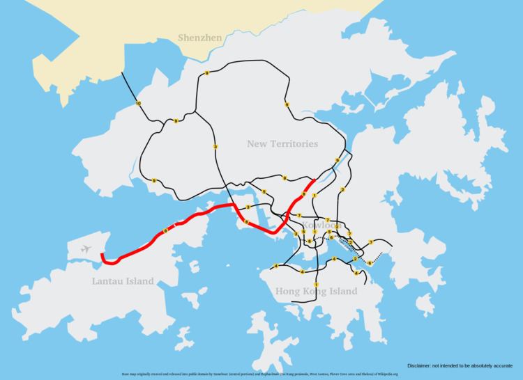
Route 8 (Chinese: 八號幹線) of Hong Kong is a dual 3-lane carriageway expressway that links Lantau Island, Tsing Yi Island, Cheung Sha Wan in West Kowloon, and Sha Tin in the southeast New Territories of Hong Kong. It is a combination of many sections.
The section from Lantau to Tsing Yi is made up of the existing North Lantau Highway and Lantau Link, which opened in 1997. Route 8 becomes Airport Road at Chek Lap Kok.
The section between Tsing Yi and Cheung Sha Wan, formerly known as Route 9, is a 7.6-kilometre (4.7 mi) dual 3-lane expressway. This section consists of the Stonecutters Bridge, which spans the Rambler Channel from Stonecutters Island and links with the Lantau Link through the Nam Wan Tunnel and West Tsing Yi viaduct and was opened on 20 December 2009. This section provides traffic with a more direct route to the Lantau Link, particularly vehicles from Tsim Sha Tsui and Western Harbour Crossing, previously vehicles had to use Route 3 (Cheung Tsing Bridge and Cheung Tsing Tunnel).
The remaining section links Cheung Sha Wan and Tai Wai, formerly known as Route 16. It is composed of the Eagle's Nest Tunnel and Sha Tin Heights Tunnel, totalling 6.7 kilometres (4.2 mi) in length and connecting Route 9 at its Sha Tin terminus. It was opened on 21 March 2008.
Areas passed through by Route 8 include Hong Kong International Airport, Tung Chung, Hong Kong Disneyland, Ma Wan, Tsing Yi, West Kowloon, and Sha Tin.