
Country Hong Kong | Constituencies 10 Area 175 km² | |
 | ||
Points of interest Tian Tan Buddha, Cheung Chau, Po Lin Monastery, Ngong Ping 360, Lantau Trail | ||
The Islands District (Chinese: 離島區) is one of the 18 districts of Hong Kong. It is part of the New Territories. It had a population of 141,327 in 2011.
Contents
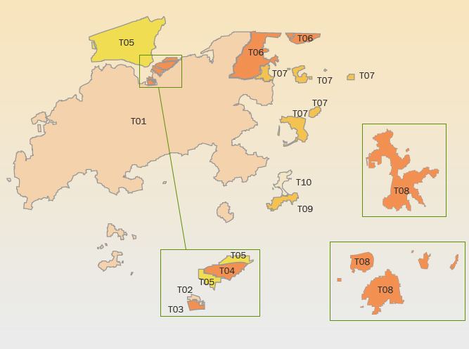
Map of Islands District, Hong Kong
Hong Kong consists of a peninsula and 236 islands. The Islands District consists of some twenty large and small islands which lie to the south and southwest of Hong Kong.
With an area that is 16% of Hong Kong and a population that is 2% of Hong Kong, the Islands District is the largest in terms of area and also the least populated. It is therefore the district with by far the lowest population density of 783 per km². The outlying islands are notable for a more relaxed way of life than that of Hong Kong Island and Kowloon Peninsula. The district has the third youngest residents.
Many islands of Hong Kong are actually not part of the district. Most notably, Hong Kong Island contains four districts itself. The term Outlying Islands tends to refer to the islands of the Islands District. The northeast point of Lantau and Ma Wan traditionally belong to Tsuen Wan District owing to their administration and transportation dependence of Tsuen Wan. Tsing Yi Island once was administrated by Tsuen Wan District and now by Kwai Tsing District. Whilst the Sai Kung Islands are part of the Sai Kung District, and the Tolo Channel Islands part of Tai Po District.
Other notable areas that are part of the Islands District include Chek Lap Kok, the reclamated island which the Hong Kong International Airport is located, Tung Chung on northern Lantau near the airport, and Discovery Bay, a large private residential area on eastern Lantau.
Collectively, Mui Wo and Tai O on Lantau, Cheung Chau, Lamma Island and Peng Chau are more populated than the rest of the area of the district.