
Constituencies 29 Area 21.82 km² | ||
 | ||
Team Kwai Tsing Women's Volleyball Team Points of interest Tsing Yi Nature Trail, Tsing Yi Park, Tsing Yi Northeast Park, Tsing Yi Promenade, Central Kwai Chung P | ||
18 pig outs in hong kong kwai tsing district
Kwai Tsing (Chinese: 葵青區) is one of the 18 districts of Hong Kong. It consists of two parts - Kwai Chung and Tsing Yi Island. Kwai Tsing is part of the New Territories. It had a population of 477,092 in 2001. The district has the third least educated residents and their income is below average.
Contents
- 18 pig outs in hong kong kwai tsing district
- Map of Kwai Tsing District Hong Kong
- Laser show at maritime square tsing yi for kwai tsing district council production by dk media
- History
- Geography
- 2003
- 1994
- Town centre
- Industry
- Basic education
- Transport
- Leisure
- References
Map of Kwai Tsing District, Hong Kong
Kwai Tsing did not exist as a standalone district when Hong Kong's District Boards were formed in the early 1980s. It remained as a part of Tsuen Wan district until 1985. The newly created district was known as Kwai Chung and Tsing Yi District (葵涌及青衣區) until 1988, when its name was shortened to Kwai Tsing District.
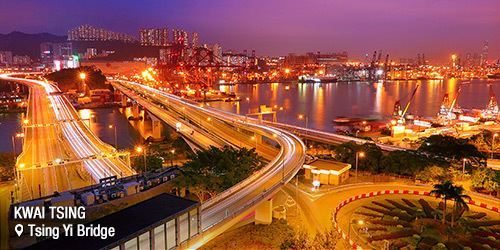
The internationally famous container terminals can be found within the district, along the shores of Rambler Channel between Kwai Chung and Tsing Yi Island. The Tsing Ma Bridge, leading to the Hong Kong International Airport through the North Lantau Highway, starts at the northwestern end of Tsing Yi Island.
Over 75% of the district residents live in public housing.
Laser show at maritime square tsing yi for kwai tsing district council production by dk media
History
During the eighth year of Emperor Kangxi (1669), the Qing Government forced the Hong Kong and the coastal regions such as Guangdong, Guangxi, Fujian, etc., to move to the inland areas of mainland China. After this move inland policy ceased, a large number of Hakka people in this period China moved to the new County and southeast coastal areas. Kwai Tsing District is traditionally speak Hakka areas, because the original inhabitants of the villages in this area mainly in Hakka Family. "Kwai" was first seen in a Ming Guo fei compiled the "big mind Guangdong, Guangdong coastal map" within the same diagram "Kwai" next to the name of an island "spring flowers", now there is a south-east Tsing Yi Island small mountain known as spring flowers, believes that "spring flowers" is the ancient name "Tsing" is. "Territories village official Fu Company" Qing Dynasty Emperor Kangxi compiled by Wang Tsung-hee "in Xin'an County Metropolitan" in the records there, "Chung child" and "Tsing Yi".
Geography
Kwai Tsing District borders in the north and west with Tsuen Wan District, east with Sha Tin District, southeast with Sham Shui Po District and Yau Tsim Mong District (marine), south with Central and Western District (marine), and southwest with Islands District (marine).
2003
By 2003 District Councils Election, the Kwai Tsing District Council is divided into 28 constituencies:
Kwai Chung
Tsing Yi
1994
etc.
Town centre
The district is part of Tsuen Wan New Town. Unlike other new towns in Hong Kong, the district has no clear town core in the course of development. Cores emerge only after Metroplaza in Kwai Fong and Maritime Square in Tsing Yi was built, but they are still incomparable to their counterparts in other new towns in Hong Kong.
Industry
Industry is an integral part of the district. Both light and heavy industries share substantial land in the district.
Basic education
Like other early new towns of Hong Kong, the district was primary for settling the influx of Chinese population around the year of the change of sovereignty in China in 1949 and the baby boom afterwards. Public housing estates were built throughout the district. Many schools have been established by various charities and religious organisations. Some have provided vocational training for industries in Hong Kong while some have become liberal schools. As the community has aged, the number of school children declined after the 2000s, and schools are facing survival problems.
Secondary schools in 2006:
Transport
The usual forms of transportation in the district are buses, minibuses and metro.
The MTR (metro) Tsuen Wan Line has four stations on three lines running through the district:
Leisure
There are several sports grounds in the district. Biu Chun Rangers are based in Tsing Yi. Kwai Tsing Theatre in Kwai Fong is gradually becoming an important performance venue in Hong Kong.