
Area 79.1 km² Phone +1 416-264-2020 | ||
 | ||
Created May 15, 2015 (2015-05-15) Similar Rouge River, Scarborough Bluffs, Toronto Zoo, Morningside Park, Edwards Gardens Profiles | ||
Rouge national urban park
Rouge National Urban Park is Canada's first and only national urban park and, once fully established, will span 79.1 km2 from Lake Ontario to the Oak Ridges Moraine in the cities of Toronto, Markham and Pickering and in the Township of Uxbridge, Ontario, Canada. A rich assembly of natural, cultural and agricultural landscapes, Rouge National Urban Park is home to over 1,700 species of plants and animals, some of the last remaining working farms in the Greater Toronto Area, rare Carolinian ecosystems, Toronto’s only campground, and human history dating back over 10,000 years, including some of Canada's oldest known Indigenous sites. Since 2011, Parks Canada has been working to nationalize and nearly double the size of the original 'Rouge Park'. In the coming years, Parks Canada is planning to add several new trails, education and orientation centres and improved signage and interpretive panels and displays throughout the park. Parks Canada has also introduced dozens of new educational programs to the park, including Learn-to-Camp, Learn-to-Hike, fire side chats, and other complimentary programming.
Contents
- Rouge national urban park
- Rouge national urban park 4k
- Overview
- History
- Transition to Rouge National Urban Park
- Biodiversity
- Farmland
- References
Rouge national urban park 4k
Overview
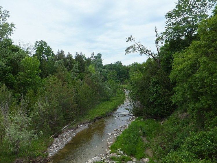
Rouge National Urban Park is located in the Rouge River, Petticoat Creek and Duffins Creek watersheds. The Rouge River remains the healthiest river that flows through the City of Toronto.
The original Rouge Park was established in 1995 by the Province of Ontario in partnership with cities of Toronto, Markham and Pickering, the regional municipalities of York and Durham, and the Toronto and Region Conservation Authority. The original park consisted of approximately 40 square kilometres of parkland in Toronto, Markham and Pickering.
Parks Canada first committed to work towards the creation of Rouge National Urban Park in 2011, following a review of the former regional Rouge Park’s governance, organization and finance, which recommended the creation of a national urban park.
In laying the groundwork for the park's establishment, Parks Canada has consulted and collaborated with over 20,000 Canadians and 200 organizations, including Indigenous People, all levels of government, community groups, conservationists, farmers and residents.
The most well-known part of the original Rouge Park, near the Toronto Zoo and Rouge Beach areas, remain open and are managed on an interim basis by the Toronto and Region Conservation Authority in partnership with Parks Canada and municipalities. As Rouge National Urban Park becomes fully operational, former Rouge Park lands will transfer to Parks Canada and become part of the much larger (79.1 km2) Rouge National Urban Park. Most remaining 'Rouge Park' lands are expected to transfer to Parks Canada in 2017.
Once fully established, Rouge National Urban Park will be the largest urban protected area in North America. It stretches from Lake Ontario in the south, north to the post-glacial Oak Ridges Moraine in the north,
On April 1, 2015, Transport Canada transferred the first lands that would make up Rouge National Urban Park to Parks Canada - 19.1 km2 in the north end of the park in the City of Markham. On May 15, 2015 the Rouge National Urban Park Act came into force, formally establishing Rouge National Urban Park.
The park is open with free admission to visitors 365 days per year, though there are camping fees. There are currently over 12 kilometres of rustic hiking trails in the Toronto and Markham areas of the park, though Parks Canada has plans to significantly expand the trail network and provide a contiguous link from Lake Ontario to the Oak Ridges Moraine. In Toronto, the park is accessible by public transportation by TTC and GO Transit.
History
Water from glaciers melting 12,000 years ago formed ancestral Lake Ontario, which covered this entire area. A large ice lobe, roughly 20 metres thick, blocked the lake from draining eastward, leaving water levels high as the lake slowly drained south to what is now the Mississippi River. The ice lobe finally retreated, draining the lake to the St Lawrence River and forming the Great Lakes as we see them today. Glaciation occurred when average annual temperatures were only 2 - 5 °C lower than present. The small decrease to the former temperatures caused big changes to the landscape. Changes in average annual temperatures now may seem small, but they could cause major changes to the natural environment in the near future.
Outcrops of rock formed during the last glacial period found in Rouge National Urban Park are important to geologists studying seismic activity, in particular the risk of earthquakes in the GTA. Faults are visible indicating significant earthquake activity between 80,000 and 13,000 years ago.
The human history of Rouge National Urban Park goes back over 10,000 years. Palaeolithic nomadic hunters, Iroquoian farmers, early European explorers, and the multicultural suburban population that one can see around the park today are all part of this history. Since humans began living in the area of the present Great Lakes-St Lawrence Lowlands in Ontario, many groups of people made the lands and waters now protected in Rouge Park their home. The river and its valleys, uplands, forests and wetlands, along with the animal and plant species that lived here, sustained small nomadic groups, and later on larger, permanent settlements long before the rapid urbanization of the 20th century altered the landscape dramatically.
Inspired by the scenery of the Rouge, F.H. Varley, one of Canada's renowned Group of Seven painters, captured the banks of the Rouge River in Markham on canvas during the 1950s as a lasting memory of their beauty.
The park protects one national historic event and one national historic sites:
This was an original portage route along the Rouge River to the Holland River, linking Lake Ontario to Lake Simcoe. This route was created by Indigenous Peoples, and later used by early European traders, explorers and settlers. The Rouge River route is not currently marked for the general public, but the western branch of the route, following the Humber River, has an official federal plaque. The Toronto Carrying-Place Trail was designated by the Historical Sites and Monuments Board of Canada in 1969.
Bead Hill is an archaeological site of an intact 17th century Seneca village and was designated a National Historic Site of Canada in 1991. The site includes the remains of an Archaic campsite, dating about 3,000 years old. Minimal excavations have been carried out, and the site includes a naturally protected midden, which is thought to contain a wealth of material. Because of its sensitive archaeological nature, it is not open to the public nor readily identified in the park. Its national historic site designation was prompted by imminent development plans that could have encroached on the area.
Transition to Rouge National Urban Park
A number of projects and initiatives are currently underway as part of the Rouge National Urban Park establishment process.
Indigenous Partnerships
Parks Canada is working with 10 different First Nations with historic and present-day connections to the park through the Rouge National Urban Park First Nations Advisory Circle. Parks Canada’s Indigenous partners play a role in and make significant contributions to all aspects of park operations, including helping to restore and enhance park ecosystems and farmland, sharing traditional stories and cuisine at in-park programs and events, and participating in and helping to monitor archaeological work throughout the park.
Blanding's Turtle Conservation
Since 2014, Parks Canada has worked with the Toronto Zoo to rear and release 113 threatened baby Blanding’s turtles in the park; prior to this initiative, its believed that only seven turtles remained in the park.
Farming and Conservation
Since 2015, Parks Canada has partnered with park farmers and the Toronto and Region Conservation Authority to complete 31 conservation and agricultural enhancements projects in Rouge National Urban Park.[1]
Educational Programming
In 2016, Parks Canada offered over 300 free public events in the park, including Frog Watch, Hoot and Howl, weekly guided walks, Art in the Park, the Fall Walk Festival, BioBlitz, Learn-to-Camp, Taste of the Trail and more.
Future Education and Welcome Facilities
Several education and orientation centres, facilities, signage and interpretive panels are being planned in the Toronto and Markham areas of the park.
Trail Expansion
Parks Canada is planning to significantly expand the park's trail network from 12 kilometres by adding dozens of kilometres of new trails in effort to provide a contiguous connection from Lake Ontario to Oak Ridges Moraine. Plans are also underway to link park trails with regional trails outside the park located in the cities of Toronto, Markham and Pickering and in the Township of Uxbridge.
Photographer-in-Residence
In 2016, Parks Canada partnered with OCAD University to hire the park’s first “Photographer-in-Residence” Heike Reuse. Heike's work was featured in the Toronto Star, CBC and Metro, and she also staged an exhibition in downtown Toronto.[2]
App Project
In partnership with University of Toronto Scarborough, Parks Canada is developing a mobile technology App for Rouge National Urban Park. The App highlights the natural, cultural and agricultural heritage of the park and is expected to be complete in early 2018.[3]
Biodiversity
The park has over 1,700 species of plants, animals and fungi, as verified in the 2012 and 2013 Ontario BioBlitz surveys.
Farmland
People have been farming in the Rouge Valley for thousands of years, including Indigenous People and, later, European settlers. Rouge National Urban Park protects large tracts of Class 1 farmland, the rarest and most fertile soil in Canada.
Since 2015, Parks Canada has partnered with park farmers, Indigenous partners, and conservation groups to complete 31 conservation and agricultural enhancements projects in Rouge National Urban Park. To date, more than 32 hectares of wetland and riparian habitat and 20 hectares of forest have been restored, and over 38,000 native trees and shrubs have been planted.
Parks Canada has committed to preserving the park's farmland and working farms in a way that contributes to the overall health of the park while also providing unique visitor farm experiences. The park is home to two well known farmers markets, Whittamore's Farm and Reesor's Farm Market.