
Province Ontario Country Canada | Phone +1 416-661-6600 | |
 | ||
Address 1100 Whites Road, Pickering, ON L1V 6K7, Canada Similar Waterfront Trail, Rouge River, Highland Creek, Bruce's Mill Conservation Area, Rouge National Urban Park Profiles | ||
Petticoat creek martian emax rs2205s 2600kv
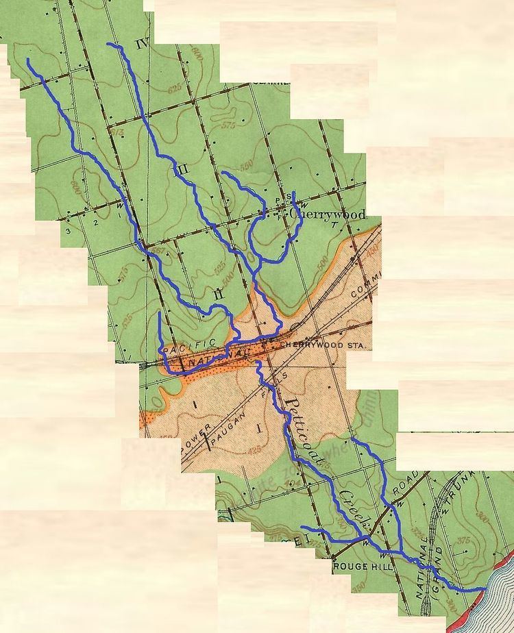
Petticoat Creek is a watercourse in Pickering, Ontario and Toronto, Ontario. Its watershed covers 27 square kilometres (10 sq mi), and the cumulative length of all its branches is 49 kilometres (30 mi). Land use in the watershed consists of 52% agricultural, 27% protected greenspace and 21% urban. Municipalities within the watershed include Pickering, Markham and Toronto.
Contents
- Petticoat creek martian emax rs2205s 2600kv
- Petticoat creek conservation area june 2015 pickering on
- References
According to the Toronto Region Conservation Authority the ″Petticoat Creek watershed is dominated by the South Slope physiographic region, a smooth, faintly drumlinized till plain.″ Because the creek is not long enough for its headwaters to lie within the groundwater rich Oak Ridges Moraine, waterflow on the upper reaches is intermittent and dependent on precipitation. Lower reaches, below the ancient shoreline of glacial Lake Iroquois, is more consistent.