
 | ||
Similar Toronto Islands, Edwards Gardens, Guild Inn, High Park, Guild Park and Gardens | ||
Drone flight over scarborough bluffs toronto ontario
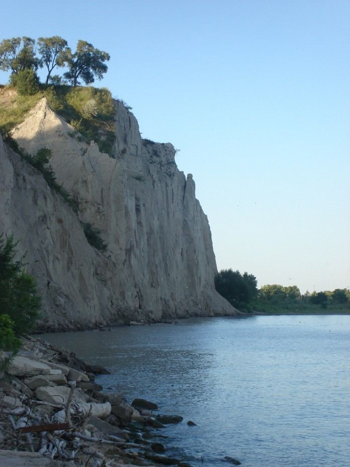
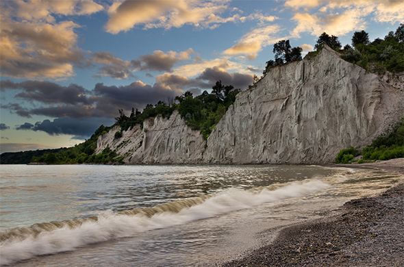
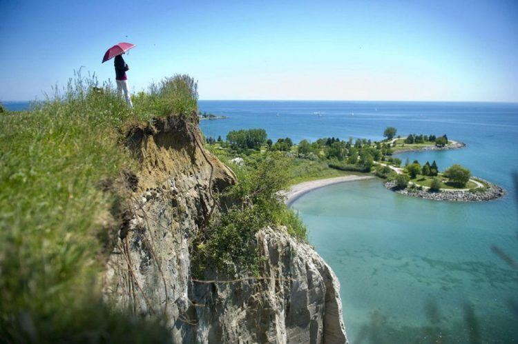
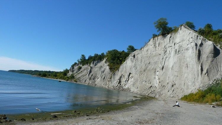
The Scarborough Bluffs, also known as The Bluffs, is an escarpment in the Scarborough district of Toronto, Ontario, Canada. There are nine parks along the bluffs, with Bluffers Park being the only one with beach access. Forming much of the eastern portion of Toronto's waterfront, Scarborough Bluffs stands above the shoreline of Lake Ontario. At its highest point, the escarpment rises 90 metres (300 ft) above the coastline and spans a length of 15 kilometres (9.3 mi). It was first named in 1793.
Contents
- Drone flight over scarborough bluffs toronto ontario
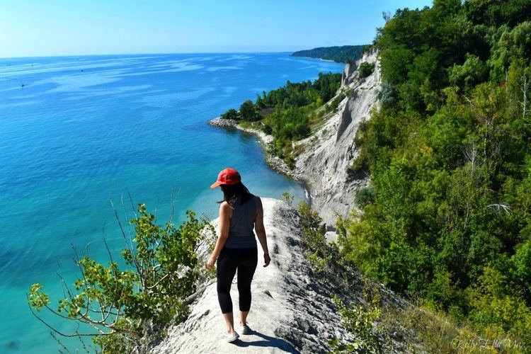
- Hiking scarborough bluffs with eva chung camille co
- History
- Geology
- Issues
- Parks
- References
Hiking scarborough bluffs with eva chung camille co
History
The French gave the name "Les grands Ecores", or tall points on the shore, to the cliffs. In the 1788 Plan of Toronto by Alexander Aitken, the bluffs were simply known as the High Lands. They became known as the Scarborough Highlands in 1793 after Scarborough, North Yorkshire, England by Elizabeth Simcoe, the wife of John Graves Simcoe, the first lieutenant governor of Upper Canada. The escarpment along Lake Ontario reminded her of the limestone cliffs in her hometown. In her diary, she wrote, "The shore is extremely bold, and has the appearance of chalk cliffs, but I believe they are only white sand. They appeared so well that we talked of building a summer residence there and calling it Scarborough." The name was later given to the entire township in 1796. In time, the cliffs became known as the Bluffs. A stylized version of The Bluffs was incorporated into the design of the former City of Scarborough flag.
The Scarborough Bluffs formerly extended further west along the coastline of Lake Ontario towards the Toronto Harbour, but extensive areas along the western fringe were levelled by the use of explosives for the implementation of primarily industrial and some residential urban development. Even the existing formation has and continues to shrink considerably decade after decade due to consistent and dramatic erosion.
The Bluffs have become a community meeting place for people of all ages. It features various recreational hiking and walking trails as well as picnic tables, firepits, places to pitch a tent, parking lots, a 'Bluffers Restaurant', and a large marina and boating club.
Geology
They run 15 kilometres (9.3 mi) from the foot of Victoria Park Avenue in the west to the mouth of Highland Creek in the east, reaching as high as 90 metres (300 ft), the equivalent of twenty-five storeys. However, the escarpment continues westward inland, running between Kingston Road and Queen Street East, pausing over the Don Valley, and continuing on the north side of Davenport Road. The escarpment forms part of the old shoreline of Glacial Lake Iroquois, formed after the last ice age, which left valuable geological records as the part of the escarpment by the lake eroded. The eroded alluvial deposits from the Bluffs then settled westward to form the Toronto Islands.
Issues
The Scarborough Bluffs had been eroding at a rapid rate since cottages were built near the edge in the 1940s and this problem escalated in the 1970s when a six-metre chunk fell off the Bluffs. Homeowners knew that erosion would occur, but the waterfront views were enticing enough to settle there, which led to a housing boom along the Bluffs, which was responsible for the accelerating rate of erosion. Even as recently as summer 2008, chunks of the Bluffs had eroded to the point that one quarter of a cottage that the late actor and comedian Billy Van once owned was left hanging on the cliff; the cottage is deemed a safety hazard by Toronto city officials as a result. To combat erosion, boulders acting as armour rocks and trees were placed at the base. However, to place these rocks and plant trees, a beach must be created to allow trucks to access the cliff base, which would involve levelling parts of the Bluffs, such as the aforementioned Bluffer's Park. The Cathedral Bluffs, which is an impressive portion of the Bluffs, was the result of continued erosion.
Parks
A number of city parks are located along the bluffs from Victoria Park Avenue to Rouge River. Most are located on the top the bluffs but some are located at the base along the shoreline with Lake Ontario.
Development of parkland began with the then Borough of Scarborough prior to 1960 while some remained in private hands. From 1960 to 1978 the current parks were acquired by the Toronto and Region Conservation Authority and developed into the current parks. Outside of the parks many sections of the bluffs are on private property.