
Founded 1785 Website www.richlandonline.com Population 399,256 (2013) | Area 2,000 km² Unemployment rate 5.8% (Apr 2015) | |
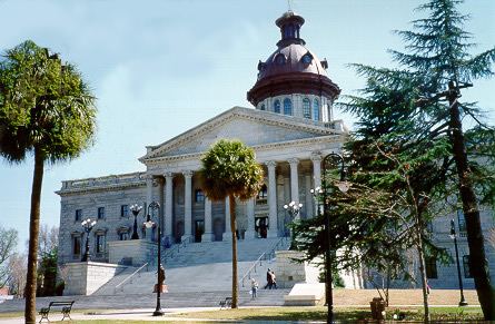 | ||
Colleges and Universities University of South Carolina, Midlands Technical College, Benedict College, Allen University, Columbia International University Points of interest South Carolina State Hou, Robert Mills House, Sesquicentennial State Park, Riverbanks Zoo, South Carolina Confeder | ||
Richland County is a county located in the U.S. state of South Carolina. As of the 2010 census, the population was 384,504, making it the second-most populous county in South Carolina, behind only Greenville County. The county seat is Columbia, the state capital.
Contents
- Map of Richland County SC USA
- History
- Geography
- Rivers and lakes
- Adjacent counties
- National protected area
- Demographics
- Government
- Transportation
- Attractions
- Cities
- Towns
- Census designated places
- Regions
- References
Map of Richland County, SC, USA
Richland County is part of the Columbia, SC Metropolitan Statistical Area.
In 2010, the center of population of South Carolina was located in Richland County, in the city of Columbia.
History
Richland County was probably named for its "rich land." The county was formed in 1785 as part of the large Camden District. A small part of Richland later went to Kershaw County (1791). The county seat is Columbia, which is also the state capital. In 1786 the state legislature decided to move the capital from Charleston to a more central location. A site was chosen in Richland County, which is in the geographic center of the state, and a new town was laid out. Richland County’s boundaries were formally incorporated on Dec. 18, 1799. Cotton from the surrounding plantations was shipped through Columbia and later manufactured into textiles there. General William T. Sherman captured Columbia during the Civil War, and his troops burned the town and parts of the county on February 17, 1865. The U. S. Army returned on more friendly terms in 1917, when Fort Jackson was established, which is now the largest and most active Initial Entry Training Center in the U.S. Army.
Geography
According to the U.S. Census Bureau, the county has a total area of 772 square miles (2,000 km2), of which 757 square miles (1,960 km2) is land and 15 square miles (39 km2) (1.9%) is water. Richland County is situated in the center of South Carolina.
Rivers and lakes
Adjacent counties
National protected area
Demographics
As of the 2010 United States Census, there were 384,504 people, 145,194 households, and 89,357 families residing in the county. The population density was 507.9 inhabitants per square mile (196.1/km2). There were 161,725 housing units at an average density of 213.6 per square mile (82.5/km2). The racial makeup of the county was 47.3% white, 45.9% black or African American, 2.2% Asian, 0.3% American Indian, 0.1% Pacific islander, 1.9% from other races, and 2.2% from two or more races. Those of Hispanic or Latino origin made up 4.8% of the population. In terms of ancestry, 9.6% were German, 8.6% were English, 7.6% were Irish, and 7.1% were American.
Of the 145,194 households, 32.9% had children under the age of 18 living with them, 39.6% were married couples living together, 17.7% had a female householder with no husband present, 38.5% were non-families, and 30.2% of all households were made up of individuals. The average household size was 2.43 and the average family size was 3.05. The median age was 32.6 years.
The median income for a household in the county was $47,922 and the median income for a family was $61,622. Males had a median income of $42,453 versus $34,012 for females. The per capita income for the county was $25,805. About 10.0% of families and 14.5% of the population were below the poverty line, including 17.6% of those under age 18 and 9.7% of those age 65 or over.
Government
Government and infrastructure Richland County is governed by an eleven-member County Council, who hold concurrent four-year terms. Richland County is governed under the Council-Administrator form of government, which is very similar to the Council-Manager form of government. The major difference between the Council Manager and Council Administrator forms of government is the title of the chief executive, being Manager in one and Administrator in the other.
In March 2008, the Richland County sheriff department acquired an armored personnel carrier equipped with a .50 caliber machine gun. This acquisition was criticized by Reason magazine as "overkill".
The South Carolina Department of Corrections, headquartered in Columbia and in Richland County, operates several correctional facilities in Columbia and in Richland County. They include the Broad River Correctional Institution, the Goodman Correctional Institution, the Camille Griffin Graham Correctional Institution, the Stevenson Correctional Institution, and the Campbell Pre-Release Center. Graham houses the state's female death row. The State of South Carolina execution chamber is located at Broad River. From 1990 to 1997 Broad River housed the state's male death row.
Transportation
Public transportation in Richland County is provided by the Central Midlands Regional Transit Authority.