
- elevation 118 ft (36 m) | Length 322 km | |
 | ||
Cities | ||
Discover kayaking on the saluda river
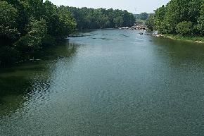
The Saluda River is a principal tributary of the Congaree River, about 200 mi (320 km) long, in northern and western South Carolina in the United States. Via the Congaree River, it is part of the watershed of the Santee River, which flows to the Atlantic Ocean.
Contents
- Discover kayaking on the saluda river
- Map of Saluda River South Carolina USA
- Sce g lake murray saluda river spillway release columbia s c
- CourseEdit
- DamsEdit
- Principal tributariesEdit
- CrossingsEdit
- Variant namesEdit
- Save Our SaludaEdit
- Endangered StatusEdit
- References
Map of Saluda River, South Carolina, USA
Sce g lake murray saluda river spillway release columbia s c
CourseEdit
The Saluda River is formed about 10 mi (15 km) northwest of the city of Greenville, on the common boundary of Greenville and Pickens Counties, by the confluence of its north and south forks, each of which rises in the Blue Ridge Mountains very near the border of North Carolina:
From this confluence the Saluda River flows generally southeastwardly through the Piedmont region, through or along the boundaries of Pickens, Greenville, Anderson, Abbeville, Laurens, Greenwood, Newberry, Saluda, Lexington and Richland Counties, past the towns of Piedmont, West Pelzer, Pelzer, Ware Shoals and West Columbia. It joins the Broad River in Columbia to form the Congaree River.
DamsEdit
Dams on the Saluda include:
Principal tributariesEdit
CrossingsEdit
As it travels downstream, the Saluda river is crossed several times. (Note: this list may at times be incomplete)
Variant namesEdit
According to the Geographic Names Information System, the Saluda River has also been known as:
The river is named after an Indian tribe that once lived along its banks near the community of Chappells, South Carolina.
Save Our SaludaEdit
In 2008, a collective of local citizens (or Citizens Action Group) based in Marietta, Greenville County, South Carolina initiated a campaign to "Save Our Saluda" following what they perceived to be aggressive property development. Their mission is to "(protect) and (preserve) the headwaters of the Saluda watershed through concerned citizens action".
Endangered StatusEdit
In April 2009, the Saluda River was named by American Rivers, a leading river conservation group to a list of rivers in the United States that are under imminent threat by dams, industry or development. The article, posted on CNN on April 7, 2009 stated "Excess levels of sewage waste threaten the drinking water of more than 500,000 South Carolina residents, conservationists say. Sewage in the river increases phosphorus and algae levels, depletes oxygen, and kills fish and other aquatic life. American Rivers is asking the South Carolina Department of Health and Environmental Control to improve sewage-treatment standards and ensure the river reduces its phosphorus levels by 25 to 50 percent."