
 | ||
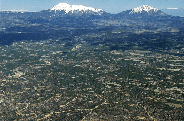
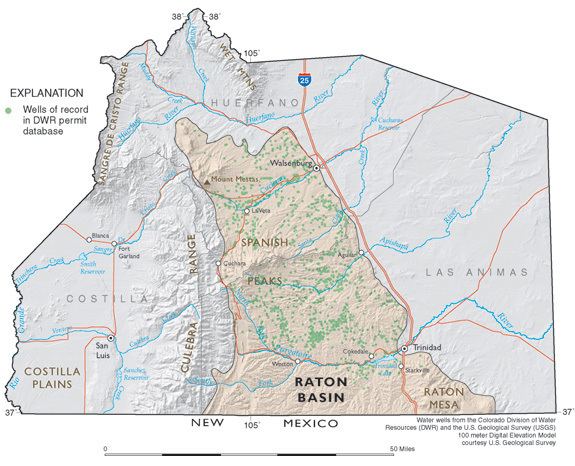
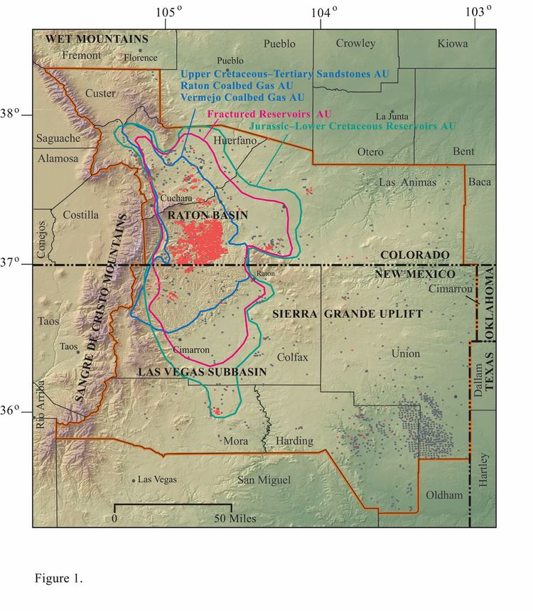
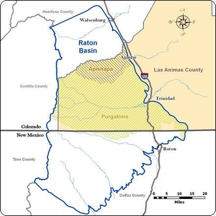
The Raton Basin is a geologic structural basin in southern Colorado and northern New Mexico. It takes its name from Raton Pass and the town of Raton, New Mexico. In extent, the basin is approximately 50 miles (80 km) east-west, and 90 miles (140 km) north-south, in Huerfano and Las Animas Counties, Colorado, and Colfax County, New Mexico.
Contents
The basin has long been a source of coal, and more recently of coalbed methane. It is known for its well-preserved exposures of the Cretaceous–Paleogene boundary (K–T boundary), which has been intensively studied for evidence of meteorite impact.
TopographyEdit
Although structurally a basin, the Raton Basin forms a topographic high dissected by eastward-flowing streams such as the Purgatoire River. The basin forms the foothills of the Rocky Mountains, immediately east of the Sangre de Cristo Range.
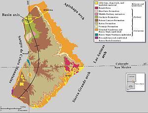
GeologyEdit
The sedimentary beds that form the basin are of Paleozoic, Mesozoic and Paleogene age. In the eastern part of the basin, the sedimentary section is capped by flows of basalt of Miocene age. The basin is highly asymmetrical, the beds dipping more steeply on the west side than the east.
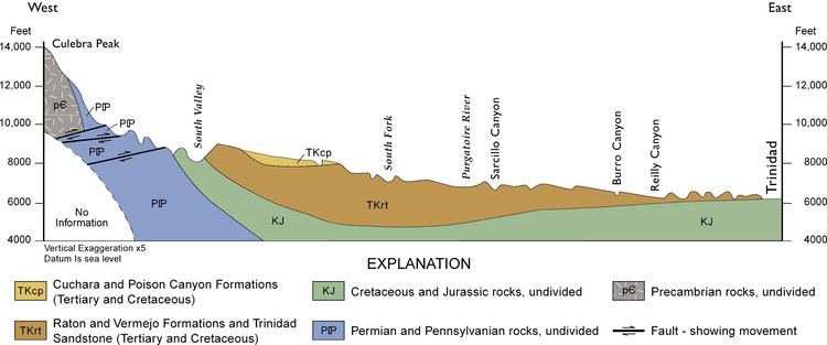
The sedimentary rocks of the basin are extensively intruded by igneous plugs, dikes and sills of Eocene to Oligocene age. Two large granitic intrusives near the axis of the basin form East Spanish Peak and West Spanish Peak. Dikes of felsic to intermediate composition radiate outward from East and West Spanish Peaks, and on the north side of the peaks have the appearance of large stone walls. Dikes of mafic and ultramafic composition trend east-northeast to west-southwest across the basin. Ultrapotassic lamprophyre dikes can also be found along the basin flanks, which are highly unusual in the Rocky Mountain region.
The site of the Raton Basin was a coastal plain at the end of Cretaceous and beginning of Paleogene time, and has a well-preserved sequence of rocks spanning the Cretaceous–Paleogene boundary. For this reason, the Raton Basin has been studied for evidence of the iridium anomaly thought to be evidence for a large meteor impact at the end of the Cretaceous that is in turn thought to have caused the Cretaceous–Paleogene extinction event. The boundary is represented in the basin by a 1-cm thick tonstein clay layer which has been found to contain anomalously high concentrations of iridium. The boundary clay layer is accessible to the public at Trinidad Lake State Park, among other places in the basin.