
Isolation 4.21 mi (6.78 km) Prominence 720 m | Elevation 3,866 m | |
 | ||
Topo map USGS 7.5' topographic mapSpanish Peaks, Colorado Easiest route West Ridge: hike/scramble class 2 Similar West Spanish Peak, Mount Mestas, Culebra Peak, Mount Zwischen, South River Peak | ||
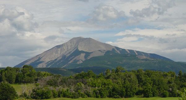
East Spanish Peak is a prominent mountain summit that is the lower of the two Spanish Peaks in the Rocky Mountains of North America. The 12,688-foot (3,867 m) peak is located in the Spanish Peaks Wilderness of San Isabel National Forest, 9.3 miles (14.9 km) southeast by south (bearing 148°) of the Town of La Veta, Colorado, United States, on the drainage divide between Huerfano and Las Animas counties. The Spanish Peaks are two large igneous stocks which form an eastern outlier of the Culebra Range, a subrange of the Sangre de Cristo Mountains. East Spanish Peak is higher than any point in the United States east of its longitude.
Contents
Map of East Spanish Peak, Colorado 81020, USA
GeologyEdit
While the Spanish Peaks have the appearance of volcanic cones, they are actually stocks, remnants of an igneous batholith which formed underground around 25 million years ago. They are surrounded by radiating dikes, up to 14 miles (23 km) long, made of the same material.
Hiking/climbingEdit
The standard ascent route for East Spanish Peak ascends the west ridge of the peak from the saddle between it and West Spanish Peak. A trail ascends to the saddle from the north side of the peaks.