
Founded November 1, 1861 Area 4,126 km² Unemployment rate 8.7% (Apr 2015) | Seat Walsenburg Congressional district 3rd Website www.huerfano.us Population 6,519 (2013) | |
 | ||
Rivers Cucharas River, Huerfano River, Little Graneros Creek Points of interest Lathrop State Park, La Veta Pass, Walsenburg Water Park, Museum Of Friends, Francisco Fort Museum | ||
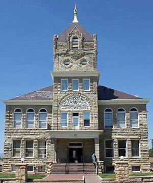
Huerfano County (/ˈwɛərfənoʊ/; [ˈweɾfano]) is one of the 64 counties in the U.S. state of Colorado. As of the 2010 census, the population was 6,711. The county seat is Walsenburg. The county, whose name comes from the Spanish huérfano meaning "orphan", was named for the Huerfano Butte, a local landmark. The area of Huerfano County boomed early in the 1900s with the discovery of large coal deposits. After large scale World War II coal demand ended in the 1940s Walsenburg and Huerfano saw a steady economical decline through 2015.
Contents
- Map of Huerfano County CO USA
- Historical
- Geography
- Local attractions
- Adjacent counties
- Protected areas
- Scenic byway
- Demographics
- Communities
- References
Map of Huerfano County, CO, USA
Other attractions include historic coal mine sites, majestic mountain hiking and mountain biking.
Historical
Huerfano County was one of the original 17 counties created by the Territory of Colorado on November 1, 1861, and was originally larger than its present size. On November 2, 1870, the Colorado General Assembly created Greenwood County from former Cheyenne and Arapaho tribal land and the eastern portion of Huerfano County. There are countless reports of vast New Spain and Native American gold treasures that lay hidden in the hills and mountains of Huerfano County including the Arapahoe Princess Treasure. Two Spanish forts were located in Huerfano County.
Geography
According to the U.S. Census Bureau, the county has a total area of 1,593 square miles (4,130 km2), of which 1,591 square miles (4,120 km2) is land and 2.2 square miles (5.7 km2) (0.1%) is water. The price of property saw an increase of more than 10% after a moratorium on commercial marijuana grows was lifted in July 2015.
Local attractions
The Huerfano River Wind Farm, Colorado's largest producer of distributed generation (DG) power, is located ten miles north of Walsenburg, just off of Interstate 25. The farm uses Sany-made turbines and feeds into the San Isabel Electric Association grid. It is owned by Tamra-Tacoma Capital Partners, a New York-based investment firm. As you travel into Huerfano County from the North you will see the Spanish Peaks loom larger and larger. Travelers will pass a series of US flags along Interstate 25 which mark the boundary of Crown Valley Ranch. Visitors can shop in the many small town antique and novelty shops along Walsenburg's downtown.
Located at 420 Main Street, Walsenburg, Colorado 81089, within the offices of The Colorado Cannabis Growers Association is a quasi Cannabis Art gallery featuring the works of various fine artists around the world. The second Wednesday of each month at 6:00 pm The Colorado Cannabis Growers Association holds top of industry special guest speakers. These speakers outline various topics regarding the legal marijuana industry.
During summer months guests can enjoy various hip music events including Sonic Bloom and Hippie Days in the beautiful mountain town of Gardner. Gardner is located on scenic "Highway of Love " or State Highway 69. Don't miss the wonderful food at the Wildflower Cafe in downtown Gardner.
Adjacent counties
Protected areas
Scenic byway
Demographics
As of the census of 2000, there were 7,862 people, 3,082 households, and 1,920 families residing in the county. The population density was 5 people per square mile (2/km²). There were 4,599 housing units at an average density of 3 per square mile (1/km²). The racial makeup of the county was 80.96% White, 2.75% Black or African American, 2.70% Native American, 0.39% Asian, 0.08% Pacific Islander, 9.41% from other races, and 3.71% from two or more races. 35.14% of the population were Hispanic or Latino of any race.
There were 3,082 households out of which 25.00% had children under the age of 18 living with them, 48.40% were married couples living together, 10.40% had a female householder with no husband present, and 37.70% were non-families. 32.80% of all households were made up of individuals and 14.10% had someone living alone who was 65 years of age or older. The average household size was 2.25 and the average family size was 2.85.
In the county, the population was spread out with 20.90% under the age of 18, 7.30% from 18 to 24, 27.40% from 25 to 44, 27.40% from 45 to 64, and 17.00% who were 65 years of age or older. The median age was 42 years. For every 100 females there were 118.80 males. For every 100 females age 18 and over, there were 122.80 males.
The median income for a household in the county was $25,775, and the median income for a family was $32,664. Males had a median income of $24,209 versus $21,048 for females. The per capita income for the county was $15,242. About 14.10% of families and 18.00% of the population were below the poverty line, including 23.70% of those under age 18 and 11.90% of those age 65 or over.