
Country United States County Colfax Area code 575 Elevation 2,036 m Zip code 87740 | Time zone Mountain (MST) (UTC-7) FIPS code 35-62060 Local time Friday 10:18 PM Population 6,537 (2013) | |
 | ||
Weather 3°C, Wind N at 26 km/h, 62% Humidity | ||
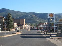
Raton is a city and the county seat of Colfax County in northeastern New Mexico. The city is located just south of Raton Pass.
Contents
- Map of Raton NM 87740 USA
- Nra whittington center raton new mexico
- History
- Geography
- Geology
- Demographics
- Road
- Rail
- Air
- Recreation
- Notable people
- References
Map of Raton, NM 87740, USA
Nra whittington center raton new mexico
History
Ratón is the Spanish term for "mouse" (literally "small rat"). The Raton Range and Raton Peak are located immediately north of the town. The Raton Range is a 75-mile-long (121 km) ridge that extends east from the Sangre de Cristo Mountains. Raton Pass and the Raton Basin are also named for the Raton Range.
Raton Pass had been used by Spanish explorers and Indians for centuries to cut through the rugged Rocky Mountains, but the trail was too rough for wagons on the Santa Fe Trail.
The post office at this location was named Willow Springs from 1877 to 1879, Otero from 1879 to 1880, then renamed Raton in 1880.
Raton was founded at the site of Willow Springs, a stop on the Santa Fe Trail. The original 320 acres (129.5 ha) for the Raton townsite were purchased from the Maxwell Land Grant in 1880. In 1879, the Atchison, Topeka and Santa Fe Railway bought a local toll road and established a busy rail line. Raton quickly developed as a railroad, mining and ranching center for the northeast part of the New Mexico territory, as well as the county seat and principal trading center of the area.
The city is mentioned in Jack Kerouac's novel On the Road.
Geography
Raton is located at 36°53′49″N 104°26′24″W (36.897082, -104.439912). According to the United States Census Bureau, the city has a total area of 8.0 square miles (20.6 km2), all land.
Geology
Raton is one of the famous sites for viewing the K-T Boundary, also known as the K-Pg Boundary or Cretaceous-Paleogene Boundary, or the Iridium Layer. There is a well-preserved sequence of rocks spanning the Cretaceous–Paleogene boundary in Climax Canyon Park, a Raton city park to the west of town. Geographic Coordinates: 36°54′13.99″N 104°27′0.75″W
The rocks have been studied for evidence of the iridium anomaly cited as evidence of a large meteorite impact at the end of the Cretaceous. It is interpreted to have caused the Cretaceous–Paleogene extinction event which killed off non-avian dinosaurs, as well as many other species of flora and fauna 65 million years ago. The K-T Boundary is represented in the rock strata by a 1-cm thick tonstein clay layer which has been found to contain anomalously high concentrations of iridium.
Demographics
As of the census of 2000, there were 7,282 people, 3,035 households, and 1,981 families residing in the city. The population density was 992.4 people per square mile (383.1/km²). There were 3,472 housing units at an average density of 473.2 per square mile (182.6/km²). The racial makeup of the city was 78.04% White, 0.23% African American, 1.59% Native American, 0.40% Asian, 0.01% Pacific Islander, 16.19% from other races, and 3.53% from two or more races. Hispanic or Latino of any race were 56.96% of the population.
There were 3,035 households out of which 30.7% had children under the age of 18 living with them, 47.0% were married couples living together, 12.9% had a female householder with no husband present, and 34.7% were non-families. 30.6% of all households were made up of individuals and 14.1% had someone living alone who was 65 years of age or older. The average household size was 2.35 and the average family size was 2.92.
In the city, the population was spread out with 25.1% under the age of 18, 7.8% from 18 to 24, 24.9% from 25 to 44, 23.9% from 45 to 64, and 18.4% who were 65 years of age or older. The median age was 40 years. For every 100 females there were 94.5 males. For every 100 females age 18 and over, there were 92.1 males.
The median income for a household in the city was $27,028, and the median income for a family was $31,762. Males had a median income of $24,946 versus $18,433 for females. The per capita income for the city was $14,223. About 14.8% of families and 17.4% of the population were below the poverty line, including 25.2% of those under age 18 and 10.4% of those age 65 or over.
Road
Rail
Air
Recreation
Sugarite Canyon State Park is located 12 miles (19 km) northeast of Raton at an elevation of 8,800 feet (2,700 m). Activities there include camping, fishing, and hiking.
The NRA Whittington Center is located 15 miles (24 km) southwest of Raton. It is the largest NRA shooting range in the US. It hosts national competitions. High-powered rifle and skeet shooting are possible.
Raton was the site of New Mexico's first horse racetrack, La Mesa Park, which closed in 1992.