
Founded March 30, 1846 Population 45,790 (2013) Area code 936 | Congressional district 36th Area 2,875 km² County seat Livingston Largest city Livingston | |
 | ||
ZIP code(s) 75934, 75936, 75939, 75960, 77326, 77335, 77350, 77351, 77360, 77364 Rivers Trinity River, Neches River, Big Sandy Creek, Caney Creek | ||
Polk county texas law enforcement recognition of harris county deputy darren goforth
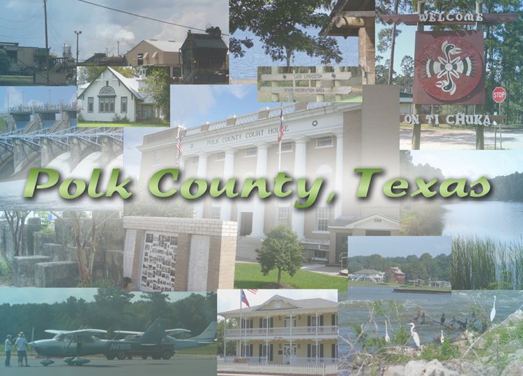
Polk County is a county located in the U.S. state of Texas. As of the 2010 census, the population was 45,413. Its county seat is Livingston.
Contents
- Polk county texas law enforcement recognition of harris county deputy darren goforth
- Map of Polk County TX USA
- History
- Infrastructure
- Demographics
- Geography
- Adjacent counties
- National protected area
- Education
- Major highways
- Mass transportation
- Airport
- Cities
- Towns
- Census designated places
- Ghost town
- Notable people
- References
Map of Polk County, TX, USA
The Alabama-Coushatta Indian Reservation of the federally recognized tribe is in Polk County, where the people have been since the early 19th century, after migrating from the Southeast. The 2000 census reported a resident population of 480 persons within the reservation. The tribe reports 1100 enrolled members.
History
Polk County, named for His Excellency James Knox Polk of Tennessee, President of the United States, was by act of the First Legislature of the State of Texas, approved on March 30, 1846, created out of Liberty County and embraced that portion thereof known and designated as the "Northern Division" of said Liberty County. It was one of the first of a series of 23 counties, formulated, constituted and established by the State of Texas, after annexation with the United States.
Infrastructure
The Texas Department of Criminal Justice Allan B. Polunsky Unit is located in West Livingston. This has been the location of the State of Texas death row since 1999.
Demographics
As of the census of 2000, there were 41,133 people, 15,119 households, and 10,915 families residing in the county. The population density was 39 inhabitants per square mile (15/km2). There were 21,177 housing units at an average density of 20 per square mile (8/km²). The racial makeup of the county was 79.64% White, 13.17% Black or African American, 1.74% Native American, 0.38% Asian, 0.01% Pacific Islander, 3.74% from other races, and 1.32% from two or more races. 9.39% of the population were Hispanic or Latino of any race.
There were 15,119 households out of which 28.80% had children under the age of 18 living with them, 57.90% were married couples living together, 10.80% had a female householder with no husband present, and 27.80% were non-families. 24.60% of all households were made up of individuals and 12.50% had someone living alone who was 65 years of age or older. The average household size was 2.50 and the average family size was 2.95.
In the county, the population was spread out with 22.90% under the age of 18, 8.10% from 18 to 24, 26.80% from 25 to 44, 24.20% from 45 to 64, and 18.00% who were 65 years of age or older. The median age was 39 years. For every 100 females there were 108.70 males. For every 100 females age 18 and over, there were 109.50 males.
The median income for a household in the county was $30,495, and the median income for a family was $35,957. Males had a median income of $30,823 versus $21,065 for females. The per capita income for the county was $15,834. About 13.30% of families and 17.40% of the population were below the poverty line, including 23.10% of those under age 18 and 12.30% of those age 65 or over.
Geography
According to the U.S. Census Bureau, the county has a total area of 1,110 square miles (2,900 km2), of which 1,057 square miles (2,740 km2) is land and 53 square miles (140 km2) (4.7%) is water.
Adjacent counties
National protected area
Education
Polk County College / Commerce Center was completed in 2013 and is located on the U.S. Highway 59 Bypass. Angelina College offers advanced curriculum study and technical training at this location. The facility provides public auditorium space and may be used as a mass shelter in a disaster event .
Major highways
Mass transportation
Greyhound Lines operates the Livingston Station at the Super Stop Food Mart in Livingston.
Airport
West Livingston has the Livingston Municipal Airport, operated by the City of Livingston.