
Length 205 mi (330 km) Season All year | Trail difficulty Moderate Designation National Trails | |
 | ||
Uses Hiking, Equestrianism, Cycling | ||
Pennine bridleway mtb
The Pennine Bridleway is a new National Trail in Northern England.
Contents
- Pennine bridleway mtb
- Pennine bridleway
- History
- Derbyshire
- Greater Manchester
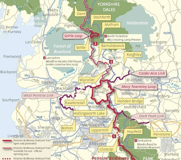
- Mary Towneley Loop
- Lancashire
- North Yorkshire and Cumbria
- Link routes
- References
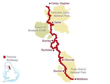
It runs roughly parallel with the Pennine Way but provides access for horseback riders and cyclists as well as walkers. The trail is around 205 miles (330 km) long, extending from Derbyshire to Cumbria. It includes the 47-mile (76 km) Mary Towneley Loop and the 10-mile (16 km) Settle Loop. In its southern part, it follows the High Peak Trail along the trackbed of the former Cromford and High Peak Railway.
Pennine bridleway
History
In 1986 Mary Towneley rode on horseback 250 miles (402 km) from Corbridge, Northumberland to Ashbourne, Derbyshire to launch the idea of a Pennine Bridleway. This was followed by a feasibility study and route investigation from 1987 to 1990. Finally in 1995 approval was granted for the Pennine Bridleway National Trail from Carsington Water, Derbyshire to Kirkby Stephen, Cumbria.
In 1999 Sport England awarded and donated £1,841,876 towards the route from Derbyshire to North Yorkshire and 3 feeder routes from Keighley, Bolton and Penistone. The Pennine Bridleway project team was appointed by the Countryside Agency and work began shortly.
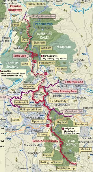
In 2000 there was a proposal for an extension to the Pennine Bridleway from Kirkby Stephen, Cumbria to Byrness, Northumberland. This extension was approved in 2002, but has not yet been funded.
Mary Towneley died in February 2001, and is commemorated by the Mary Towneley Loop, which opened in 2002. The southern section of the Trail from Derbyshire followed, and in 2005 the Settle Loop opened. The final sections of the trail were opened by Martin Clunes in June 2012.
The Pennine Bridleway is not to be confused with the Pennine Cycleway (part of the National Cycle Network) or the Pennine Way (a separate National Trail).
Derbyshire
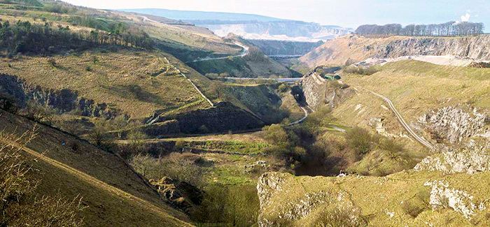
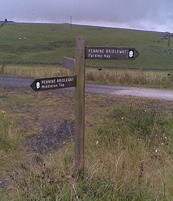
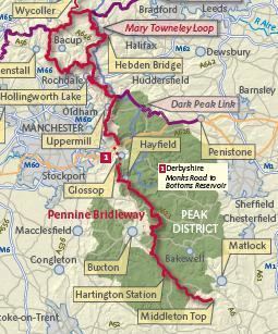
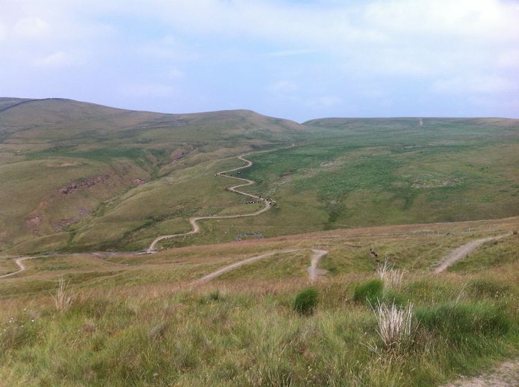
The Pennine Bridleway has two starting points in Derbyshire. The main starting point is at Middleton-by-Wirksworth, from where it follows the High Peak Trail along a disused railway passing through the limestone of the White Peak. The second starting point, recommended for horse riders, is the site of the former Hartington railway station, and uses a short section of the Tissington Trail before joining the High Peak Trail at Parsley Hay. At the end of the High Peak Trail, 7 kilometres (4 mi) south east of Buxton, the route heads north following the line of a packhorse road from Tideswell, via Peak Forest to Hayfield, where it briefly follows the line of another converted railway, the Sett Valley Trail.
North of Hayfield, there is a gap of 8 kilometres (5 mi) in the bridleway. There are alternative routes for walkers and cyclists, but no safe route for horse riders until the missing section is completed in 2015. The route resumes at Bottoms Reservoir near Tintwistle in Longdendale.
Greater Manchester
Leaving Derbyshire for Greater Manchester, the trail follows the edge of a heather moor and picks up an ancient highway along the Tame valley to the village of Diggle. From here the trail heads west across moorland and descends to follow a dismantled railway towards Hollingworth Lake. It then crosses more moorland east of Littleborough before joining the Mary Towneley Loop near Summit.
Mary Towneley Loop
The shorter route follows the Mary Towneley Loop counterclockwise, heading north into West Yorkshire. The trail passes the villages of Bottomley and Mankinholes, then drops down to cross the Calder Valley just west of the town of Hebden Bridge. It then climbs to cross Heptonstall Moor and enters Lancashire south of Widdop.
The longer clockwise route of the Mary Towneley Loop heads west from Summit and climbs to Top of Leach at 474 metres (1,555 ft). The trail passes through the town of Waterfoot in the Rossendale Valley and follows new tracks via Lumb before entering the Cliviger Gorge and then climbing up to the Long Causeway. It then heads north to the top of the Loop just east of Worsthorne.
Lancashire
From the top of the Mary Towneley Loop the trail heads north to the village of Wycoller, then turns west to pass south of Earby and Barnoldswick. For several miles it follows an old track named Coal Pit Lane to reach Gisburne Park on the River Ribble. It then heads north across the flatter landscape of the Ribble Valley to enter North Yorkshire just north of the village of Paythorne.
North Yorkshire and Cumbria
At the southern edge of the Yorkshire Dales the route reaches Long Preston on the busy A65 road. The route through Long Preston and across the A65 has not yet been finalised. The trail heads north from Long Preston to the town of Settle. South of Settle the Settle Loop branches east to rejoin the main route just north of the town.
At Stainforth the route turns west to Feizor, Austwick and Clapham on ancient walled lanes. From Clapham the trail turns north east to Selside and crosses to the east side of Ribblesdale. It then joins the Pennine Way for 7 kilometres (4 mi), climbing Cam Fell. A new trail is then followed west over high and exposed terrain to Newby Head. The route briefly enters Cumbria over Dent Fell, then reenters North Yorkshire at Garsdale Head.
At the head of Wensleydale the route follows an old track (Lady Anne's Way) to cross into the Mallerstang valley in Cumbria. The trail then crosses Wild Boar Fell to reach its present terminus near the village of Ravenstonedale.
Link routes
One feeder route has been opened, and two more are planned: