
OS grid SD757988 Elevation 708 m | Topo map OS Landranger 98 Prominence 344 m | |
 | ||
Listing Marilyn, Hewitt, Nuttall Similar Swarth Fell, Baugh Fell, Nine Standards Rigg, Howgill Fells, The Calf | ||
Wild boar fell howgills 20 september 2014
Wild Boar Fell is a mountain (or more accurately a fell) in the Yorkshire Dales National Park, Mallerstang on the eastern edge of Cumbria, England. At 708 metres (2,323 ft), it is either the 4th highest fell in the Yorkshire Dales or the 5th, depending on whether nearby High Seat (709 m) is counted or not.
Contents
- Wild boar fell howgills 20 september 2014
- Map of Wild Boar Fell Kirkby Stephen UK
- History
- Geography
- References
Map of Wild Boar Fell, Kirkby Stephen, UK
The nearest high point is Swarth Fell which is a mile-long (1.5 km) ridge to the south, at grid reference SD754965. To the east, on the opposite side of the narrow dale, are High Seat and Hugh Seat.
History
According to Wainwright the fell gets its name from the wild boar which inhabited the area over 500 years ago. But it would be unusual in an area of Viking settlement, for its old Norse name to have disappeared, when the names of many of its features, such as The Nab, Dolphinsty, etc., retain their Norse origin. Wild Boar fell was named in a late 17th century boundary description as both Wilbright and Wilbert fell and it must be doubtful that Wild Boar is the original name. We should instead look to the Old Norse tongue for an original name.
In earlier times, probably up to the mid nineteenth century, the Millstone Grit, or gritstone, which forms the flat top of the fell, was used for making millstones. Some partly formed millstones can be seen on the eastern flank of the fell - and also on the corresponding western flank of Mallerstang Edge on the opposite side of the dale. Sand (composed of Millstone Grit) from the beach of Sand Tarn was used by local people to sharpen knives and scythes; they made "strickles" by sticking the sand to wooden blocks with tar.
A tusk, claimed to be of "the last wild boar caught on the fell", is kept in Kirkby Stephen parish church.
During World War II Wild Boar Fell was used by the British Army at Warcop Training Area for training tank crews to operate in difficult terrain.
Geography
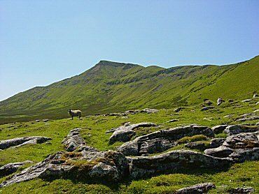
Wild Boar Fell is a dramatic sight and a landmark for many miles around. Approached from the north it gives the misleading impression that it is a peak (see photo, above left). But from the south of the dale at Aisgill its true profile is seen, not dissimilar to Ingleborough, with steep sides and a flat top (consisting of a cap of millstone grit).
The classic route for walking up Wild Boar is via the bridle way from Hazelgill Farm, ascending west to High Dophinsty before following Scriddles ridge top to Blackbed Scar. Once there you are on Wild Boar Fell's table top plateau, a rather boggy expanse. The summit is marked by a trig point and Sand Tarn is about 300 m (1,000 ft) to the west, just below the summit.
The views from the top make a spectacular panorama. The Howgills, Pennines, the Lake district fells, the Yorkshire Three Peaks can all be seen and, on a clear day, there is even a glimpse of the sea at Morecambe Bay.
A common feature of many Pennine dales and Lake District fells are the groups of cairns on the high ground. There is a fine cluster of "stone men" on The Nab of Wild Boar Fell - and a smaller group on subsidiary peak, Little Fell (559 m, 1834 ft) at grid reference NY766008, 2 km to the north. There seems little agreement on when, why, or by which people such cairns were built. (One common suggestion, that they were built by shepherds as markers for paths, may explain some of the cruder "piles of stones"; but groups like those on The Nab surely need a more convincing explanation.)