
State California Incorporated January 3, 1906 Time zone PST (UTC-8) Local time Sunday 7:43 PM University Butte College | County Butte Elevation 167 ft (51 m) Area 33.7 km² Population 16,061 (2013) | |
 | ||
Country United States of America Weather 11°C, Wind E at 16 km/h, 94% Humidity | ||
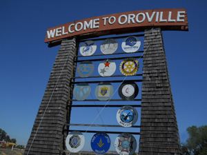
Oroville is the county seat of Butte County, California, United States. The population was 15,506 at the 2010 census, up from 13,004 in the 2000 census. Oroville is considered the gateway to Lake Oroville and Feather River recreational areas. The city of Oroville has recently annexed two locations in South Oroville, areas A and B, which have a combined population of 2,725 people. The U.S. Census Bureau estimated the population of the city to be 17,996 as of January 1, 2016, up 1,908 people or 11.9 percent since 2010. The Berry Creek Rancheria of Maidu Indians of California is headquartered here.
Contents
- Map of Oroville CA USA
- History
- 1881 lynching
- Geography
- Climate
- 2010
- 2000
- Economy
- Top employers
- Tourism
- Parks and Recreation
- Education
- Elementary Schools
- Middle Schools
- High Schools
- Higher education
- Media
- Hospital
- Fire department
- Superfund sites
- Notable people
- In popular culture
- Notable events
- Sister cities
- References
Map of Oroville, CA, USA
Oroville is located off of State Route 70, and is in close proximity to State Route 99, which connects Butte County with Interstate 5. Chico, California is located about 25 minutes north of the city, and Sacramento lies about an hour south.
History
Oroville is situated at the base of the foothills on the banks of the Feather River where it flows out of the Sierra Nevada onto the flat floor of the Sacramento Valley. It was established as the head of navigation on the Feather River to supply gold miners during the California Gold Rush.
The town was originally called "Ophir City", but the name was changed to Oroville when the first post office opened in 1854 ("oro" is "gold" in Spanish). The City Of Oroville was incorporated on January 3, 1906.
Gold was found at Bidwell Bar, one of the first gold mining sites in California, bringing thousands of prospectors to the Oroville area seeking riches. Now inundated by the waters of enormous Lake Oroville, which was filled in 1968, Bidwell Bar is memorialized by the Bidwell Bar Bridge, an original remnant from the area and the first suspension bridge in California (California Historical Landmark #314). In the early 20th century the Western Pacific Railroad completed construction of the all-weather Feather River Canyon route through the Sierra Nevadas giving it the nickname of "The Feather River Route". Oroville would serve as an important stop for the famous California Zephyr during its 20-year run. In 1983, this became a part of the Union Pacific Railroad as their Feather River Canyon Subdivision. A major highway, State Route 70, roughly parallels the railroad line winding through the canyon.
The Chinese Temple (CHL #770 and listed on the National Register of Historic Places) is another monument to Oroville's storied past. Chinese laborers from the pioneer era established the Temple as a place of worship for followers of Chinese Popular Religion and the three major Chinese religions: Taoism, Buddhism, and Confucianism. The Chinese Temple and Garden, as it is now called, has an extensive collection of artifacts and a serene garden to enjoy.
The olive-canning industry was founded in Oroville by Freda Ehmann, the "mother of ripe olives." She built a large cannery in Oroville, and by 1900 was the president of the world's largest canned olive factory. Ehmann was a believer in women's suffrage and a friend of Susan B. Anthony
Ishi, Oroville's most famous resident, was the last of the Yahi Indians and is considered the last "Stone Age" Indian to come out of the wilderness and into western civilization. When he appeared out of the hills in East Oroville in 1911, he was immediately thrust into the national spotlight. The Visitor's Center at Lake Oroville has a thorough exhibit and documentary film on Ishi and his life in society.
Archaeological finds place the northwestern border for the prehistoric Martis people in the Oroville area.
1881 lynching
On August 7, 1881, beloved elderly pioneer Jack Crum was stomped to death by local bully Tom Noacks in Chico, California. The young Noacks was feared by the locals of Butte County, not only because of his size and strength, but because he was mentally unbalanced and enjoyed punching oxen in the head. Noacks was arrested and jailed in Chico’s jail, but once word got out that the old pioneer had been murdered, the authorities moved him to the Butte County jail in Oroville for his safety. Crum’s friends knew that Noacks was in the county jail, and they made their way to Oroville with rope in hand. Knocking on the jail door, the men told the jailer that they had a prisoner from the town of Biggs, California. Once in the jail, they overpowered the jailer and dragged Noacks from his cell. They took the man to Crum’s former farm and hanged him from an old cottonwood tree. Nobody was ever prosecuted for the lynching.
Geography
Oroville is situated at the head of navigation on the Feather River. The Yuba River flows into the Feather River near Marysville, California and these flow together to the Sacramento River. Geologically, Oroville is situated at the meeting place of three provinces: the Central Valley alluvial plain to the west, the crystalline Sierra Nevada to the SE and the volcanic Cascade Mountains to the north. It has a Mediterranean climate.
Oroville sits on the eastern rim of the Great Valley, defined today by the floodplains of the Sacramento River and its tributaries. Around Oroville these sediments are dominated by thick fans of Feather River sediments, but just east of this there is a thin, N-S band of late Cretaceous sediments. These sit on top of the Sierran basement, which beneath eastern Oroville comprise greenschist-facies metavolcanic rocks of Jurassic age, giving way to granites of the Sierra batholith to the east. These are manifestations of a vigorous island arc sequence, built out over an east-dipping subduction zone of mid-to-late Mesozoic age. The gold veins lace this ancient arc, remobilized by Mesozoic shearing and intrusions of igneous rock. The crystalline foothills are locally overlain by a Cenozoic sequence of Eocene clean beach sands overlain by Neogene volcanics, including the Diamond Head-like profile of "Table Mountain".
Climate
According to the Köppen Climate Classification system, Oroville has a warm-summer Mediterranean climate, abbreviated "Csa" on climate maps.
According to US climate data, on the average Oroville receives 30.7 inches of precipitation per year, which is about 20% less than the national average, but somewhat higher than the average California rainfall.
2010
The 2010 United States Census reported that Oroville had a population of 15,546. The population density was 1,194.8 people per square mile (461.3/km²). The racial makeup of Oroville was 11,686 (75.2%) White, 453 (2.9%) African American, 573 (3.7%) Native American, 1,238 (8.0%) Asian, 56 (0.4%) Pacific Islander, 554 (3.6%) from other races, and 986 (6.3%) from two or more races. Hispanic or Latino of any race were 1,945 persons (12.5%).
The Census reported that 14,662 people (94.3% of the population) lived in households, 72 (0.5%) lived in non-institutionalized group quarters, and 812 (5.2%) were institutionalized.
There were 5,646 households, out of which 2,126 (37.7%) had children under the age of 18 living in them, 1,893 (33.5%) were opposite-sex married couples living together, 1,174 (20.8%) had a female householder with no husband present, 430 (7.6%) had a male householder with no wife present. There were 615 (10.9%) unmarried opposite-sex partnerships, and 33 (0.6%) same-sex married couples or partnerships. 1,699 households (30.1%) were made up of individuals and 718 (12.7%) had someone living alone who was 65 years of age or older. The average household size was 2.60. There were 3,497 families (61.9% of all households); the average family size was 3.22.
The population was spread out with 4,267 people (27.4%) under the age of 18, 1,969 people (12.7%) aged 18 to 24, 3,940 people (25.3%) aged 25 to 44, 3,417 people (22.0%) aged 45 to 64, and 1,953 people (12.6%) who were 65 years of age or older. The median age was 31.5 years. For every 100 females there were 93.7 males. For every 100 females age 18 and over, there were 91.8 males.
There were 6,194 housing units at an average density of 476.0 per square mile (183.8/km²), of which 2,423 (42.9%) were owner-occupied, and 3,223 (57.1%) were occupied by renters. The homeowner vacancy rate was 3.6%; the rental vacancy rate was 8.4%. 6,293 people (40.5% of the population) lived in owner-occupied housing units and 8,369 people (53.8%) lived in rental housing units.
2000
According to the United States Census Bureau, the city has a total area of 12.3 square miles (31.8 km²), of which, 12.2 square miles (31.7 km²) of it is land and 0.04 square miles (0.1 km²) of it (0.16%) is water.
As of the census of 2000, there were 13,004 people, 4,881 households, and 2,948 families residing in the city. The population density was 1,061.4 people per square mile (409.9/km²). There were 5,419 housing units at an average density of 442.3 per square mile (170.8/km²). The racial makeup of the city was 77.2% White, 4.0% Black or African American, 3.9% Native American, 6.3% Asian, 0.3% Pacific Islander, 2.8% from other races, and 5.4% from two or more races. 8.3% of the population were Hispanic or Latino of any race.
There were 4,881 households out of which 33.9% had children under the age of 18 living with them, 36.4% were married couples living together, 18.9% had a female householder with no husband present, and 39.6% were non-families. 33.2% of all households were made up of individuals and 14.5% had someone living alone who was 65 years of age or older. The average household size was 2.50 and the average family size was 3.19.
In the city, the population was spread out with 30.1% under the age of 18, 10.3% from 18 to 24, 25.8% from 25 to 44, 19.2% from 45 to 64, and 14.7% who were 65 years of age or older. The median age was 33 years. For every 100 females there were 95.8 males. For every 100 females age 18 and over, there were 90.7 males.
The median income for a household in the city was $21,911, and the median income for a family was $27,666. Males had a median income of $28,587 versus $21,916 for females. The per capita income for the city was $12,345. About 16.2% of families and 23.1% of the population were below the poverty line, including 39.3% of those under age 18 and 8.9% of those age 65 or over.
Economy
The 2008 cost of living index in Oroville was 79.0 (low, U.S. average is 100).
Recently, as Chico has grown as a regional commercial giant, more people have been drawn to Oroville for close shopping, and lower property prices. It has been speculated that Oroville has undergone more construction of homes in the last four years than it has in the last 30 before it. A possible reason for this could be that the skyrocketing of property values in the San Francisco Bay Area has caused migration of new families.
Oroville is also home to a considerable number of ethnic Hmong. The Hmong migrated from Southeast Asia, especially from the country Laos, after the Vietnam War. The Hmong were allies of the American forces during the Vietnam War, many were recruited to help fight the Communist forces in Laos and Vietnam. Thus the Hmongs were given political asylum after the fall of Saigon to the Communist in 1975. Every year there is an annual festival during autumn which was originally a harvest festival but now called the New Year celebration. Ethnic Hmong make up 4.8% of Oroville's population, one of the larger communities in the north state. In the 1950s, a community of Romanians migrated from Europe, with 560 still there today.
Nearby Indian reservations led to a surge in the Native American population, measured at 6.7% of the population in the 2000 census, but may be as high as 12%. The largest tribal group is the local Maidu. The world's largest museum of Maidu culture is located in Oroville East, at the Lookout Museum.
Top employers
According to the City's 2008 Comprehensive Annual Financial Report, the top employers in the city are:
Tourism
The Oroville Municipal Airport is located south of State Route 162 west of State Route 70.
Parks and Recreation
Oroville has several parks featuring playgrounds, picnic tables and benches. Parks and recreation areas include Bedrock Park, Centennial Plaza, Hammon Park, Hewitt Park, Rotary Park, Riverbend Park, Nelson Sports Complex, Gary Nolan Baseball Complex, and the Feather River Bike Trail.
Education
The Oroville Union High School District includes all of the greater Oroville area, including many neighborhoods that are not within the city limits of Oroville. The District includes two traditional high schools, Las Plumas High School and Oroville High School, and Prospect High School, which functions as a continuation/remedial high school. The city also has an Adult School, Oroville Adult School.
There are also several small rural school districts in the surrounding areas.
Elementary Schools
Middle Schools
High Schools
Higher education
Media
Oroville is home to KOYO-LP, a low-power community radio station owned and operated by the Bird Street Arbor Day Media Project. The station was built by numerous volunteers from Oroville and around the region in April 2002 at the second Prometheus Radio Project barnraising. KOYO-LP broadcasts music, news, and public affairs to listeners at 107.1FM.
Hospital
Oroville Hospital is a general acute care hospital with a Level III trauma center and offers basic emergency care located in the City of Oroville.
Fire department
The Oroville Fire Department is responsible for calls within the city jurisdiction of approximately 13 square miles (34 km2) with a population of 16,260 (as of 2015).
Superfund sites
Oroville has three designated superfund cleanup sites, two of which have been cleaned up and delisted: a Koppers Co. wood treatment plant, a Louisiana Pacific sawmill, and the Western Pacific railyard.
The Koppers Co. plant was listed on September 21, 1984 for pentachlorophenol (PCP), dioxin, furan, polycyclic aromatic hydrocarbon (PAH), and heavy metals (copper, chromium, and arsenic) contamination due to chemicals spilled on unpaved areas.
The Louisiana-Pacific sawmill was listed on June 10, 1986 for pentachlorophenol PCP, dioxin, furan, heavy metals (arsenic, boron, and copper), and polycyclic aromatic hydrocarbon (PAH) contamination. Following remediation, the site was delisted on November 21, 1996. The sawmill was shut down in 2001.
The Western Pacific Railroad yard was listed on August 30, 1990 for volatile organic compound (VOC) and heavy metals (arsenic, lead, and chromium) contamination. Following remediation, the site was delisted on August 29, 2001.
Notable people
In popular culture
In the early 1970s, the movie The Klansman was filmed in Oroville.
This Is Oroville, a novelty song recorded and released as a 45 rpm single in 1987 by local teacher Steve Herman, is generally considered to be among the more popular California 'city songs'.