
Length 35 km Basin area 138.6 km² | Basin area 138.6 km² | |
 | ||
- left Old Orchard, Bryants Nursery, Norwood, Rolling Stone - right Bachelors Forest, Longmeade, Bel Pre Creek, Wheaton Park, Lamberton Dr, Sligo Creek | ||
Northwest Branch Anacostia River is a 21.5-mile-long (34.6 km) free-flowing stream in Montgomery County and Prince George's County, Maryland. It is a tributary of the Anacostia River, which flows to the Potomac River and the Chesapeake Bay.
Contents
- Map of Northwest Branch Anacostia River Maryland USA
- CourseEdit
- WatershedEdit
- GeologyEdit
- TributariesEdit
- References
Map of Northwest Branch Anacostia River, Maryland, USA
CourseEdit
The headwaters of the Northwest Branch are located near the community of Sandy Spring. The stream flows southward for 21.5 miles (34.6 km) to its confluence with the Northeast Branch near Bladensburg to form the main stem of the Anacostia.
WatershedEdit
The watershed in Montgomery County includes portions of the communities of Norwood, Bel Pre Manor, Colesville, Layhill, Glenmont, Wheaton, Hillandale, White Oak, Silver Spring, Kemp Mill, Four Corners and Takoma Park. The Prince George's County portion of the watershed includes Adelphi, Langley Park, University Park, Chillum, Hyattsville, Avondale and Brentwood. The total watershed area, including a small portion of land in Washington, D.C., is 53.5 square miles (139 km2), with a resident population of about 254,000.
The middle section of the Northwest Branch is referred to as the Rachel Carson Environmental Area. It flows through a small gorge underneath the Capital Beltway between Colesville Road and Adelphi Mill. Located at the north end of the Northwest Branch Trail, near the home of noted environmental author Rachel Carson, it is deliberately left rustic and unimproved.
The majority of the Northwest Branch stream valley is a riparian buffer, protected as parkland by the Maryland-National Capital Park and Planning Commission (M-NCPPC). The Rachel Carson Greenway planned by M-NCPPC will extend the Northwest Branch Trail into northern Montgomery County as an unimproved hiking trail, connecting to the Anacostia Tributary Trail System in Prince George's County.
GeologyEdit
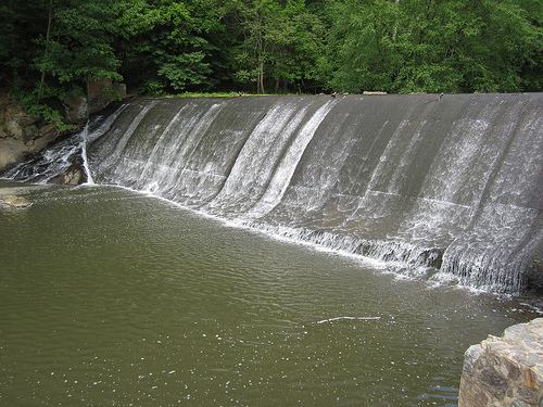
Northwest Branch crosses the geological fall line between the piedmont and Atlantic coastal plain regions, which forms a small waterfall on the stream near White Oak.
TributariesEdit
The total stream channel length of Northwest Branch and all tributaries is 75 miles (121 km).