
Time zone Eastern (EST) (UTC-5) GNIS feature ID 0591544 Area 12.9 km² | FIPS code 24-84375 Elevation 113 m Population 20,973 (2000) | |
 | ||
Country United States of America | ||
Mva drivers test white oak maryland 20904 street course 2013
White Oak is a census-designated place and an unincorporated area in Montgomery County, Maryland, United States.
Contents
- Mva drivers test white oak maryland 20904 street course 2013
- Map of White Oak MD USA
- Geography
- About White Oak
- Quaint Acres
- Demographics
- Education
- References
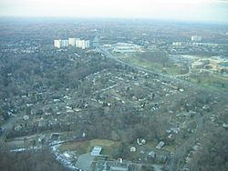
Map of White Oak, MD, USA
Geography
As an unincorporated area, White Oak's boundaries are not officially defined by either a municipal government or by the government of Montgomery County. Boundaries for the White Oak census-designated place have been established by the United States Census Bureau, while the United States Geological Survey recognizes White Oak to be a populated place located at 39°2′32″N 76°59′18″W (39.042109, -76.988273). Many of its residents consider themselves to be residents of the White Oak neighborhood of Silver Spring, similar to how large cities have different neighborhoods within their borders.
About White Oak
The community was known for its Naval Ordnance Laboratory, which was closed in 1994. The Food and Drug Administration now occupies the property, which has been renamed the Federal Research Center at White Oak. According to the United States Census Bureau, the place has a total area of 5.0 square miles (12.9 km²), all of it land. White Oak is a diverse neighborhood. The main area of White Oak is from Lockwood Dr starting from New Hampshire Ave (MD 650) towards Stewart Lane crossing Columbia Pike (US-29).
Quaint Acres
"Quaint Acres" is a subdivision of White Oak just north of modern Route 29 and west of New Hampshire Avenue. The subdivision was named after the house of Altus Lacy Quaintance, a State Entomologist of Maryland who worked at the Maryland Agricultural College and later at the USDA.
On May 26, 1945, a TB-25D 'Mitchell' bomber en route from Biloxi to Bolling Field crashed near Quaint Acres, killing all four aboard. The bomber was piloted by Dudley M. Outcalt who flew in the 94th Aero Squadron during World War I.
After the war, the Quaint Acres subdivision was home to famed naturalist Rachel Carson and where she wrote Silent Spring in 1962, the book that facilitated the ban of the pesticide DDT in the United States. She built the ranch house at 11701 Berwick Rd. in 1956, and lived there until her death in 1964. The house is a National Historic Landmark, but not open to the public.
Quaint Acres was also the Washington area home to Margaret Chase Smith, the first woman to be elected to both the U.S. House and the Senate.
Demographics
As of the census of 2010, there were 17,403 people, 6,520 households, and 4,227 families residing in the area. The population density was 4,604.0 people per square mile (1,777.6/km²). There were 6,865 housing units at an average density of 1,816.1 per square mile (701.2/km²). The racial makeup of the area was 27.7% White, 49.4% African American, 0.4% Native American, 8.9% Asian, 0.1% Pacific Islander, 9.1% from other races, and 4.5% from two or more races. Hispanic or Latino of any race were 18.4% of the population.
Education
Depending on how White Oak is geographically defined, students attend Cresthaven, Jackson Road and Burnt Mills Elementary Schools, which feed into White Oak and Francis Scott Key Middle School. Eighth-grade students have the option of choosing between the three Northeast Consortium schools, Blake High School, Paint Branch High School, and Springbrook High School.
Springbrook is located in the White Oak CDP.