
Time zone BST (UTC+6) | ||
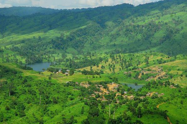 | ||
birishiri a gift of nature netrokona district bangladesh
Netrakona (Bengali: নেত্রকোনা) is a District in northern Bangladesh. It is a part of Mymensingh Division.
Contents
- birishiri a gift of nature netrokona district bangladesh
- Map of Netrokona District Bangladesh
- Geography
- Upazilas
- Economy
- Tourist Attractions
- Religion
- References
Map of Netrokona District, Bangladesh
Geography
Netrakona is situated in the northern part of Bangladesh, near the Meghalayan border. There are four main rivers in Netrakona: Kangsha, Dhala, Magra, and Teorkhali.
Netrakona Pouroshabha (Town of Netrakona) is a municipal town, established in 1887 and with an area of 13.63 km².
Upazilas
Netrokona district is divided into ten upazilas.
Economy
The economy of Netrakona is largely agrarian. Susang Durgapur, an Upazila of Netrakona, is one of the major sources of country's China-Clay used for ceramic products. Its vast water bodies (Hawor) provides wide varieties of fishes. Bara Bazar is commerce centre of Netrakona.
Tourist Attractions
Religion
The district of Netrakona consists 3146 mosques, 958 temples, 83 churches and eight Buddhist temples.