
Sub-Metropolitan Municipality Nepalgunj Elevation 150 m Area code 081 Number of airports 1 | Development Region Mid-Western District Banke Time zone NST (UTC+5:45) Population 128,450 (2011) Local time Friday 3:12 PM University Nepalgunj Medical College | |
 | ||
Weather 34°C, Wind W at 8 km/h, 33% Humidity | ||
Nepalgunj (Nepali: नेपालगन्ज [nepaːlɡəndʒ]), also spelled Nepalganj, is a Sub-Metropolitan City in Banke District, Nepal on the Terai plains near the southern border with Bahraich district, Uttar Pradesh state of India. It is 85 kilometers south-west of Ghorahi and 16 km south of Kohalpur and 35 kilometers east of Gulariya.It is one of the developed cities in Nepal.
Contents
- Map of Nepalgunj Nepal
- Overview
- Demographics
- Lifestyle
- Culture and Religion
- Transport
- Infrastructure
- Climate
- Hotels
- Places of interest
- Sports
- Media
- References
Map of Nepalgunj, Nepal
Overview
The heart of the city- Dhamboji, where lies the center and perhaps the most important traffic junction of the town, referred to Birendra chowk, is the main business hub with several banks, book shops, lodges, motor-parts and hardware dealers, and other general home appliance distributors. The 24 km long Surkhet Road starts from Mahendra Chowk in Kohalpur and terminates at the Nepal-India Border; it runs through the middle of the city passing through Dhambojhi Chowk and two other important junctions- Pushpalal Chowk and BP Chowk, creating a network of roads that cover the major portion of city's industrial and residential areas.
Tribhuvan Chowk is famous for its commodity and fancy shops along Sadar Line and Ek-Laini, while most of the important government offices like Chief District Office, Telecommunication Office, Post office, etc. are located within a radius of a few kilometers. Another famous area called New Road, while still under development, is emerging as a major attraction for its modern fashion retail shops, hotels and restaurants. Also important place is Siddhart Tole (jailroad) where different important public offices such as Bheri Zonal Hospital, Jilla Karagar (District Jail) Banke, Bheri Briddhashram, Rastriya Samachar Sameeti, Nepalgunj Nursing Campus, Nepal Telecom are located.
There are a lot of other areas in Nepalgunj that are developing rapidly and attracting new residents and industries. The city is developing fast due to relocation of mid-hill migrants. It is also a center for business for vicinity zones and their districts. Recently the city has been a possibility of being developed into a major IT center in Nepal since a large population of young entrepreneurs are investing new technologies and marketing into new sectors.
Nepalgunj is considered the hottest place in Nepal, with temperature rising well above 44 °C in summer.
Kohalpur is located 16 km north of Nepalgunj. It is a wonderful place with growing city and market. It is facilitated with all the infrastructures of development.
Demographics
The 2011 census counted 73,779 inhabitants, with 20% growth since 2001. Nepali is spoken natively by Paharis as well as by people of other ethnicity as the national language and lingua franca. The mother tongue for the native inhabitants is still Awadhi, which is understood and normally spoken by the entire population of the district.
Lifestyle
Temperature highly affects the lifestyle of Nepalgunj. Due to extreme heat in summer season, people wear light cotton clothes and rarely come out during the day time. While in the winter season, the temperature may drop to 4 °C during which people wear thick woollen clothes.
Restaurants in Nepalgunj are famous for its samosas, chaat, golgappas, dahibada, momos (Nepalese-style Dumplings), sekuwa (roasted spiced-meat), biryani and chilled beer. Samosas, chaat,katti roll, golgappas and sekuwa from Nepalgunj are considered to be the most delicious in all of Nepal. It is also famous for ravadi (milk item) all over the country.
The city also has religious significance. Bageshwori Temple is a renowned temple for Hindu devotees in the country as well as those from nearest border cities of India.It is main trade center of Mid western and Far western development also.
Culture and Religion
Nepalgunj has a diverse culture with people from different faiths living within mixed communities. Hinduism and Islam are two major religions in the city with Hindus comprising larger percentage of the population. Other religions like Buddhism, Sikhism and Christianity are among in the minorities. People of different ethnicity are known to have traditionally lived together, without any significant conflicts.
However, there have been religious conflicts in the past in the city between its Hindu and Muslim majorities. Recent conflict occurred in December 2006 between Pahari people of the hill-origin and Madhesi people of Madhesh origin. The conflict resulted in the death of at least one person, while dozens were injured. The conflict followed immediately after the 2006 democracy movement in Nepal. During the conflict, Nepali Maoist of Madhesi origin destroyed the statue of late King Tribhuvan placed at a junction named after him while demanding to rename the junction as Kamal Madheshi Chok after a man from the madhesi side who was killed in the violence. The local administration had to impose a curfew to take the mob under control, and later formed a commission to investigate the causes of the riot.
Transport
Nepalgunj Airport is located 6 km north of Dhamboji Chok. The airport was officially named Mahendra Airport after the late King Mahendra, but it is commonly referred just with its present name Ranjha Airport. It operated flights to Kathmandu and to airports in less developed western districts such as Dolpa, Jumla, Mugu and Rukum.
Nepalgunj has fully operational bus and mini-bus services that reach almost all parts of the western region that connected by roadways, as well as most parts of the eastern region, including all the major hubs in the country. The main hub for buses is Nepalgunj new buspark, while small transits are located in several other places in the city like Pushpalal Chok, Nepalgunj Airport, and Belaspur. Short routes are generally covered by micro-buses and mini-buses, while luxury coaches are available for long routes to destinations like Kathmandu, Pokhara, Birganj and Biratnagar. The country's longest highway- Mahendra Highway, runs through the town of Kohalpur located 10 kilometers from the city center.
A line of Indian Railways reaches Rupaidiha across the border. It involves train changes at Gonda, Bahraich and Nanpara. For travellers coming in from India it is also possible to take an express train to Lucknow and from there a direct bus to Rupaidiha. Indian and Nepalese nationals may cross the border without restrictions, however there is a customs checkpoint for goods and third country nationals.
The most common public transport for commuters within the city have long been cycle rickshaws. City mini- and micro-buses are used by commuters along the Surkhet road from the town of Kohalpur to the Nepal-India border. Most common private transport are motorcycles, especially among young adults while bicycles are used by many. Recently the number of automobiles has increased significantly in the city.
Infrastructure
Health Infrastructure
Education Infrastructure
There are good education facilities in the city. Several boarding and government schools have been established. Mahendra Multiple Campus is the largest public higher-level institution in the district, affiliated to Tribhuvan University.
List of secondary and higher-level academic institutions in the city ranked as follows;
Water management infrastructure
Most households in the city rely groundwater as the only means of water supply, although there's provision of running water provided by the Nepal Water Supply Corporation. Ground water is extracted through handpumps or electric pumps- with most recent household having access to both of these facilities. Each household in the city has access to at least one of the three (running water, handpump and electric pump) facilities.
Communications infrastructure
Cultural, sports and recreational infrastructure
Climate
Nepalgunj has a sub-tropical climate. Temperatures sometimes exceed 40 °C (104 °F) from April to June. During the rainy season—arriving in June and lasting into September—it is less hot but sometimes very humid. Winter is usually pleasant while the sun is out. It sometimes is foggy and overcast; then it can be chilly with temperatures below 10 °C (41 °F) but no frost. The highest temperature ever recorded in Nepalgunj was 45.0 °C (113.0 °F) on the 16th June 1995, while the lowest temperature ever recorded was −0.3 °C (31.5 °F) on the 9th January 2013 .
Hotels
With the boost in the tourism industry after the change in political scenario of Nepal in the 1950s, hotel industry in Nepalgunj has picked up a significant growth. Nepalgunj boasts several standard and well known hotels such as Traveller's Village, Hotel Siddhartha, Sneha, Batika, etc. There are a number of good restaurants in the city that offer traditional Nepalese, as well as, a variety of Indian, Chinese and Western cuisines. Some famous restaurants in the city include Cross Road, New-Road Cafe and Restaurant, Gonjalo, Mangalam Green Cottage, Swastik Cottage, Om cottage, Siddhartha Cottage, Siddhartha View Hotel , kalpataru,pahuna ghar ,etc etc. Nepalgunj, and the Sneha Hotel, feature in the atmospheric travel memoir A Glimpse of Eternal Snows by Jane Wilson-Howarth.
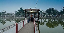
Places of interest
Sports
Cricket and football are the two most popular sports in Nepalgunj. Most of the city's big sports tournaments are held in the city's football stadium and gymnasium, as well as, in the MP school-ground. An international cricket stadium is under construction in Kohalpur.
Media
Nepalgunj has cinema halls
Nepalgunj has Community radio Stations:
Broadcasts from Kantipur FM 101.8 MHz and Image FM 97.9 MHz can also be received in the city.