
Last eruption Unknown Elevation 4,321 m First ascent 1911 Parent range Eastern Rift mountains | Easiest route Scramble Prominence 2,458 m Listing Ultra-prominent peak | |
 | ||
Topo map Mount Elgon Map and Guide First ascenders Rudolf Kmunke, Robert Stigler Similar Mount Kenya, Mount Stanley, Mount Muhabura, Mount Sabyinyo, Mount Gahinga | ||
Mount Elgon is an extinct shield volcano on the border of Uganda and Kenya, north of Kisumu and west of Kitale. The mountain's highest point, named "Wagagai", is located entirely within the country of Uganda. At 4,321 m (14,177 ft), Elgon is the seventeenth-highest mountain of Africa. Although there is no verifiable evidence of its earliest volcanic activity, geologists estimate that Mount Elgon is at least 24 million years old, making it the oldest extinct volcano in East Africa. It covers an area around 3,500 square kilometres (1,400 sq mi).
Contents
Map of Mount Elgon
Physical features
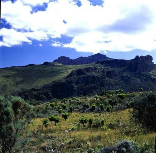
Mount Elgon is a massive solitary volcanic mountain on the border of eastern Uganda and western Kenya. Its vast form, 80 kilometres (50 mi) in diameter, rises 3,070 metres (10,070 ft) above the surrounding plains. Its cooler heights offer respite for humans from the hot plains below, and its higher altitudes provide a refuge for flora and fauna.
Mt. Elgon consists of five major peaks:
Other features of note are:
The mountain soils are red laterite. The mountain is the catchment area for the several rivers such as the Suam River, which becomes the Turkwel downstream and drains into Lake Turkana, and the Nzoia River and the Lwakhakha River, which flow to Lake Victoria. The town of Kitale is in the foothills of the mountain. The area around the mountain is protected by two Mount Elgon National Parks, one on each side of the international border.
Name
It was known as "Ol Doinyo Ilgoon" (Breast Mountain) by the Maasai and as "Masaba" on the Ugandan side by the Bamasaba.
Flora
Some rare plants are found on the mountain, including Ardisiandra wettsteinii, Carduus afromontanus, Echinops hoehnelii, Ranunculus keniensis, and Romulea keniensis.
Local ethnicities
Mount Elgon and its tributaries are home to four tribes, the Bagisu, the Sapiinjak, the sabaot and the Ogiek, better known in the region under the derogatory umbrella term Ndorobo.