
Governing body U.S. Forest Service Area 425.6 km² | Address Arnold, CA 95223, USA Established 1964 | |
 | ||
Location Similar Caples Lake Resort, Woods Lake Campgro, Lower Blue Lake Campgro, Silver Lake East‑ Eldorado, Plasse's Resort | ||
Mokelumne wilderness eldorado national forest california
The Mokelumne Wilderness is a 105,165-acre (425.59 km2) federally designated wilderness area located 70 miles (110 km) east of Sacramento, California. It is within the boundaries of three national forests: Stanislaus, Eldorado and Toiyabe. First protected under the Wilderness Act of 1964, the Mokelumne’s borders were expanded under the California Wilderness Act of 1984 with the addition of 55,000 acres. The wilderness takes its name from the Mokelumne River, which was named after a Mi-wok Indian village located on the riverbank in California's Central Valley.
Contents
- Mokelumne wilderness eldorado national forest california
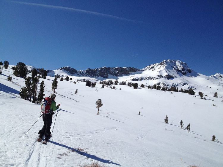
- Hiking through the mokelumne wilderness
- Landscape flora and faunaEdit
- Areas of special interestEdit
- RecreationEdit
- References
The wilderness encompasses an area of the Sierra Nevada mountain range between Ebbetts Pass to Carson Pass. There are two sections separated by the Blue Lakes Road and an Off-Road Vehicle corridor.
Elevations range from 4,000 feet (1,200 m) to 10,381 feet (3,164 m). The highest point is Round Top (10,364 feet), a remnant volcano from which the wilderness area's volcanic soils are derived from and is located on the east side of the Sierra crest.
Hiking through the mokelumne wilderness
Landscape, flora and faunaEdit
The west slopes have been eroded by glaciation and water down to the granite bedrock which has created a dramatic contrast between the volcanic and the granitic landscapes.
The wilderness protects habitat for a great variety of plants and animals especially on the slopes of Round Top, which is designated a special interest area. Plants include Ponderosa pine, canyon live oak as well as alpine vegetation of Whitebark pine, subalpine fir, and western juniper, with western white pine, mountain hemlock, and lodgepole pine found in sheltered areas. Waterways such as the North Fork of the Mokelumne River have riparian zones of white and mountain alder, creek dogwood, western azalea and bitter cherry. Wildlife include the black bear and mule deer, as well as martin, bald eagle and the California spotted owl.
Areas of special interestEdit
The Round Top Botanical Area is at the junction of three botanical provinces and includes red fir forest, sagebrush scrub, subalpine and alpine environments. The combination of soil types, varying exposure and elevations produce diverse plant life, such as the phantom orchid (Cephalanthera austiniae), a rare plant that gets nutrients from dead material (saprophyte). The plant's common name is due to its color being all or mostly white.
The Round Top Geologic Area has more than 3,000 acres (12 km2) within the wilderness and encompasses a variety of geological areas, including exposed granodiorite, lava flows, dikes, glacial moraines and cirques. The landform known as Elephants Back is a rounded mass of solidified lava. Mineralization produced gold-bearing quartz veins, and relics of past gold mining activities are still present in the area.
RecreationEdit
The Mokelumne Wilderness has a variety of recreational opportunities all year. With landscapes ranging from deep canyons to alpine heights and more than two hundred ice-scoured lakes and tarns, fishing and hiking are popular activities as well as cross country skiing. Access is from roads surrounding the wilderness boundary with Carson Pass being the most used entry point. The Pacific Crest Trail, the Tahoe-Yosemite Trail and the Emigrant Summit Trail all cross through the Mokelumne Wilderness. The Emigrant Summit Trail is a designated National Recreation and Historic Trail that follows the western boundary and then passes through the wilderness from Emigrant Valley to Caples Lake.
Wilderness permits are required year-round for overnight visits.