
Nearest city Placerville, CA Area 2,415 km² Established July 28, 1910 | Governing body U.S. Forest Service Phone +1 530-622-5061 | |
 | ||
Location Website Eldorado National Forest Address 100 Forni Road, Placerville, CA 95667, USA Management United States Forest Service Similar Desolation Wilderness, Wench Creek Campgro, Silver Lake East‑ Eldorado, Silver Lake West Campgro, Pacific Ranger District Profiles | ||
Eldorado National Forest is a U.S. National Forest located in the central Sierra Nevada mountain range, in eastern California.
Contents
- Eldorado national forest
- Geography
- Land ownership
- Elevations
- Wilderness areas
- Climate
- Vegetation
- Logging
- Water
- Transportation
- History
- References
Eldorado national forest
Geography
Most of the forest (72.8%) lies in El Dorado County. In descending order of land area the others counties are: Amador, Alpine, and Placer counties in California; and Douglas County in Nevada with 78 acres (320,000 m2). The forest is bordered on the north by the Tahoe National Forest, on the east by the Lake Tahoe Basin Management Unit, on the southeast by the Humboldt-Toiyabe National Forest, and to the south by the Stanislaus National Forest.
Eldorado National Forest headquarters are located in Placerville, California. There are local ranger district offices in Camino, Georgetown, Pioneer, and Pollock Pines.
Land ownership
A complicated ownership pattern exists. The parcels of Other Ownership (private or other Agency land) are mostly isolated and surrounded on all sides by government land. An opposite pattern occurs outside of the Forest Boundary where several small scattered pieces of National Forest lands are separated from the main body and surrounded by lands of Other Ownership.
Elevations
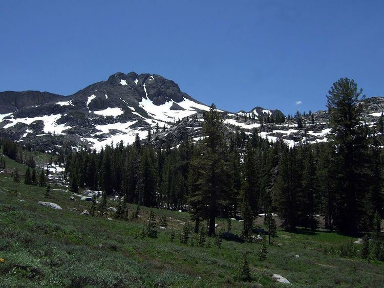
The Forest ranges in elevation from 1,000 feet (300 m) in the foothills to more than 10,000 feet (3,000 m) above sea level along the Sierra crest. The mountainous topography is broken by the steep canyons of the Mokelumne, Cosumnes, American, and Rubicon rivers. Plateaus of generally moderate relief are located between these steep canyons.
Wilderness areas
The Desolation Wilderness is located within the forest's boundaries, as is most of the Mokelumne Wilderness (which extends into neighboring Stanislaus National Forest and Toiyabe National Forest).
Climate
A cool montane version of Mediterranean climate extends over most of the forest with warm, dry summers and cold, wet winters.
Vegetation
A wide variety of hardwoods, conifers, shrubs, native grasses, and forbs are represented in the various Eldorado National Forest ecosystems.
The principle plant communities found here are:
Old-growth forests totaling 122,000 acres (49,000 ha) have been identified in the Eldorado National Forest, consisting of:
Sierra Nevada mixed conifer forestsLogging
The major commercial Forest species are White Fir, Red Fir, Ponderosa Pine, Jeffrey pine, Sugar Pine, Douglas Fir, and Incense Cedar.
Water
Water is a major resource of the Eldorado National Forest. The forest receives about 56 inches (1,400 mm) of precipitation annually. Average annual runoff is about 29 inches (740 mm). This is equal to an annual water yield of 2.4 acre feet (3,000 m3) per acre (737,000 m³/km²); therefore National Forest lands yield an estimated 1,444,000 acre feet (1.781×10⁹ m3) annually.
Transportation
The Eldorado National Forest has a high density of transportation routes, with 2,367 miles (3,809 km) of roads, and 349 miles (562 km) of trails. Roads under Forest Service jurisdiction total 2,158 miles (3,473 km). There are 209 miles (336 km) of county roads, and 400 miles (640 km) of private roads within the National Forest boundaries.
History
The forest was established on July 28, 1910 from a portion of Tahoe National Forest and other lands.