
Country Japan Area 978.77 km2 Mayor Akira Sugenoya | Population 243,037 (2010) Region ChubuKoshinetsu | |
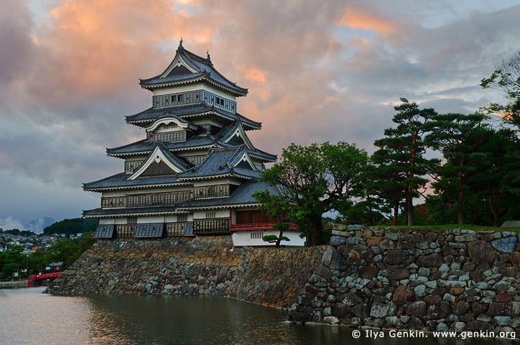 | ||
Points of interest Matsumoto Castle, Kamikochi, Japan Ukiyo-e Museum, Mount Yari, Mount Hotaka Colleges and Universities | ||
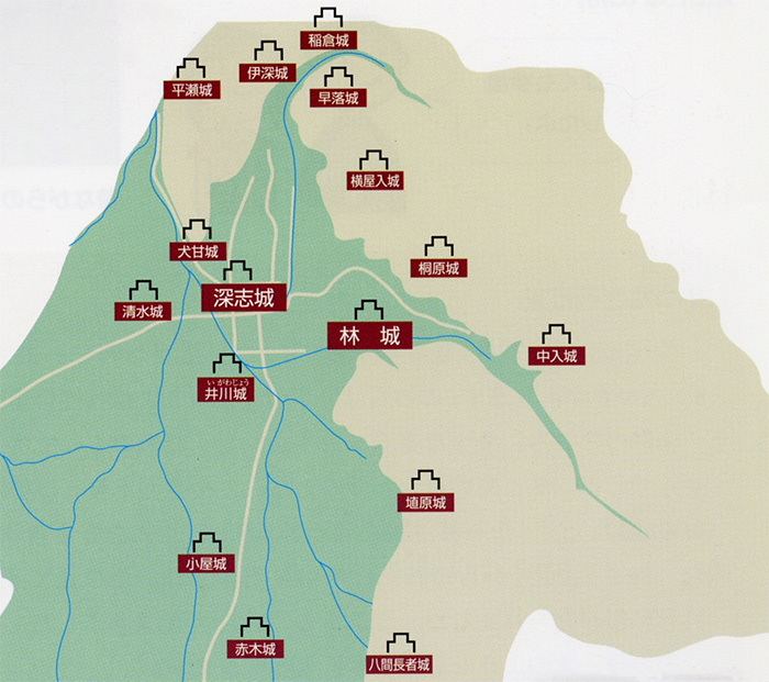
Map of Matsumoto, Nagano
Matsumoto (松本市, Matsumoto-shi) is a city located in central Nagano Prefecture, in the Chūbu region of Japan. It is a city located in Nagano Prefecture. Matsumoto is designated as a Special City. As of 1 October 2016, the city had an estimated population of 241,102 and a population density of 246 persons per km². Its total area was 978.47 square kilometres (377.79 sq mi).
Contents
- Map of Matsumoto Nagano
- History
- Geography
- Surrounding municipalities
- Climate
- Universities and colleges
- Primary and secondary education
- Airport
- Railway
- Highway
- Local attractions
- Sports
- References
History
Matsumoto is located in former Shinano Province and was the provincial capital from the Heian period onwards. The area developed as the castle town of Matsumoto Domain under the Tokugawa shogunate of the Edo period. Modern Matsumoto Town was established with the creation of the municipalities system on April 1, 1889. It was raised to city status on May 1, 1907.
On February 1, 1925 Matsumoto absorbed the village of Matsumoto (from Higashichikuma District).
The city expanded further by annexing the Kanda hamlet of the village of Nakayama from Higashichikuma District on April 1, 1943, the villages of Nakayama, Shimadachi and Shimauchi (all from Higashichikuma District) on April 1, 1954, the villages of Wada, Niimura, Kanbayashi, Sasaga, Yoshikawa, Kotobuki, Okada, Iriyamabe, Satoyamabe and Imai (all from Higashichikuma District) on August 1, 1954 and Kitauchida ward (excluding the Gakenoyu hamlet from the Minamiuchida ward of the village of Kataoka, from Higashichikuma District) from the city of Shiojiri on April 1, 1960. This was followed by the Gakenoyu hamlet of Minamiuchida ward of the village of Kataoka (from Higashichikuma District) from the city of Shiojiri on April 1, 1961, the village of Hongo (from Higashichikuma District) on May 1, 1974 and parts of Seba hamlet (the hamlet of Kukohigashi) from the city of Shiojiri on April 1, 1982.
Between the days of June 27 and June 28, 1994 - The Matsumoto Incident sarin gas attack occurred.
Matsumoto was proclaimed a Special City with increased local autonomy on November 1, 2000. Matsumoto annexed the villages of Azumi, Azusagawa and Nagawa (all from Minamiazumi District), and the village of Shiga (from Higashichikuma District) on April 1, 2005. This was followed by the town of Hata (from Higashichikuma District) on March 31, 2010.
Geography
Matsumoto is located in the Matsumoto Basin of central Nagano Prefecture surrounded by mountains and is acclaimed for its beautiful views. It is approximately 75 kilometers south of the prefectural capital at Nagano City, and 124 kilometers from central Tokyo. The 3000 meter Hida Mountains are to the west of the city.
Surrounding municipalities
Climate
Matsumoto has a humid subtropical climate (Köppen climate classification Cfa) bordering on a humid continental climate (Köppen Dfa) with hot summers and cold winters. Precipitation is quite high in summer, but the weather is somewhat drier in winter.
Universities and colleges
Primary and secondary education
Matsumoto has 29 public elementary schools operated by the city government, one operated by the national government and one private elementary school. The city also manages 19 public middle schools, with one more middle school shared between Matsumoto and neighbouring Asahi. There is one public middle school operated by the national government and one private middle school. The city has seven public high schools operated by the Nagano Prefectural Board of Education and six private high schools. The city also has a North Korean school, Nagano Korean Elementary and Junior High School (長野朝鮮初中級学校).
Airport
Railway
Highway
Local attractions
Matsumoto is attractive to travellers not only because of the traditional culture but also its calm climate and local products. Matsumoto soba is famous for its delicate taste Local attractions include:
Sports
Matsumoto is represented in the J. League of football with its local club, Matsumoto Yamaga FC based at the Alwin Stadium in Kambayashi.
It was one of the host cities of the official Women's Volleyball World Championship for its 1998 and 2010 editions.