
Phone number 0263-98-3111 Population 8,321 (Oct 2016) | Area 24.98 km² Local time Monday 9:37 AM | |
 | ||
Weather 7°C, Wind E at 3 km/h, 39% Humidity | ||
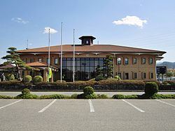
Yamagata (山形村, Yamagata-mura) is a village located in Chiisagata District in central Nagano Prefecture, in the Chūbu region of Japan. As of 1 October 2016, the village had an estimated population of 8,321 and a population density of 333 persons per km². Its total area was 24.98 square kilometres (9.64 sq mi).
Contents
- Map of Yamagata Higashichikuma District Nagano Prefecture Japan
- Geography
- Surrounding municipalities
- History
- Economy
- Education
- Railway
- Highway
- Sister city relationship
- References
Map of Yamagata, Higashichikuma District, Nagano Prefecture, Japan
Geography
Yamagata is located in the centre of Nagano Prefecture in the Matsumoto Basin at an altitude of approximately 700 meters. Mount Hachimori (2447 meters) is partially within the borders of the village.
Surrounding municipalities
History
The area of present-day Yamanaga was part of ancient Shinano Province. The area was part of the holdings of Matsumoto Domain during the Edo period. The modern village of Yamagata was established on April 1, 1889 by the establishment of the municipalities system and has not changed its borders since that time.
Economy
The economy of the village is based on agriculture.
Education
Yamagata has one public elementary school and one public middle school shared with the neighboring village of Asahi. The village does not have a high school.
Railway
The village does not have any passenger railway service.
Highway
The village is not located on any national highway.