
Area 70.62 km² Local time Sunday 9:59 AM | Phone number 0263-99-2001 Population 4,480 (Oct 2016) | |
 | ||
Weather 0°C, Wind NW at 6 km/h, 61% Humidity | ||
Asahi (朝日村, Asahi-mura) is a village located in Higashichikuma District in central Nagano Prefecture, in the Chūbu region of Japan. As of 1 October 2016, the village had an estimated population of 4,480 and a population density of 63.4 persons per km². Its total area was 70.62 square kilometres (27.27 sq mi).
Contents
- Map of Asahi Higashichikuma District Nagano Prefecture Japan
- Geography
- Surrounding municipalities
- History
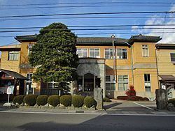
- Education
- Railway
- Highway
- References
Map of Asahi, Higashichikuma District, Nagano Prefecture, Japan
Geography
Nagawa is located in the centre of Nagano Prefecture within the Matsumoto Basin. Mount Hachimori (2446 meters) is the highest elevation in the village. The Shin Shinano Frequency Converter Station is located in Asahi.
Surrounding municipalities
History
The area of present-day Nagawa was part of ancient Shinano Province. Most of the area was part of the holdings of Matsumoto Domain, with a portion held by Takatō Domain during the Edo period. The modern village of Asahi was established on April 1, 1889 by the establishment of the municipalities system.
Education
Asahi has one public elementary schools and one public middle school operated jointly between Asahi and neighboring Yamagata village. The village does not have a high school.
Railway
The village does not have any passenger railway service.
Highway
The village is not located on any national highway.