
Effective January 1, 1982 Time zone EST (UTC−5) Population 36,286 (2011) Area code 819 | Area 2,502 km² Province Québec | |
 | ||
Website www.mrc-maskinonge.qc.ca Destinations Maskinongé, Saint‑Alexis‑des‑Monts, Lake Saint Pierre, Saint‑Paulin, Réserve Faunique Mastigouche | ||
Maskinongé is a regional county municipality in the Mauricie region of Quebec, Canada. The seat is Louiseville. It is located adjacent on the west of Trois-Rivières on the Saint Lawrence River.
Contents
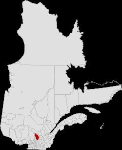
- Map of MaskinongC3A9 Regional County Municipality QC Canada
- History
- Subdivisions
- Access Routes
- References
Map of Maskinong%C3%A9 Regional County Municipality, QC, Canada
The population according to the Canada 2011 Census is 36,286.
History
The RCM was formed on January 1, 1982, and it consisted of Hunterstown Township (now part of Saint-Paulin); Belleau Municipality (now part of Saint-Alexis-des-Monts); the parish municipalities of Saint-Alexis-des-Monts, Sainte-Angèle (since renamed to Sainte-Angèle-de-Prémont), Sainte-Anne-d'Yamachiche (now part of Yamachiche), Saint-Antoine-de-la-Rivière-du-Loup (now part of Louiseville), Saint-Barnabé, Saint-Édouard (since renamed to Saint-Édouard-de-Maskinongé), Saint-Joseph-de-Maskinongé (now part of Maskinongé), Saint-Justin, Saint-Léon-le-Grand, Saint-Paulin, Saint-Sévère, and Sainte-Ursule; and the village municipalities of Louiseville, Maskinongé, Saint-Paulin, and Yamachiche.
On January 1, 2002, the municipalities of Charette, Saint-Boniface-de-Shawinigan (since renamed to Saint-Boniface), Saint-Élie (since renamed to Saint-Élie-de-Caxton), Saint-Étienne-des-Grès, and Saint-Mathieu-du-Parc were transferred to the Maskinongé RCM when the Centre-de-la-Mauricie and Francheville Regional Counties were dissolved.
Subdivisions
There are 17 subdivisions within the RCM:
Access Routes
Highways and numbered routes that run through the municipality, including external routes that start or finish at the county border: