
Borders on Mantiqueira Mountains | Elevation 2,798 m Country Brazil | |
 | ||
Mountains Pedra do Baú, Pico das Agulhas Negras, Pedra da Mina, Pico dos Marins, Pedra de São Domingos Similar Pico das Agulhas Negras, Pedra da Mina, Pico dos Marins, Pedra do Baú, Pico dos Três Estados | ||
The Mantiqueira Mountains (Portuguese: Serra da Mantiqueira) are a mountain range in Southeastern Brazil, with parts in the states of São Paulo, Minas Gerais and Rio de Janeiro. It rises abruptly from the northwestern bank of the Paraíba do Sul River and extends northeastward for approximately 320 km (200 mi), reaching a height of 2,798 m (9,180 ft) at Pedra da Mina. The mountains, which eventually merge with the Serra do Espinhaço, were originally forest-covered, except for the peaks that rise above the tree line. They provide charcoal and pasture for cattle; on the lower slopes there are several health and tourist resorts, such as Campos do Jordão, Brazil's highest city. The name Mantiqueira derives from a Tupi word meaning "mountains that cry", denoting the large number of springs and streams found there.
Contents
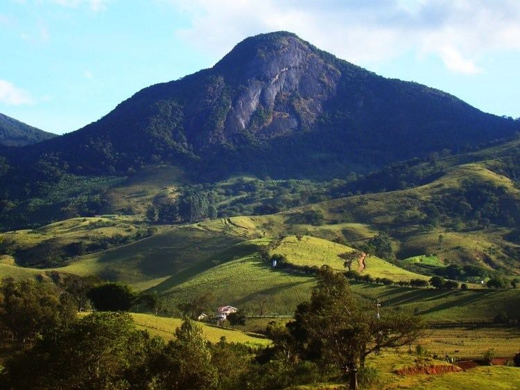
- Map of Mantiqueira Mountains Baependi State of Minas Gerais Brazil
- Ecology
- Altitudes and climate
- Micro regions
- Miscellaneous information
- References
Map of Mantiqueira Mountains, Baependi - State of Minas Gerais, Brazil
The name shows the range's great importance as a source of drinking water, and the waters supply a great number of important cities in the southeast of Brazil. From its brooks are formed the Jaguari River, which supplies the northern region of Greater São Paulo; most left-bank tributaries of the Paraíba do Sul River, which crosses a densely populated and highly industrialized region; and the Grande River, which is the source of the Paraná River, one of the longest and most important in South America and the river with the world's largest hydroelectric output, through a series of power plants way down the river to Argentina and Paraguay.
Many springs of mineral water lie in the regions of Caxambu and São Lourenço in Minas Gerais, and Campos do Jordão and Serra Negra in São Paulo.
Ecology
The Serra da Mantiqueira is a part of the Mata Atlântica ecosystem. Despite the clearing of the land for livestock raising, the difficult access to many areas has made possible for sanctuaries of well-preserved forest to still exist, with trees such as the jacarandá, Spanish cedar, canjerana, guatambu, ipê, canela, angico, jequitibá, and also the araucaria, more typical of subtropical South America but found in the area because of altitude. At its closest point, the region is only 100 km (62 mi) from the city of São Paulo.
It is also the habitat of a varied fauna: pampas deer (locally known as veado campeiro), maned wolves (lobo guará), cougars (onça-parda or suçuarana), bush dogs (cachorro-vinagre), ocelots (jaguatirica), pacas, howler monkeys (bugio), Atlantic titis (sauá), squirrels, and hedgehogs can still be found there. Birds of note are the azure jay, the toucan, the scaly-headed parrot (maitaca), the inhambu, the jacana, the seriema and the caracara.
Altitudes and climate
The Mantiqueira is a popular region for mountain climbers and trekkers, where in winter, which is the dry season, one can climb some of the highest peaks in the country:
Here are also some of the highest Brazilian cities:
Due to altitude, winter in the Serra da Mantiqueira sees low temperatures, with the occurrence of fog in early morning and frost, giving the landscape the appearance of regions with a much colder climate. In winter, it is common for the thermometer to reach temperatures near 0 °C (32 °F), and then sub-freezing temperatures not rarely occur in the region's towns. On top of the highest peaks, the cold can be even more intense, and temperatures can drop to -10 °C (14 °F). Snow is rare, but it has been recorded a few times, such as in the winter of 1994, when it snowed in the Itatiaia massif.
Micro-regions
Miscellaneous information
Brazilian composer Antonio Carlos Jobim composed a song called "Mantiqueira Range" for his album Jobim (1972). Jobim got his inspiration for the piece from the mountain range of the same name.