
Website www.mackinaccounty.net Population 11,061 (2013) Unemployment rate 10.0% (Apr 2015) | Area 5,442 km² County seat St. Ignace | |
 | ||
Founded October 26, 1818organized 1849 Rivers Carp River, South Branch Hendrie River, Chub Creek Points of interest Destinations | ||
Mackinac County is a county in the Upper Peninsula of the U.S. state of Michigan. As of the 2010 census, the population was 11,113. The county seat is St. Ignace. Formerly known as Michilimackinac County, in 1818 it was one of the first counties of the Michigan Territory, as it had long been a center of French and British colonial fur trading, a Catholic church and Protestant mission, and associated settlement.
Contents
- Map of Mackinac County MI USA
- History
- Geography
- Adjacent counties
- National protected area
- Airports
- Highways
- County designated highways
- Ferry
- Rail
- Demographics
- Religion
- Government
- Elected officials
- Historical markers
- Newspapers
- Television
- Radio
- Attractions
- Cities
- References
Map of Mackinac County, MI, USA
The county's name is believed to be shortened from "Michilimackinac", which referred to the Straits of Mackinac area as well as the French settlement at the tip of the lower peninsula.
History
Michilimackinac County was created on October 26, 1818, by proclamation of territorial governor Lewis Cass. The county originally encompassed the Lower Peninsula of Michigan north of Macomb County and almost the entire present Upper Peninsula. As later counties were settled and organized, they were divided from this territory.
At the time of founding, the county seat was the community of Michilimackinac Island on Michilimackinac Island, later known as Mackinac Island, Michigan. This has been an important center for fur trading before the 1830s, when European demand declined. The county was organized in 1849 as Mackinac County. In 1882 the county seat was moved from Mackinac Island to St. Ignace, Michigan, which had been founded as a French Jesuit mission village during the colonial years.
Mackinac County is home to the Mackinac Bands of Chippewa and Ottawa Indians, a Native American tribe located in St. Ignace.
Geography
According to the U.S. Census Bureau, the county has a total area of 2,101 square miles (5,440 km2), of which 1,022 square miles (2,650 km2) is land and 1,079 square miles (2,790 km2) (51%) is water. Mackinac County lies at the boundary of Lake Huron and Lake Michigan.
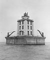
St. Ignace is the northern terminus of the Mackinac Bridge. Mackinac Island is within the county.
Adjacent counties
National protected area
Airports
The Mackinac County Airport (83D) in St. Ignace and Mackinac Island Airport (MCD) on Mackinac Island are located within Mackinac County. The nearest airports with scheduled commercial passenger service are Chippewa County International Airport (CIU) in Sault Ste. Marie and Pellston Regional Airport (PLN).
Highways
M-185 does not allow motor vehicles with the exception of emergency vehicles.
County-designated highways
Ferry
Numerous companies operate ferries to Bois Blanc Island and Mackinac Island. Ferries to and from Mackinac Island sail from St. Ignace and Mackinaw City, while the Bois Blanc Island ferry sails from Cheboygan.
Rail
Demographics
The 2010 United States Census ireported that Mackinac County had a population of 11,113. This was a decrease of 830 (-6.9%) from the 2000 United States Census. In 2010 there were 5,024 households and 3,219 families residing in the county. The population density was 11 per square mile (5/km²). There were 11,010 housing units at an average density of 11/sq mi (4/km²). 76.5% of the population were White, 17.3% Native American, 0.5% Black or African American, 0.2% Asian, 0.2% of some other race and 5.3% of two or more races. 1.1% were Hispanic or Latino (of any race). 18.5% were of German, 8.8% English, 8.0% French, French Canadian or Cajun, 7.6% Irish and 5.1% Polish ancestry.
There were 5,024 households of which 20.9% had children under the age of 18 living with them, 51.3% were married couples living together, 8.1% had a female householder with no husband present, and 35.9% were non-families. 31.0% of all households were made up of individuals and 14.3% had someone living alone who was 65 years of age or older. The average household size was 2.19 and the average family size was 2.7.
18.7% of the population were under the age of 18, 5.5% from 18 to 24, 19.3% from 25 to 44, 34.0% from 45 to 64, and 22.3% who were 65 years of age or older. The median age was 49 years. The population was 50.5% male and 49.5% female.
The median household income was $39,055 and the median family income was $50,984. The per capita income was $22,195. About 10.5% of families and 14.1% of the population were below the poverty line, including 19.3% of those under age 18 and 6.2% of those age 65 or over.
Religion
Mackinac County is part of the Roman Catholic Diocese of Marquette.
Government
The county government operates the jail, maintains rural roads, operates the major local courts, keeps files of deeds and mortgages, maintains vital records, administers public health regulations, and participates with the state in the provision of welfare and other social services. The county board of commissioners controls the budget but has only limited authority to make laws or ordinances. In Michigan, most local government functions — police and fire, building and zoning, tax assessment, street maintenance, etc. — are the responsibility of individual cities and townships.
Elected officials
(information as of April 2015)
Historical markers
There are 34 official state historical markers in the County:
Newspapers
Television
The following television stations can be received in St. Ignace:
Radio
The following stations can be heard in St. Ignace: