
Designated NHLDCP October 15, 1966 Phone +1 231-436-4100 | Area 7.278 km² | |
 | ||
Address Mackinac Island, MI 49701, USA Similar Mackinac Island, Fort Mackinac, Richard and Jane Manoogi, Fort Holmes, Straits State Park | ||
Escape to nature at mackinac island state park
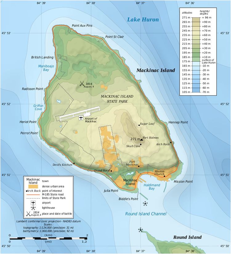
Mackinac Island State Park is a state park located on Mackinac Island in the U.S. state of Michigan. The island park encompasses 2.81 mi² (7.28 km²), which is approximately 74% of the island's total area of 3.78 mi² (9.78 km²). The park is also within the boundaries of the city of Mackinac Island and has permanent residents within its boundaries. M-185 circles the perimeter of the park as the only motorless highway in the state due to the island's ban of automobiles. The park is governed by the Michigan Department of Natural Resources and the Mackinac Island State Park Commission. On July 15, 2009, the park celebrated its 20 millionth visitor.
Contents
- Escape to nature at mackinac island state park
- Mackinac island state park
- War of 1812Edit
- Information centersEdit
- Historic buildingsEdit
- SitesEdit
- Caves and rock formationsEdit
- InstallationsEdit
- References
The park was first established as Mackinac National Park in 1875, which was the second national park established in the United States after Yellowstone National Park. In 1895, it was transferred to state control and reorganized as Mackinac Island State Park, which was the first state park in Michigan. The park contains many important historical and geological features, such as Fort Mackinac, Fort Holmes, other historic buildings, historic sites, limestone caves, and other unique rock formations. The park also operates the Mackinac Island Airport. Many of these sites are formally operated by the Mackinac Island State Park Commission, which also governs many parks around the Straits of Mackinac area.
Mackinac island state park
War of 1812Edit
Mackinac Island played an important role in the War of 1812 between the United States and Canada (then a British colony). Fort Mackinac, upon the island, was built by the British army during the Revolutionary War. The British later relinquished the fort to the Americans in 1796, but then built and maintained a similar fort on nearby St. Joseph Island. The two nations used their island forts in a struggle to maintain supremacy over the waters of northern Lake Huron. As one of the opening actions of the War of 1812, the British captured Fort Mackinac and maintained it as a British stronghold until the end of the war. An American attempt to recapture the fort in 1814 failed in the Battle of Mackinac Island. When the war ended with the Treaty of Ghent in 1815, the island was returned to American control.