
Founded 1869 Congressional district 1st Area 3,600 km² County seat Charlevoix | Largest city Boyne City Time zone Eastern: UTC-5/-4 Population 26,129 (2013) Unemployment rate 6.3% (Apr 2015) | |
 | ||
Named for Pierre François Xavier de Charlevoix Website www.charlevoixcounty.org Rivers Jordan River, Horton Creek, Warner Creek, Bear River Points of interest Castle Farms, Boyne Mountain Resort, Young State Park, Lake Michigan, Avalanche Bay Indoor Waterpark Destinations Charlevoix, Boyne City, Boyne Mountain Resort, Boyne Falls, East Jordan | ||
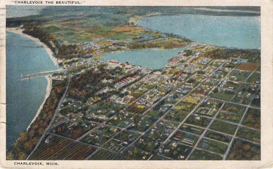
Charlevoix County (/ˈʃɑːrləˌvɔɪ/ SHARL-ə-VOY) is a county in the U.S. state of Michigan. As of the 2010 census, the population was 25,949. The county seat is Charlevoix.
Contents
- Map of Charlevoix County MI USA
- 1840s Surveyed and Organized as Keskkauko County
- 1853 Strangites gain power and re organize Keskkauko into Emmet County
- Popular Dissatisfaction with Mormon Power
- Charlevoix Township splits off to become Charlevoix County in 1869
- County Seat Wars Charlevoix vs East Jordan vs Boyne City
- Other History
- Geography
- Adjacent counties
- National protected area
- State highways
- County designated highways
- Airports
- Ferry service
- Bus service
- Demographics
- Government
- Cities
- Village
- Census designated places
- References
Map of Charlevoix County, MI, USA
1840s: Surveyed and Organized as Keskkauko County
Between 1840 and 1841, surveyors William Austin Burt, John Mullett and Charles W. Cathcart, surveyed much of Northern Michigan. Cathcart oversaw the internal lines survey for 34N 08W, the region which would later be known as Charlevoix. Mullett and Cathcart laid out many of the townships in the new county including Charlevoix Township.
The county was named in 1843 for Pierre François Xavier de Charlevoix, a Jesuit missionary of the French colonial era. The county was originally organized in 1840 as Kesk-kauko in honor of a great chief of the Saginaw tribe, and name was changed from Resh-kanko to Charlevoix County in 1843.
1853: Strangites gain power and re-organize Keskkauko into Emmet County
In 1847, a group of "Strangite" Mormons settled on Beaver Island and established a "kingdom" led by "King" James Jesse Strang. There were bitter disputes between Strang's followers and other white settlers. Strang, seeking to strengthen his position, gained election to the Michigan State House of Representatives. In January 1853, he pushed through legislation titled, "An act to organize the County of Emmet", which enlarged Emmet County by attaching the nearby Lake Michigan islands to Emmet county, as well as a portion of Cheboygan County and Keskkauko/Resh-kanko/ Charlevoix. Charlevoix was thus organized in 1853 as a township under Emmet County and consisted all of the nine townships in the southern half of Emmet County.
Popular Dissatisfaction with Mormon Power
Due to Strang's influence, Mormons came to dominate Emmet county government, causing an exodus of many non-Mormon settlers to neighboring areas. In 1855, the non-Mormon resistance succeeded in getting the Michigan Legislature to reorganize Emmet County. The islands, including Beaver Island and North and South Manitou Islands, were transferred into the separate Manitou County, which effectively eliminated Mormons from Emmet County government. After an assassination attempt on June 20, 1856, Strang died three weeks later.
Charlevoix Township splits off to become Charlevoix County in 1869
Emmet County continued to experience tensions as citizens clashed over over whether to put the county seat at Little Traverse (Harbor Springs) versus Mackinaw City. In a contested election in 1867, residents voted to move the county seat to Charlevoix, which was upheld by a Circuit Court decision in 1868. However, in 1869, Charlevoix County was split from Emmet County, resulting in Charlevoix being the official county seat for Emmet county as well as for the newly formed Charlevoix County.
County Seat Wars -- Charlevoix vs East Jordan vs Boyne City
In 1873, the Grand Rapids and Indiana Railroad was completed through the eastern side of Charlevoix county up to Petoskey, and the east side of Pine Lake became more and more populated. For example, Resort Township and Springvale Township, Michigan were formed in 1880 as a part of Charlevoix County. As new townships became established, Boyne City colluded with East Jordan to gain a requisite 2/3 majority of township supervisors to vote to move the county seat to East Jordan. In October 1884, 11 of the existing 16 township supervisors designated East Jordan to be the county seat. In October 1886, Boyne City convinced 2/3 of township supervisors to move the county seat to Boyne City.
Finally, in a January 1897 land deal with Emmet County and the state legislature, Charlevoix County took on three townships on Beaver Island while giving up Resort, Bear Lake, and Springvale townships to Emmet County. The resulting balance of township supervisor votes gave the City of Charlevoix enough votes to obtain the county seat after a 13-year hiatus.
Other History
The Ironton Ferry began operation in 1876, and Ironton soon became a location for iron manufacture.
The ten Michigan historical markers in the county generally mark events or places related to European-American history, although this has long been a hunting and fishing grounds for the Odawa people:
Geography
According to the U.S. Census Bureau, the county has a total area of 1,390 square miles (3,600 km2), of which 416 square miles (1,080 km2) is land and 974 square miles (2,520 km2) (70%) is water. It is the fourth-smallest county in Michigan by land area.
Lake Charlevoix, with 17,200 acres (7,000 ha) surface area and 56 miles (90 km) of shoreline, is a very prominent feature of the county. Gull, Hat, Pismire, and Shoe Islands, which are part of the Beaver Island archipelago, form the Lake Michigan division of the Michigan Islands National Wildlife Refuge, and two of them are part of the Michigan Islands Wilderness Area.
The county is considered to be part of Northern Michigan.
Adjacent counties
National protected area
State highways
County-designated highways
Airports
Ferry service
Bus service
Demographics
As of the census of 2000, there were 26,090 people, 10,400 households, and 7,311 families residing in the county. The population density was 63 people per square mile (24/km²). There were 15,370 housing units at an average density of 37 per square mile (14/km²). The racial makeup of the county was 96.31% White, 0.17% Black or African American, 1.54% Native American, 0.23% Asian, 0.09% Pacific Islander, 0.41% from other races, and 1.25% from two or more races. 1.04% of the population were Hispanic or Latino of any race. 21.8% were of German, 12.0% English, 11.0% American, 10.6% Irish and 8.4% Polish ancestry according to Census 2000. 97.3% spoke English and 1.1% Spanish as their first language.
There were 10,400 households out of which 31.80% had children under the age of 18 living with them, 58.40% were married couples living together, 8.10% had a female householder with no husband present, and 29.80% were non-families. 25.20% of all households were made up of individuals and 10.50% had someone living alone who was 65 years of age or older. The average household size was 2.48 and the average family size was 2.96.
In the county, the population was spread out with 25.90% under the age of 18, 6.50% from 18 to 24, 27.40% from 25 to 44, 25.20% from 45 to 64, and 14.90% who were 65 years of age or older. The median age was 39 years. For every 100 females there were 97.90 males. For every 100 females age 18 and over, there were 94.80 males.
The median income for a household in the county was $39,788, and the median income for a family was $46,260. Males had a median income of $32,457 versus $22,447 for females. The per capita income for the county was $20,130. About 5.40% of families and 8.00% of the population were below the poverty line, including 10.00% of those under age 18 and 5.90% of those age 65 or over.
Government
The county government operates the jail, maintains rural roads, operates the major local courts, keeps files of deeds and mortgages, maintains vital records, administers public health regulations, and participates with the state in the provision of welfare and other social services. The county board of commissioners controls the budget but has only limited authority to make laws or ordinances. In Michigan, most local government functions — police and fire, building and zoning, tax assessment, street maintenance, etc. — are the responsibility of individual cities and townships. Charlevoix is part of the 114th district.