
Airport type Public 8/26 3,501 Code MCD Phone +1 906-847-3231 | Elevation AMSL 739 ft / 225 m 3,501 1,067 Elevation 226 m Added to NRHP 9 October 1960 | |
 | ||
Address Mackinac Island State Park, 7700 Annex Rd, Mackinac Island, MI 49757, USA Similar Mackinac Island Hotel, Grand Hotel, Star Line Mackinac Island Fer, Star Line Mackinac Island Fer, Mackinac Island State Park | ||
Landing at mackinac island airport kmcd
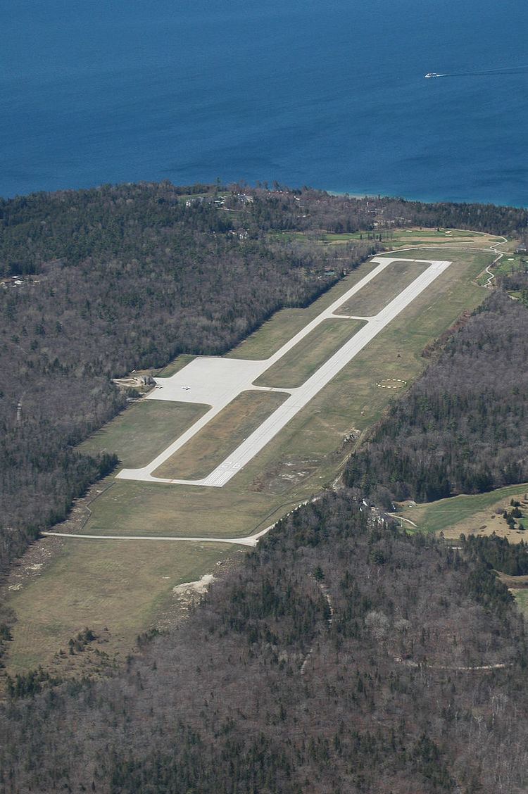
Mackinac Island Airport (IATA: MCD, ICAO: KMCD, FAA LID: MCD) is a public use airport in Mackinac County, Michigan, United States. It is located one nautical mile (1.9 km) northwest of downtown Mackinac Island, Michigan in the center of Mackinac Island. The airport is owned by Mackinac Island State Park Commission. It is included in the Federal Aviation Administration (FAA) National Plan of Integrated Airport Systems for 2017–2021, in which it is categorized as a basic general aviation facility.
Contents
- Landing at mackinac island airport kmcd
- Mackinac island airport mcd kmcd terminal walk through
- Facilities and aircraft
- Transit
- Incidents and Accidents
- References
Mackinac Island Airport started as a grass strip in 1934. It got a paved runway in 1963 and a terminal building in 1969. A $4.6 million project in 2012 moved the runway 65 feet east to a flatter location.
Mackinac island airport mcd kmcd terminal walk through
Facilities and aircraft
Mackinac Island Airport covers an area of 125 acres (51 ha) at an elevation of 739 feet (225 m) above mean sea level. It has one runway designated 8/26 with a concrete surface measuring 3,501 by 75 feet (1,067 x 23 m).
For the 12-month period ending December 31, 2015, the airport had 11,100 aircraft operations, an average of 30 per day: 32% air taxi and 68% general aviation. In March 2017, there were no aircraft based at this airport.