
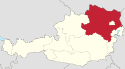
Country Austria Capital Sankt Polten | Area 19,186 km2 Population 1,636,287 | |
 | ||
Destinations Sankt Polten, Wiener Neustadt, Krems an der Donau, Baden bei Wien, Tulln an der Donau Points of interest Melk Abbey, Klosterneuburg Monastery, Gottweig Abbey, Essl Museum, Heiligenkreuz Abbey | ||
Map of Lower Austria
Lower Austria (German: Niederösterreich, [ˈniːdɐˌʔøːstɐʀaɪ̯ç]; Czech: Dolní Rakousy; Slovak: Dolné Rakúsko) is the northeasternmost state of the nine states in Austria. The capital of Lower Austria since 1986 is Sankt Pölten, the most recently designated capital town in Austria. The capital of Lower Austria had formerly been Vienna, even though Vienna has not officially been part of Lower Austria since 1921. With a land area of 19,186 km2 (7,408 sq mi) and a population of 1.612 million people, it is the largest state in Austria, and in terms of population second only to the federal state of Vienna.
Contents
- Map of Lower Austria
- Lower austria niederosterreich
- Geography
- Mountains
- Alpine passes
- Rivers
- Lakes
- Caves
- History
- Administrative divisions
- Independent towns
- Districts
- References
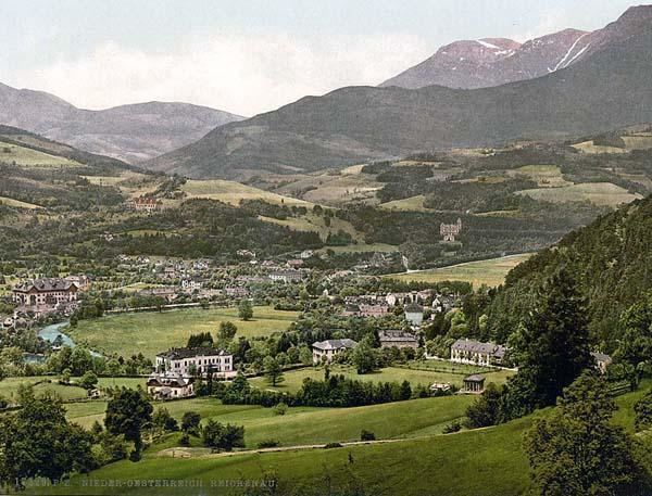
Lower austria niederosterreich
Geography
Situated east of Upper Austria, Lower Austria derives its name from its downriver location on the Danube River, which flows from west to east. Lower Austria has an international border, 414 km (257 mi) long, with the Czech Republic (mainly South Moravia) and Slovakia. The state has the second longest external border of all Austrian states. It also borders the other Austrian states of Upper Austria, Styria and Burgenland as well as surrounding Vienna.
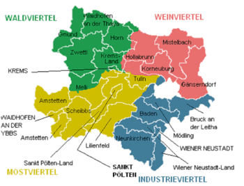
Lower Austria is divided into four regions, known as Viertel (quarters):
These regions have different geographical structures. Whilst the Mostviertel is dominated by the foothills of the Limestone Alps with mountains up to 2,000 m (AA) high, most of the Waldviertel is a granite plateau. The hilly Weinviertel lies to the northeast, descends to the plains of Marchfeld in the east of the state, and is separated by the Danube from the Vienna Basin to the south, which in turn is separated from the Vienna Woods by a line of thermal springs (the Thermenlinie) running north to south.
Mountains
Other mountains in Lower Austria may be found at Category:Mountains of Lower Austria.
Alpine passes
The state border with Styria runs over both passes.
Rivers
Almost all of Lower Austria is drained by the Danube. The only river that flows into the North Sea (via the Moldau and the Elbe) is the Lainsitz in northern Waldviertel.
The most important rivers north of the Danube (on its left bank) are the Ysper, Kamp, Krems, Lainsitz, March and Thaya. South of the Danube (on its right bank) are the Enns, Ybbs, Erlauf, Melk, Pielach, Traisen, Schwechat, Fischa, Schwarza, Triesting, Pitten and the Leitha.
Lakes
Caves
Lower Austria is rich in natural caves; in all 4,082 have been recorded. Most of the caves have formed in limestone and dolomite rocks and are therefore called karst caves. Cavities also form in the marble of the Central Alps and the Bohemian Massif. Among the largest caves in Lower Austria are:
The last two are open as show caves, along with the Allander stalactite cave, the Unicorn Cave, the Hochkarschacht, the Nixhöhle and the Ötschertropfsteinhöhle.
History
The history of Lower Austria is very similar to the history of Austria. Many castles are located in Lower Austria. Klosterneuburg Abbey, located here, is one of the oldest abbeys in Austria. Before World War II, Lower Austria had the largest number of Jews in Austria.
Administrative divisions
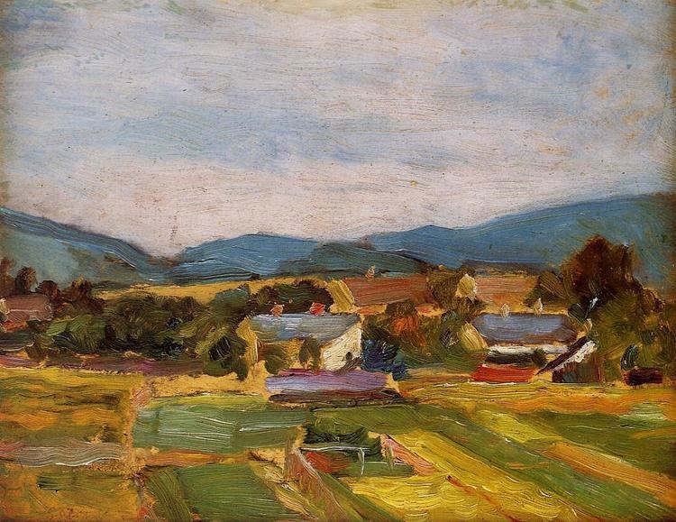
Lower Austria is divided into four regions: Waldviertel, Mostviertel, Industrieviertel, and Weinviertel. The Wachau valley, situated between Melk and Krems in the Mostviertel region, is famous for its landscape, culture, and wine.
Administratively, the state is divided into 20 districts (Bezirke), and four independent towns (Statutarstädte). In total, there are 573 municipalities within Lower Austria.