
Prominence 693 m ↓ Naßkamm Normal route Walkable | Isolation 7.3 km → Heukuppe Mountain type Plateau mountain Elevation 1,903 m | |
 | ||
Similar Schneeberg, Großer Sonnleitstein, Sonnwendstein, Tonion, Kampalpe | ||
The Schneealpe or Schneealm is a limestone massif in the Northern Limestone Alps on the Styrian-Lower Austrian border. Its highest point is the Windberg at 1,903 metres above sea level. Other peaks are the Ameisbühel (also Amaißbichl, 1,828 m, in the east, on the Styrian-Lower Austrian border), the Schönhaltereck (1,860 m, west of the Windberg) and the Donnerwand (1,799 m, in the northwest).
Contents
Map of Schneealpe, 8691, Austria
Its valley settlements are Hinternaßwald in the northeast, Altenberg an der Rax in the east, Kapellen and Neuberg an der Mürz in the south, Mürzsteg and Frein an der Mürz in the west. The heavily wooded mountains and hills north of the Schneealpe are uninhabited.
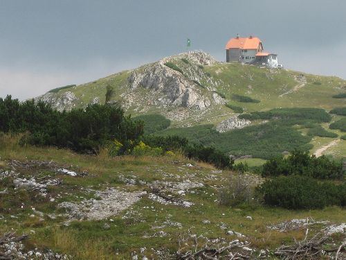
The Schneealpen House and several alm huts are located the high plateau at a height of about 1,780 metres. On the western perimeter of the plateau on the Hinteralm is another Alpine Club hut, the Hinteralm House. In the northern area is the source region of the Kalte Mürz. The Schneealpen area belongs, together with the Rax and the Schneeberg, to the catchment area of the First Vienna Mountain Spring Pipeline (I. Wiener Hochquellenwasserleitung). Drinking water is led through the Schneealpen Tunnel, built between 1965 and 1968 by the city of Vienna, to Hinternaßwald.