
Length 60 km | Tributaries Right:Further Bach Country Austria | |
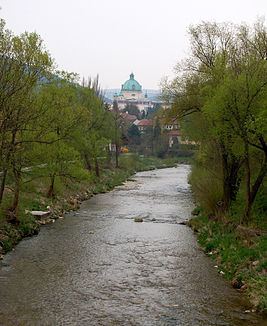 | ||
Landmarks Small towns: Berndorf, SchwechatVillages: Kaumberg, Altenmarkt, Weissenbach, Pottenstein, , Hirtenberg, Enzesfeld, Leobersdorf, Trumau, Münchendorf, Oberwaltersdorf | ||
The Triesting is a river in the southeastern part of the Vienna Woods. It discharges into the smaller Schwechat at Achau and is part of the catchment area of the River Danube. It has a length of 60 km.
Contents
Map of Triesting, Austria
FloodsEdit
The floods of 1944 were the worst ever in the Triesting valley. On 4 July 1944, there were severe floods, following heavy cloudbursts over the upper Triesting valley, in the vicinity of the Schöpfl mountain and in the Further valley. The narrow neck of the valley above Pottenstein was blocked by driftwood and the Fahrafeld Basin turned into a dammed lake. The dam broke and floodwaters up to 2 metres high surged through the valley. In the whole valley 188 people lost their lives, "the majority being foreign workers".
References
Triesting Wikipedia(Text) CC BY-SA