The Ardennes lie in Belgium, with foothills in France and Luxembourg.
Baraque de Fraiture (652 m), Province of Luxembourg (B)Cairn Roy Albert (589 m), Province of Luxembourg (B)Hochtumsknopf (Hüttensknipp; 510 m), Province of Liege (B)Croix Scaille (505 m), Province of Namur (B)The Eifel lies in Germany with foothills in Belgium and Luxembourg.
→ main article: List of mountains and hills of the Eifel
Hohe Acht (746.9 m), High Eifel (RP)Ernstberg (699.8 m), Vulkan Eifel (RP)unnamed peak (near Schwarzer Mann; 699.1 m), Schnee Eifel (RP)Schwarzer Mann (697.8 m), Schnee Eifel (RP)Botrange (694.24 m), High Fens (B)Weißer Stein (693 m), North Eifel (NW / B)Scharteberg (691.4 m), Vulkan Eifel (RP)Nürburg (ca. 678 m), High Eifel (RP)Hochkelberg (674.9 m), High Eifel (RP)Raßberg (663.8 m), High Eifel (RP)Steling (658.3 m), High Fens (NW / B)Giescheid (652 m), North Eifel (NW)Nerother Kopf (651.7 m), Vulkan Eifel (RP)Aremberg (623.8 m), Ahr Hills (RP)Hardtkopf (601.5 m), South Eifel (RP)Michelsberg (586.1 m), Ahr Hills (NW)Eigart (565.5 m), North Eifel (NW)Rockeskyller Kopf (554.6 m), Vulkan Eifel (RP)Hoher List (549.1 m), Vulkan Eifel (RP)Wildbretshügel (525.3 m), North Eifel/Rur Eifel (NW)Herkelstein (434.5 m), North Eifel (NW)Veitskopf (428.1), Vulkan Eifel (RP)Burgberg (400.8), Rur Eifel, North Eifel (NW)Sonnenberg (393.3 m), Rur Eifel (NW)Calmont (378.4 m), Anterior Eifel (RP)Bausenberg (339.8 m), North Eifel (RP)Landskrone (271.7 m), Ahr Hills (RP)The High Fens lie in Belgium with foothills in Germany.
Botrange (694.24 m), Province of Liege (B)Pannensterzkopf (Bovel; ca. 662 m), Province of Liege (B)Hühnerhöhe (659.9 m), county of Euskirchen (North Rhine-Westphalia)Steling (658.3 m), county of Aachen (North Rhine-Westphalia) / Province of Liege (B)Hahnheister (636.3 m), county of Aachen (North Rhine-Westphalia) / Province of Liege (B)Hohe Mark (ca. 609 m), Province of Liege (B)The Hunsrück lies in Rhineland-Palatinate with foothills in the Saarland.
Erbeskopf (816.32 m), Schwarzwalder Hochwald (RP)An den zwei Steinen (766.2 m), Idar ForestKahlheid (766.0 m), Idar Forest(RP)Ruppelstein (762.7 m), Schwarzwalder Hochwald (RP)Sandkopf (757.4 m), Schwarzwalder Hochwald (RP)Steingerüttelkopf (756.6 m), Idarwald (RP)Idarkopf (745.7 m), Idar Forest(RP)Usarkopf (725.4 m), Idar Forest(RP)Rösterkopf (708.1 m), Osburger Hochwald (RP)Friedrichskopf (707.4 m), Schwarzwalder Hochwald (RP)Dollberg (695.4 m), Schwarzwalder Hochwald (RP, SL)Teufelskopf (695.0 m), Schwarzwalder Hochwald (RP)Schimmelkopf (694.8 m), Schwarzwalder Hochwald (RP, SL)Mückenbornberg (692.6), Schwarzwalder Hochwald (RP)Hohe Wurzel (668.9 m), Osburger Hochwald (RP)Ellerspring (656.8 m), Soonwald – source of the Ellerbach (RP)Simmerkopf (653.0 m), Soonwald (RP)Ringkopf (650.1 m), Idar Forest(RP)Hochsteinchen (648.3 m), Soonwald (RP)Schanzerkopf (643.5 m), Soonwald (RP)Kandrich (638.6 m), Bingen Forest (RP)Wildburghöhe (633.5 m), Soonwald (RP)Alteburg (620.5 m), Soonwald (RP)Womrather Höhe (599.1 m), Lützelsoon (RP)Koppensteiner Höhe (554.9 m), Soonwald (RP)The Kellerwald lies entirely within Hesse.
→ main article: List of mountains and hills of the Kellerwald
Wüstegarten (675.3 m), county of Waldeck-Frankenberg, Schwalm-Eder-KreisHohes Lohr (656.7 m), county of Waldeck-FrankenbergGroße Aschkoppe (639.8 m), county of Waldeck-FrankenbergHunsrück (635.9 m), Schwalm-Eder-KreisTraddelkopf (626.4 m), county of Waldeck-FrankenbergAuenberg (610.7 m), county of Waldeck-FrankenbergJeust (ca. 585 m), county of Waldeck-Frankenberg, Schwalm-Eder-KreisSauklippe (584.4 m), Schwalm-Eder-KreisTalgang (566.1 m), county of Waldeck-FrankenbergHomberg (518.5 m), county of Waldeck-FrankenbergPeterskopf (506.6 m), county of Waldeck-FrankenbergHundskopf (470.6 m), Schwalm-Eder-KreisRabenstein (439.3 m), county of Waldeck-FrankenbergKeseberg (431.2 m), county of Waldeck-FrankenbergUhrenkopf (ca. 405 m), county of Waldeck-FrankenbergSüder Uplands
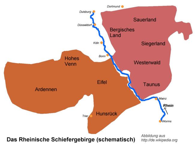
The Süder Uplands (Süderbergland) comprise inter alia the historic regions of the Sauerland, Upland, Siegerland, Wittgenstein Land, Bergisches Land and parts of the Hessian Hinterland.
The subdivisions of the Rothaar is based largely on historic regions. It lies in North Rhine-Westphalia with foothills in Hesse.
→ main article: List of mountains and hills of the Rothaar
Sauerland and Upland
The following mountains in the highest area of the Rothaar Mountains are those belongin to the historic Upland which lies in the Hessian county of Waldeck-Frankenberg.
→ see also section: Mountains in the article on Upland
Langenberg (843.2 m), counties of Hochsauerlandkreis (NW) and Waldeck-Frankenberg (HE)Hegekopf (842.9 m), county of Waldeck-Frankenberg (HE)Kahler Asten (841.9 m), Hochsauerlandkreis, Rothaar Mountains (NW)Ettelsberg (837.7 m), county of Waldeck-Frankenberg (HE)Clemensberg (837 m), Hochsauerlandkreis (NW)Hopperkopf (832.3 m), counties of Hochsauerlandkreis and Waldeck-Frankenberg (NW, HE)Mühlenkopf (ca. 815 m), county of Waldeck-Frankenberg (HE)Hunau (818.5 m), Hochsauerlandkreis (NW)Ziegenhelle (815.9 m), Hochsauerlandkreis (NW)Wallershöhe (812.1 m), Hochsauerlandkreis (NW)Bremberg (ca. 810 m), Hochsauerlandkreis (NW)Hoher Eimberg (806.1 m), counties of Hochsauerlandkreis and Waldeck-Frankenberg (NW, HE)Hoppernkopf (805.0 m), counties of Hochsauerlandkreis and Waldeck-Frankenberg (NW, HE)Hillekopf (804.9 m), Hochsauerlandkreis (NW)Mittelsberg (801.0 m), county of Waldeck-Frankenberg (HE)Reetsberg (792.2 m), Hochsauerlandkreis (NW)Schlossberg (791.3 m), Hochsauerlandkreis (NW)Bollerberg (757.7 m), Hochsauerlandkreis (NW)Härdler (756.3 m), county of Olpe (NW)Wittgenstein Land
The Wittgenstein Land lies entirely within North Rhine-Westphalia.
Albrechtsberg (768 m), county of Siegen-WittgensteinHohe Hessel (742.8 m), county of Siegen-WittgensteinGroßer Kopf (740 m), county of Siegen-WittgensteinKompass (694.1 m), county of Siegen-WittgensteinEbschloh (686.3 m), county of Siegen-WittgensteinSiegerland (historic)
The historic Siegerland (not to be confused with the natural region of Siegerland) lies entirely within North Rhine-Westphalia:
→ see also section: Hills in the article on Siegerland
Riemen (677.7 m), county of Siegen-WittgensteinAukopf (644.9 m), county of Siegen-WittgensteinGiller (653.5 m), county of Siegen-WittgensteinKindelsberg (618.1 m), county of Siegen-WittgensteinHessians Hinterland
The Hessian Hinterland lies entirely within Hesse.
Sackpfeife (673.5 m), counties of Marburg-Biedenkopf and Waldeck-Frankenberg (HE)Rimberg (495.1 m), county of Marburg-BiedenkopfThe Saalhausen Hills lie entirely within North Rhine-Westphalia.
→ see also section: Hills in the article on Saalhausen Hills
Himberg (688.5 m), county of Hochsauerlandkreis (NW)Hoher Lehnberg (668.8 m), county of Olpe (NW)Jürgensberg (619.2 m), county of Olpe (NW)Beerenberg (614.1 m), county of Hochsauerlandkreis (NW)The Ebbe Mountains lies entirely within North Rhine-Westphalia.
→ see also section: Hills in the article on Ebbe Mountains
Nordhelle (663.3 m), county of Märkischer KreisWaldberg (ca. 638 m), county of Märkischer KreisHomert (538.3 m), county of Märkischer KreisThe Lenne Mountains lies entirely within North Rhine-Westphalia.
→ see also section: Hills in the article on Lenne Mountains
Homert (656.1 m), county of HochsauerlandkreisSchomberg (647.6 m), county of HochsauerlandkreisGroßes Sonnenstück (686.8 m), county of HochsauerlandkreisDümberg (575.5 m), county of HochsauerlandkreisMittelbigge Upland
Rammskopf (523.1 m), county of Märkischer KreisHomert (519 m), county of Oberbergischer KreisHorst (514.9 m), county of Märkischer KreisEulenberg (497.1 m), county of Märkischer KreisSonnenberg (458.5 m), county of OlpeNordhelle (437.2), county of Märkischer KreisBracht (429.1 m), county of OlpeRappelsberg (410.7 m), county of OlpeGilberg (360.0 m), county of OlpeSiegerland (natural region)
The natural region of Siegerland (not to be confused with the historic Siegerland) lies entirely within North Rhine-Westphalia:
→ see also section: Mountains in the article on Siegerland (natural region)
Alte Burg (633.0 m), county of Siegen-Wittgenstein, (NW)Lipper Nürr (616.9 m), county of Altenkirchen (RP), county of Siegen-Wittgenstein (NW)Sanktkopf (ca. 606 m), county of Siegen-Wittgenstein, (NW)Die Höh (ca. 598 m), county of Siegen-Wittgenstein (NW)Die Burg (594.5 m), county of Siegen-Wittgenstein (NW)Hohenseelbachskopf (517.5 m), county of Siegen-Wittgenstein (NW), county of Altenkirchen (RP)Eisernhardt (482.3 m), borough of Siegen (NW)The Arnsberg Forest lies in the eponymous nature park entirely within North Rhine-Westphalia.
→ see also section: Hills in the article on Arnsberg Forest Nature Park
Plackweghöhe (actually an unnamed peak; 581.5), county of Hochsauerlandkreissecond highest hill: unnamed peak (559.5), county of Hochsauerlandkreisthird highest hill: unnamed peak (557.4), county of HochsauerlandkreisWarsteiner Kopf (556.9 m), county of HochsauerlandkreisGemeinheitskopf (551.9 m), county of HochsauerlandkreisNiekopf (550.4 m), county of SoestBergisches Land on the Upper Agger and Wiehl
Unnenberg (505.7 m), county of Oberbergischer KreisThe Taunus lies in Hesse with foothills in Rhineland-Palatinate.
→ main article: List of mountains and hills of the Taunus
Großer Feldberg (881.5 m), county of HochtaunuskreisKleiner Feldberg (825.2 m), HochtaunuskreisAltkönig (798.2 m), HochtaunuskreisWeilsberg (700.7 m), HochtaunuskreisGlaskopf (686.8 m), HochtaunuskreisPferdskopf (662.6 m), HochtaunuskreisKalte Herberge (619.3 m), Rheingau-Taunus-KreisHohe Wurzel (617.9 m), Rheingau-Taunus-KreisHohe Kanzel (591.8 m), Rheingau-Taunus-KreisHerzberg (591.4 m), HochtaunuskreisHallgarter Zange (580.5 m), Rheingau-Taunus-KreisErbacher Kopf (579.8 m), Rheingau-Taunus-KreisWolfsküppel (545.1 m), HochtaunuskreisRassel (539.4 m), WiesbadenKuhbett (525.6 m), county of Limburg-WeilburgSteinkopf (518.0 m), WetteraukreisRossert (515.9 m), Main-Taunus-KreisAtzelberg (506.7 m), Main-Taunus-KreisGroßer Lindenkopf (498.7 m), Rheingau-Taunus-KreisBuchwaldskopf (ca. 492 m), Rheingau-Taunus-KreisGoldgrube (492.0 m), HochtaunuskreisKellerskopf (474.0 m), WiesbadenSuterkopf (461.8 m), county of Limburg-WeilburgStaufen (451.0 m), Main-Taunus-KreisHühnerküppel (369.3 m), county of Limburg-WeilburgThe Westerwald lies within Rhineland-Palatinate with foothills in North Rhine-Westphalia and Hesse.
→ main article: List of mountains and hills of the Westerwald
Fuchskaute (657.3 m), Westerwaldkreis (RP)Stegskopf (654.4 m), county of Altenkirchen (RP)Salzburger Kopf (654.2 m), Westerwaldkreis (RP)Höllberg (642.8 m), Lahn-Dill-Kreis (HE)Auf der Baar (> 621.25 m), Lahn-Dill-Kreis (HE)Bartenstein (Barstein; ca. 614 m), Lahn-Dill-Kreis (HE)Knoten (605.4 m), Lahn-Dill-Kreis (HE)Alarmstange (545.2 m), Westerwaldkreis (RP)Köppel (540.2 m), Westerwaldkreis (RP)Hohenseelbachskopf (517.5 m), county of Siegen-Wittgenstein (NW), county of Altenkirchen (RP)Gräbersberg (513.1 m), Westerwaldkreis (RP)Mahlscheid (509.3 m), county of Siegen-Wittgenstein (NW) and county of Altenkirchen (RP)Helleberg (491.3 m), Westerwaldkreis (RP)Asberg (441.0 m), county of Neuwied (RP)Meerberg (Mehrberg; 430.5 m), county of Neuwied (RP)Malberg (422.0 m), Westerwaldkreis (RP)Minderberg (417.4 m), county of Neuwied (RP)Hummelsberg (411 m), county of Neuwied (RP)Heidenhäuschen (397.9 m), county of Limburg-Weilburg (HE)Hoher Schaden (388.3 m), Rhein-Sieg-Kreis (RP)Beulskopf (388.2 m), county of Altenkirchen (RP)Himmerich (366.4 m), Rhein-Sieg-Kreis (RP)Leyberg (358.8 m), Rhein-Sieg-Kreis (RP)Pfahlberg (Pfahlberg; 346.2 m), Westerwaldkreis (RP)Gladenbach Uplands
The Gladenbach Upland lies entirely within Hesse.
→ see also section: Hills in the article on Gladenbach Uplands
Angelburg (609.4 m), Lahn-Dill-KreisEschenburg (589.0 m), Lahn-Dill-KreisSchwarzenberg (561.2 m), county of Marburg-BiedenkopfDaubhaus (551.8 m), county of Marburg-BiedenkopfHünstein (503.7 m), county of Marburg-BiedenkopfDünsberg (497.7 m), county of GießenHornberg (451.0 m), county of Marburg-BiedenkopfAltenberg (442.2 m), Lahn-Dill-KreisVolpertsberg (426.4 m), Lahn-Dill-KreisHemmrain (561 m), Lahn-Dill-KreisThe following abbreviations are used in the table:
German states (Bundesländer; ISO 3166-2):
HE = HesseNW = North Rhine-WestphaliaRP = Rhineland-PalatinateSL = SaarlandCountries (based on their international vehicle registration codes):
B = BelgiumD = Germany (generally not used above)F = France (not used above as no mountains are listed yet)L = Luxembourg (not used above as no mountains are listed yet)