
Isolation 36 kilometres (22 mi) Elevation 675 m | Parent range Kellerwald Prominence 315 m | |
 | ||
Similar Hohes Lohr, Jeust, Hunsrück, Eisenberg, Hundskopf | ||
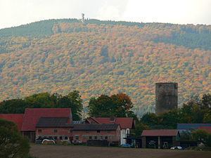
Wüstegarten is a mountain in the counties of Waldeck-Frankenberg and Schwalm-Eder-Kreis in the north of the German state of Hesse. It is in the Kellerwald mountains and has an elevation of 675.3 metres (2,216 ft).
Map of W%C3%BCstegarten, 35114 Haina, Germany
The mountain is within the Kellerwald-Edersee National Park, Hesse's only national park. Activities include hiking, nordic walking, mountain biking, and cross-country skiing.
References
Wüstegarten Wikipedia(Text) CC BY-SA