Supriya Ghosh (Editor)

Taunus

Updated on
Edit
Like
Comment
Share on FacebookTweet on TwitterShare on LinkedInShare on Reddit
Elevation
  
878 m (2,881 ft)

Width
  
35 km (22 mi) NW/SE

Area
  
2,700 km²

Country
  
Germany

Types of rock
  
Phyllite, Greywacke

Length
  
75 km (47 mi) NE/SW

State/Province
  
Hesse

Highest point
  
Großer Feldberg

Age of rock
  
Devonian

Taunus httpsuploadwikimediaorgwikipediacommonsthu

Peak
  
Großer Feldberg (Hochtaunus)

Parent range
  
Rhenish Slate Mountains

Mountains
  
Großer Feldberg, Altkönig, Kleiner Feldberg, Bleibeskopf

Similar
  
Großer Feldberg, Frankfurt Rhine‑Main, Westerwald, Kleiner Feldberg, Hunsrück

The Taunus is a mountain range in Hesse, Germany located north of Frankfurt. The tallest peak in the range is Großer Feldberg at 878 m; other notable peaks are Kleiner Feldberg (825 m) and Altkönig (798 m).

Contents

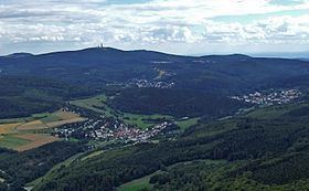
Map of Taunus, 61479 Glash%C3%BCtten, Germany

The Taunus range spans the districts of Hochtaunuskreis, Main-Taunus, Rheingau-Taunus, Limburg-Weilburg, and Rhein-Lahn. The range is known for its geothermal springs and mineral waters that formerly attracted members of the European aristocracy to its spa towns. The car line Ford Taunus is named after it.

DescriptionEdit

It is a relatively low range, with smooth, rounded mountains covered with forest. The Taunus is bounded by the valleys of the Rhine, Main and Lahn rivers and it is part of the Rhenish Slate Mountains. On the opposite side of the Rhine, The Taunus range is continued by the Hunsrück.

For geographical, ecological and geological purposes the Taunus is divided in three parts:

  • Pre-Taunus (Vortaunus or Vordertaunus) in the south, next to the cities of Frankfurt am Main and Wiesbaden. This section is mainly made up of old sedimentary rocks with phyllite, greenschist and muscovite. The rocks are often given a greenish hue by the presence of epidote and chlorites.
  • High Taunus (Hoher Taunus). The central region of the range where the highest peaks are found. Its geological composition includes slates, quartzite and sandstones.
  • Back-Taunus (Hintertaunus) at its northern end is the biggest part by area. The geological materials that compose it include greywacke, claystones and siltstones.
  • The Taunus range originated during the Devonian period. The geological composition of the mountains was formed in a region covered by an ancient sea that was a few hundred kilometers wide and are mainly made up of phyllite, greenschist, gneiss, slates and sandstone.

    SummitsEdit

  • Großer Feldberg (878 m), Hochtaunuskreis (Kreis = district). Being the highest point in the range, it provides the scenario for the Feldbergrennen hillclimbing and rallying contests. It should not be confused with the Feldberg in the Black Forest
  • Kleiner Feldberg (825 m), Hochtaunuskreis. It has an observatory on the summit.
  • Altkönig (798 m), Hochtaunuskreis. It has the remains of a late Iron Age hill fort (La-Tène A, ca. 400 BC) near the summit.
  • Weilsberg (701 m), Hochtaunuskreis
  • Glaskopf (685 m), Hochtaunuskreis
  • Pferdskopf (663 m), Hochtaunuskreis
  • Kolbenberg (684 m; telecommunication facility), Hochtaunuskreis
  • Klingenkopf (683 m), Hochtaunuskreis
  • Sängelberg (665 m), Hochtaunuskreis
  • Pferdskopf (663 m), Hochtaunuskreis
  • Weißeberg (660 m), Hochtaunuskreis
  • Fauleberg (633 m), Hochtaunuskreis
  • Großer Eichwald (633 m), Hochtaunuskreis
  • Roßkopf (632 m; telecommunication facility), Hochtaunuskreis
  • Kalte Herberge (619 m), Rheingau-Taunus-Kreis
  • Hohe Wurzel (618 m; telecommunication facility), Rheingau-Taunus-Kreis
  • Hohe Kanzel (592 m), Rheingau-Taunus-Kreis
  • Hallgarter Zange (580 m), Rheingau-Taunus-Kreis
  • Erbacher Kopf (580 m), Rheingau-Taunus-Kreis
  • Steinkopf (Hochtaunuskreis) (570 m), Hochtaunuskreis
  • Kuhbett (526 m), Kreis Limburg-Weilburg at Weilrod-Hasselbach
  • Steinkopf (Wetteraukreis) (518 m), Wetteraukreis
  • HistoryEdit

    The Roman Limes was built across the Taunus. The Saalburg, a restored Roman castellum, now houses a museum.

    After the fall of the Limes (in 259/260 AD), the Alamanni settled in the range and for this reason there are some Alemannic cemeteries in the southern foothills of the Taunus (Eschborn). This area of the Taunus became part of the Frankish confederation of Germanic tribes after the Battle of Tolbiac around 500 AD.

    In past centuries the Taunus became famous among aristocrats for its therapeutic hot springs.

    Certain towns in the area, such as Bad Homburg vor der Höhe with its Kurpark, have geothermal spas that were formerly renowned. Other spa towns in the Taunus range are Bad Schwalbach (formerly Langenschwalbach) mentioned in documents dating back to the 16th century, Bad Ems, one of the most reputed therapeutic spas in Germany since the 17th century, as well as Bad Weilbach where a spring reached wide fame for some time. By the 19th century the most famous spa towns in the area were Wiesbaden, Bad Homburg vor der Höhe, Bad Nauheim and Bad Soden am Taunus.

    References

    Taunus Wikipedia