
Country United States FIPS code 29-79558 Elevation 243 m Zip code 63387 Population 77 (2013) | Time zone Central (CST) (UTC-6) GNIS feature ID 0728787 Area 23 ha Local time Sunday 6:30 AM Area code 573 | |
 | ||
Weather 8°C, Wind E at 11 km/h, 84% Humidity | ||
Whiteside is a village in Lincoln County, Missouri, United States. The population was 75 at the 2010 census.
Contents
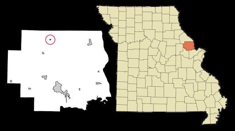
Map of Whiteside, MO, USA
History
Whiteside was platted in 1882, and named after William Whiteside, the original owner of the town site. A post office called Whiteside has been in operation since 1883.
Geography
Whiteside is located at 39°11′6″N 91°0′57″W (39.184899, -91.015952).
According to the United States Census Bureau, the village has a total area of 0.09 square miles (0.23 km2), all of it land.
2010 census
As of the census of 2010, there were 75 people, 29 households, and 20 families residing in the village. The population density was 833.3 inhabitants per square mile (321.7/km2). There were 32 housing units at an average density of 355.6 per square mile (137.3/km2). The racial makeup of the village was 96.0% White, 1.3% from other races, and 2.7% from two or more races. Hispanic or Latino of any race were 2.7% of the population.
There were 29 households of which 31.0% had children under the age of 18 living with them, 41.4% were married couples living together, 17.2% had a female householder with no husband present, 10.3% had a male householder with no wife present, and 31.0% were non-families. 20.7% of all households were made up of individuals and 6.9% had someone living alone who was 65 years of age or older. The average household size was 2.59 and the average family size was 2.80.
The median age in the village was 42.5 years. 18.7% of residents were under the age of 18; 13.3% were between the ages of 18 and 24; 19.9% were from 25 to 44; 36% were from 45 to 64; and 12% were 65 years of age or older. The gender makeup of the village was 56.0% male and 44.0% female.
2000 census
As of the census of 2000, there were 67 people, 26 households, and 19 families residing in the village. The population density was 737.7 people per square mile (287.4/km²). There were 31 housing units at an average density of 341.3 per square mile (133.0/km²). The racial makeup of the village was 100.00% White.
There were 26 households out of which 30.8% had children under the age of 18 living with them, 57.7% were married couples living together, 11.5% had a female householder with no husband present, and 26.9% were non-families. 23.1% of all households were made up of individuals and 15.4% had someone living alone who was 65 years of age or older. The average household size was 2.58 and the average family size was 2.84.
In the village, the population was spread out with 32.8% under the age of 18, 3.0% from 18 to 24, 31.3% from 25 to 44, 17.9% from 45 to 64, and 14.9% who were 65 years of age or older. The median age was 37 years. For every 100 females there were 123.3 males. For every 100 females age 18 and over, there were 95.7 males.
The median income for a household in the village was $41,250, and the median income for a family was $48,125. Males had a median income of $31,250 versus $26,250 for females. The per capita income for the village was $16,297. There were 11.1% of families and 12.5% of the population living below the poverty line, including 16.7% of under eighteens and none of those over 64.