
Country United States FIPS code 29-80422 Area 166 ha Zip code 63389 Local time Tuesday 5:10 AM | Time zone Central (CST) (UTC-6) GNIS feature ID 0728996 Elevation 137 m Population 1,418 (2013) Area code 636 | |
 | ||
Weather 13°C, Wind W at 13 km/h, 84% Humidity | ||
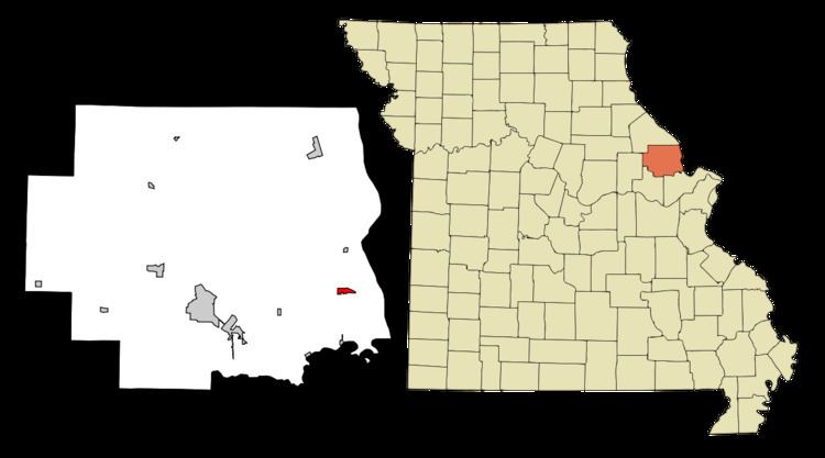
Winfield is a city in Lincoln County, Missouri, United States. The population was 1,404 at the 2010 census.
Contents
Map of Winfield, MO 63389, USA
History
Winfield was laid out in 1879, and named after Winfield Scott Killam, the original owner of the town site. A post office called Winfield has been in operation since 1880.
On 2008-06-18 floodwaters opened a 150-foot breach in a primary levee along the Mississippi River in Winfield. The breach allowed floodwaters to claim dozens of homes and large tracts of farmland and put pressure on a secondary levee. The breach also prompted Lincoln County emergency officials to order the evacuation of residents east of Winfield. Press reports noted that some evacuees were being housed at the local high school.
On April 9, 2009, Winfield made news around both the USA and the rest of the world after it elected their popular mayor, Harry Stonebraker, to a fourth term, several weeks after he died of a heart attack. This was because ballot papers had already been printed and absentee voting had begun. He won by a landslide, securing 90% of the vote by April 9.
Winfield appointed a temporary mayor to serve until a special election was held in April 2010.
Geography
Winfield is located at 38°59′47″N 90°44′24″W (38.996469, -90.739898).
According to the United States Census Bureau, the city has a total area of 0.64 square miles (1.66 km2), all of it land.
2010 census
As of the census of 2010, there were 1,404 people, 525 households, and 360 families residing in the city. The population density was 2,193.8 inhabitants per square mile (847.0/km2). There were 568 housing units at an average density of 887.5 per square mile (342.7/km2). The racial makeup of the city was 97.0% White, 0.4% African American, 0.3% Asian, 0.1% Pacific Islander, 0.9% from other races, and 1.3% from two or more races. Hispanic or Latino of any race were 1.3% of the population.
There were 525 households of which 43.2% had children under the age of 18 living with them, 47.0% were married couples living together, 16.2% had a female householder with no husband present, 5.3% had a male householder with no wife present, and 31.4% were non-families. 24.6% of all households were made up of individuals and 7.6% had someone living alone who was 65 years of age or older. The average household size was 2.61 and the average family size was 3.10.
The median age in the city was 31 years. 28.4% of residents were under the age of 18; 8.8% were between the ages of 18 and 24; 33.8% were from 25 to 44; 20.4% were from 45 to 64; and 8.5% were 65 years of age or older. The gender makeup of the city was 49.9% male and 50.1% female.
2000 census
As of the census of 2000, there were 723 people, 293 households, and 183 families residing in the city. The population density was 1,293.5 people per square mile (498.5/km²). There were 319 housing units at an average density of 570.7 per square mile (219.9/km²). The racial makeup of the city was 98.62% White, 0.14% African American, 0.28% Native American, 0.41% Asian, and 0.55% from two or more races. Hispanic or Latino of any race were 0.28% of the population.
There were 293 households out of which 34.1% had children under the age of 18 living with them, 39.2% were married couples living together, 17.7% had a female householder with no husband present, and 37.5% were non-families. 30.7% of all households were made up of individuals and 10.2% had someone living alone who was 65 years of age or older. The average household size was 2.42 and the average family size was 3.01.
In the city the population was spread out with 28.1% under the age of 18, 11.8% from 18 to 24, 29.6% from 25 to 44, 17.4% from 45 to 64, and 13.1% who were 65 years of age or older. The median age was 33 years. For every 100 females there were 90.8 males. For every 100 females age 18 and over, there were 88.4 males.
The median income for a household in the city was $36,167, and the median income for a family was $45,536. Males had a median income of $35,313 versus $21,071 for females. The per capita income for the city was $17,740. About 10.0% of families and 15.8% of the population were below the poverty line, including 19.0% of those under age 18 and 13.5% of those age 65 or over.
Government
The Chief of Police is Charles Hobby. He previously served as a part-time officer. The Department consists of seven full-time officers and nine reserve officers. The department is located at 51 Harry's Way in Winfield and is a 24-hour Department as of 2011.
Education
Winfield, MO has four different schools.