
Area 1,404 km² Population 11,965 (2013) | Website mcmo.us Founded 1818 | |
 | ||
Cities Montgomery City, New Florence, Jonesburg, Wellsville, High Hill, Bellflower, Middletown, Rhineland, McKittrick Rivers Loutre River, Warren Branch, Lost Creek, Bear Creek | ||
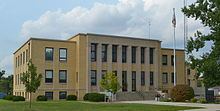
277 acres montgomery county missouri
Montgomery County is a county in the eastern part of the U.S. state of Missouri. As of the 2010 census, the population was 12,236. Its county seat is Montgomery City. The county was named in honor of Richard Montgomery, an American Revolutionary War general killed in 1775 while attempting to capture Quebec City, Canada.
Contents
- 277 acres montgomery county missouri
- Map of Montgomery County MO USA
- History
- Geography
- Adjacent counties
- Major highways
- Demographics
- Community groups
- Public schools
- Private schools
- Local
- State
- Federal
- Cities
- Village
- Census designated places
- Other unincorporated places
- References
Map of Montgomery County, MO, USA
With a branch of Stone Hill Winery in New Florence, the county is part of the Missouri Rhineland. It is approximately halfway between Columbia and St. Louis.
History
The county has evidence of human habitation from 10,000 years ago, the Archaic period of indigenous Americans. An ancient site was found during archaeological excavations at Graham Cave on the Loutre River.
In the early 19th century, European settlement started at a greater pace, after exploration during previous decades by French trappers and British and American fur traders.
Although the Loutre Island area is commonly associated with the German-founded towns of Rhineland and Starkenburg, established by immigrants of the mid-19th century and later, it was originally settled by Missouri's Anglo-southern settlers from places such as Kentucky or Virginia. Although the southern part of the county is more closely associated with Missouri's Rhineland, its northern part is more associated with Missouri's "Little Dixie" region, earning Montgomery county the nickname "Gateway to Little Dixie".
An early house of worship was a log church, which is still maintained as a chapel. St. Martin's Church is also located in Starkenburg, built in 1873 and listed on the National Register of Historic Places. Above its entrance is the text: "This is the House Of God and the Gate Of Heaven."
Starkenburg is also the site of the Shrine of Our Lady of Sorrows Catholic Church, built in the early 20th century and listed on the NRHP. For further devotions and pilgrimage, the community created an outdoor area for representations of the Stations of the Cross, Mount Calvary and Holy Sepulchre. Starkenburg is located inland from the Missouri River. After the destructive Great Flood of 1993, Rhineland citizens used federal funds to relocate their houses 1.5 miles (2.4 km) inland away from the river.
Geography
According to the U.S. Census Bureau, the county has a total area of 542 square miles (1,400 km2), of which 536 square miles (1,390 km2) is land and 5.8 square miles (15 km2) (1.1%) is water.
Adjacent counties
Major highways
Demographics
As of the census of 2000, there were 12,136 people, 4,775 households, and 3,337 families residing in the county. The population density was 23 people per square mile (9/km²). There were 5,726 housing units at an average density of 11 per square mile (4/km²). The racial makeup of the county was 95.97% White, 2.04% Black or African American, 0.24% Native American, 0.26% Asian, 0.01% Pacific Islander, 0.21% from other races, and 1.28% from two or more races. Approximately 0.77% of the population were Hispanic or Latino of any race. 39.1% were of German, 18.4% American, 10.2% English and 9.2% Irish ancestry.
There were 4,775 households out of which 31.30% had children under the age of 18 living with them, 56.90% were married couples living together, 8.60% had a female householder with no husband present, and 30.10% were non-families. 26.30% of all households were made up of individuals and 13.20% had someone living alone who was 65 years of age or older. The average household size was 2.47 and the average family size was 2.97.
In the county, the population was spread out with 25.40% under the age of 18, 7.40% from 18 to 24, 26.10% from 25 to 44, 23.90% from 45 to 64, and 17.20% who were 65 years of age or older. The median age was 39 years. For every 100 females there were 98.10 males. For every 100 females age 18 and over, there were 93.70 males.
The median income for a household in the county was $32,772, and the median income for a family was $38,632. Males had a median income of $27,933 versus $19,809 for females. The per capita income for the county was $15,092. About 8.40% of families and 11.80% of the population were below the poverty line, including 15.60% of those under age 18 and 10.60% of those age 65 or over.
Community groups
Public schools
Private schools
Local
The Republican Party predominantly controls politics at the local level in Montgomery County. Republicans hold all but one of the elected positions in the county.
State
Montgomery County is part of Missouri's 42nd district in the Missouri House of Representatives and is represented by Bart Korman (R-High Hill).
Montgomery County is a part of Missouri’s 10th District in the Missouri Senate and is currently represented by Jeanie Riddle (R-Fulton).
Federal
Montgomery County is included in Missouri's 3rd congressional district and is represented by Blaine Luetkemeyer (R-St. Elizabeth) in the U.S. House of Representatives.