
Named for Zebulon M. Pike Area 1,774 km² Population 18,669 (2013) | Website www.pikecountymo.net Founded 1818 | |
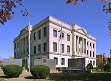 | ||
Cities Bowling Green, Louisiana, Clarksville, Eolia, Frankford, Curryville, Annada, Ashburn, Paynesville, Tarrants University Pike-Lincoln Technical Center | ||
Pike County is a county in the eastern part of the U.S. state of Missouri. As of the 2010 census, the population was 18,516. Its county seat is Bowling Green. The county was organized December 4, 1818, and named for explorer Zebulon M. Pike. The folksong Sweet Betsy from Pike is generally thought to refer to Pike County, Missouri.
Contents
- Map of Pike County MO USA
- Geography
- Adjacent counties
- Major highways
- National protected area
- Demographics
- Public schools
- Private schools
- Local
- State
- Federal
- Missouri Presidential Preference Primary 2008
- Cities
- Villages
- Census designated places
- Other unincorporated place
- References
Map of Pike County, MO, USA
Pike County is said to be the home of Momo (The Missouri Monster), with the first reported sightings in the 1970s dating back to various locations throughout the county.
Geography
According to the U.S. Census Bureau, the county has a total area of 685 square miles (1,770 km2), of which 670 square miles (1,700 km2) is land and 14 square miles (36 km2) (2.1%) is water.
Adjacent counties
Pike County in Missouri and Illinois are two of twenty-two counties or parishes in the United States with the same name to border each other across state lines. The others are Union Parish, Louisiana and Union County, Arkansas, Big Horn County, Montana and Big Horn County, Wyoming, Sabine County, Texas and Sabine Parish, Louisiana, Bristol County, Massachusetts and Bristol County, Rhode Island, Kent County, Delaware and Kent County, Maryland, Escambia County, Alabama and Escambia County, Florida, Teton County, Idaho and Teton County, Wyoming, Park County, Montana and Park County, Wyoming, San Juan County, New Mexico and San Juan County, Utah, and Vermilion County, Illinois and Vermillion County, Indiana. respectively. (Note, despite the different spellings, the source of the name is the same for Vermilion County, Illinois and Vermillion County, Indiana—the Vermillion River which flows through both counties.)
Major highways
National protected area
Demographics
As of the census of 2010, there were 18,516 people, 6,451 households, and 4,476 families residing in the county. The population density was 27 people per square mile (11/km²). There were 7,493 housing units at an average density of 11 per square mile (4/km²). The racial makeup of the county was 88.44% White, 9.17% Black or African American, 0.24% Native American, 0.15% Asian, 0.04% Pacific Islander, 0.92% from other races, and 1.04% from two or more races. Approximately 1.61% of the population were Hispanic or Latino of any race. 24.6% were of American, 24.5% German, 8.9% English and 8.5% Irish ancestry.
There were 6,451 households out of which 31.30% had children under the age of 18 living with them, 55.70% were married couples living together, 9.60% had a female householder with no husband present, and 30.60% were non-families. 26.70% of all households were made up of individuals and 12.90% had someone living alone who was 65 years of age or older. The average household size was 2.50 and the average family size was 3.01.
In the county, the population was spread out with 23.40% under the age of 18, 9.10% from 18 to 24, 29.80% from 25 to 44, 22.80% from 45 to 64, and 15.00% who were 65 years of age or older. The median age was 38 years. For every 100 females there were 119.20 males. For every 100 females age 18 and over, there were 123.80 males.
The median income for a household in the county was $32,373, and the median income for a family was $39,059. Males had a median income of $28,528 versus $19,426 for females. The per capita income for the county was $14,462. 15.50% of the population and 11.90% of families were below the poverty line. 20.20% of those under the age of 18 and 15.20% of those 65 and older were living below the poverty line.
Public schools
Private schools
Local
The Democratic Party predominantly controls politics at the local level in Pike County. Democrats hold all but one of the elected positions in the county.
State
Pike County is a part of Missouri’s 40th District in the Missouri House of Representatives and is represented by Jim Hansen (R-Frankford).
Pike County is a part of Missouri’s 18th District in the Missouri Senate and is currently represented by Brian Munzlinger (R-Williamstown).
Federal
Pike County is included in Missouri’s 6th Congressional District and is currently represented by Sam Graves (R-Tarkio) in the U.S. House of Representatives.