
Type Highway | Length 577 km | |
 | ||
Route number(s) State Highway A5Westwood - Goondiwindi North National Highway A39 / State Route 85Goondiwindi North - Goondiwindi Formerroute number National Highway 39 National Route 39 South end Newell Highway (A39) / Barwon Highway (State Route 85), Goondiwindi, Queensland NSW/Qld Border | ||
The Leichhardt Highway is a major transport route in Queensland, Australia. It is a continuation northward from Goondiwindi of the Newell Highway.
Contents
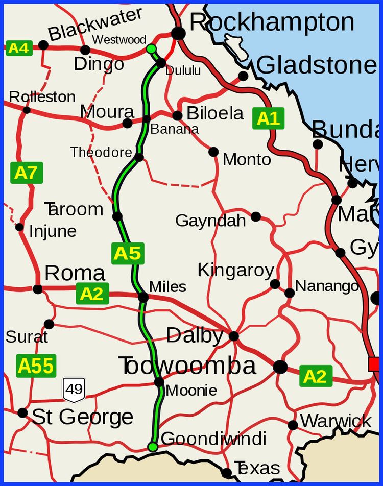
Map of Leichhardt Hwy, Queensland, Australia
It runs northward from Goondiwindi for more than 600 kilometres until its termination at the Capricorn Highway near the small town of Westwood.
It is named after Prussian explorer Ludwig Leichhardt who travelled a route in the 19th Century that roughly parallels today's highway.
List of towns along the Leichhardt Highway
Travelling from south to north:
References
Leichhardt Highway Wikipedia(Text) CC BY-SA