
Type Highway Length 580 km | Formerroute number National Route 66 | |
 | ||
Major settlements Jericho, Alpha, Emerald, Blackwater, Gogango, Westwood | ||
The Capricorn Highway is located in Central Queensland, Australia, and links the city of Rockhampton with western Queensland. The highway is 575 kilometres long, and joins the Landsborough Highway at Barcaldine. Formerly National Route 66, Queensland began to convert to the alphanumeric system much of Australia had adopted in the early-2000s and is now designated as A4. The highway runs parallel with the Tropic of Capricorn, hence its name.
Contents
- Map of Capricorn Highway Queensland Australia
- Emerald cnr capricorn highway codenwarra road rod brown chase commercial
- References
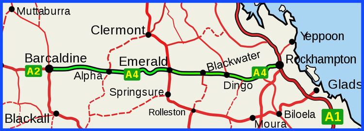
Map of Capricorn Highway, Queensland, Australia
Other towns situated along the highway include (from east to west): Gracemere, Kabra, Gogango, Westwood, Duaringa, Dingo, Blackwater, Emerald, Bogantungan, Alpha and Jericho.
Running virtually east/west, the highway traverses the area known as the Central Highlands, and crosses the Great Dividing Range between Alpha and Jericho.