
Effective January 1, 1982 Time zone EST (UTC−5) Area 1,242 km² Province Québec | Area code(s) 450 and 579 Population 21,197 (2011) | |
 | ||
Destinations Ormstown, Saint‑Anicet, Franklin, Huntingdon, Saint‑Chrysostome | ||
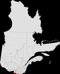
Le Haut-Saint-Laurent (Upper Saint Lawrence) is a regional county municipality in southwestern Quebec, Canada, in the Montérégie region. Its seat is in Huntingdon and it is named for the Saint Lawrence River which forms its western and northwestern boundary.
Contents
- Map of Le Haut Saint Laurent Regional County Municipality QC Canada
- History
- Subdivisions
- Access Routes
- References
Map of Le Haut-Saint-Laurent Regional County Municipality, QC, Canada
History
The RCM was formed on 1 January 1982 from most of historic Huntingdon County.
Subdivisions
There are 13 subdivisions and one native reserve within the RCM:
Access Routes
Highways and numbered routes that run through the municipality, including external routes that start or finish at the county border:
References
Le Haut-Saint-Laurent Regional County Municipality Wikipedia(Text) CC BY-SA