
Time zone EST (UTC−5) Area code(s) 450 and 579 Area 89.4 km² Local time Saturday 1:44 AM | Constituted April 1, 1863 Postal code(s) J0S 2C0 Population 756 (2011) Province Québec | |
 | ||
Weather -14°C, Wind SW at 2 km/h, 64% Humidity | ||
For other places with the same name, see Havelock (disambiguation)
Contents
- Map of Havelock QC Canada
- History
- Communities
- Lakes Rivers
- Topographic Features
- Arts and culture
- References
Map of Havelock, QC, Canada
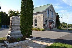
Havelock is a township in Le Haut-Saint-Laurent Regional County Municipality in southern Quebec, Canada. The population as of the Canada 2011 Census was 756. Neighbouring townships include Franklin to the west, St-Chrysostome to the north and Hemmingford to the east. Havelock's southern boundary is situated along the Canada–United States border with New York State, United States.
Located within Havelock is Covey Hill, one of the northernmost hills of the Adirondack Mountains and the highest point in Le Haut-Saint-Laurent Regional County Municipality.
History
Named after Major-General Sir Henry Havelock, a British general who served in India, the township was created in 1863 from the west end of Hemmingford Township.
Communities
The following locations reside within the municipality's boundaries:
Lakes & Rivers
The following waterways pass through or are situated within the municipality's boundaries:
Topographic Features
Arts and culture
The town is noted for its annual agricultural fair, Havelock Fair, held every September. It showcases the best the local countryside has to offer. It was founded in 1871 and is one of the oldest fairs in Canada.